This guide is about the Gaumukh Tapovan Trek — dates, price, day-by-day itinerary and booking are on the trek page.
Quick answer: The Gaumukh Tapovan trek covers about 46 km in 5 trekking days, out and back from Gangotri (3,065 m) to the Gaumukh glacier snout (3,892 m) and the Tapovan meadow (4,463 m / 14,640 ft) below Shivling. The full trip is 7 days from Dehradun. Trekkaro runs it in May–June and September–October for ₹16,500 + 5% GST (₹17,325).
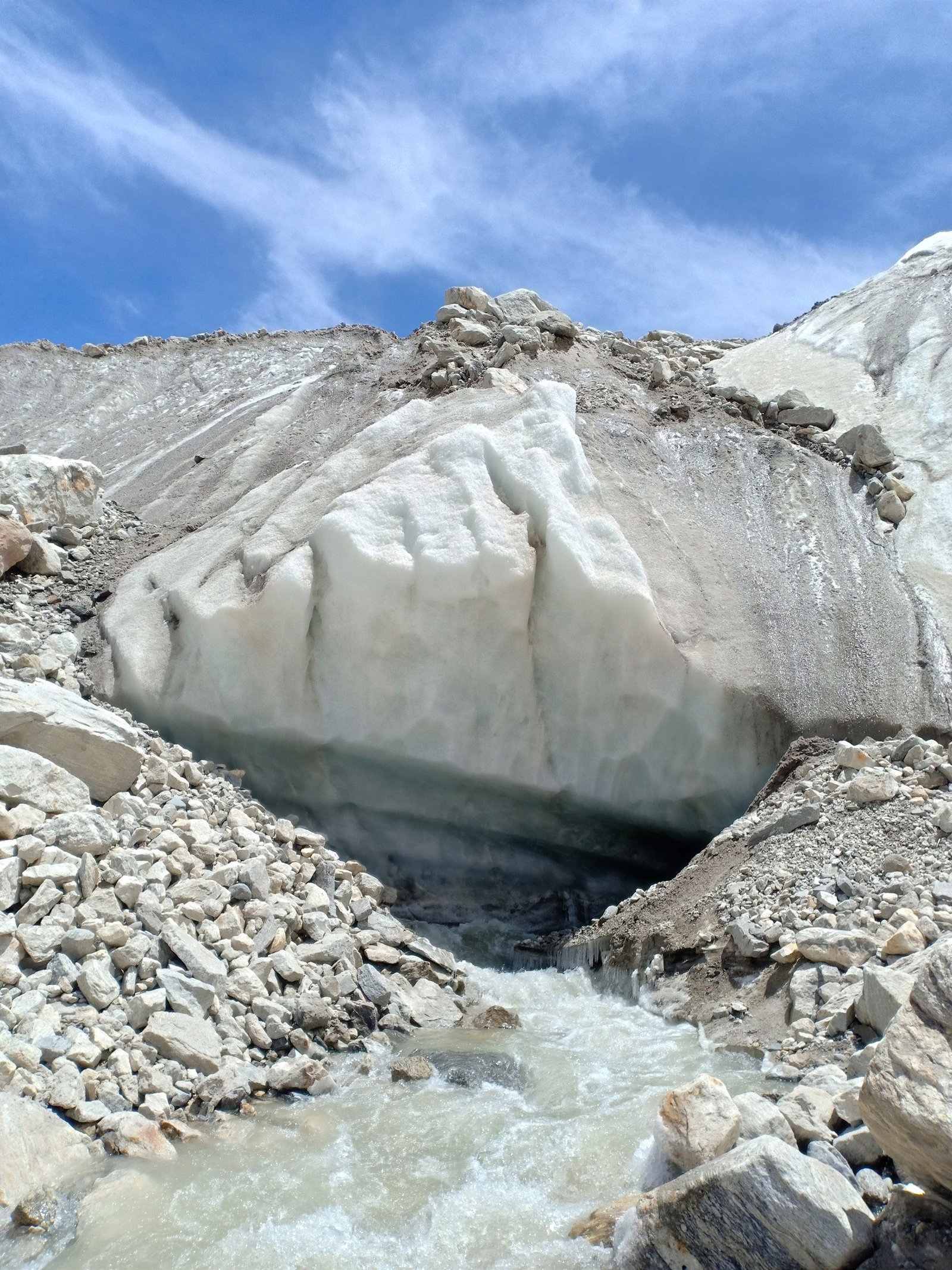
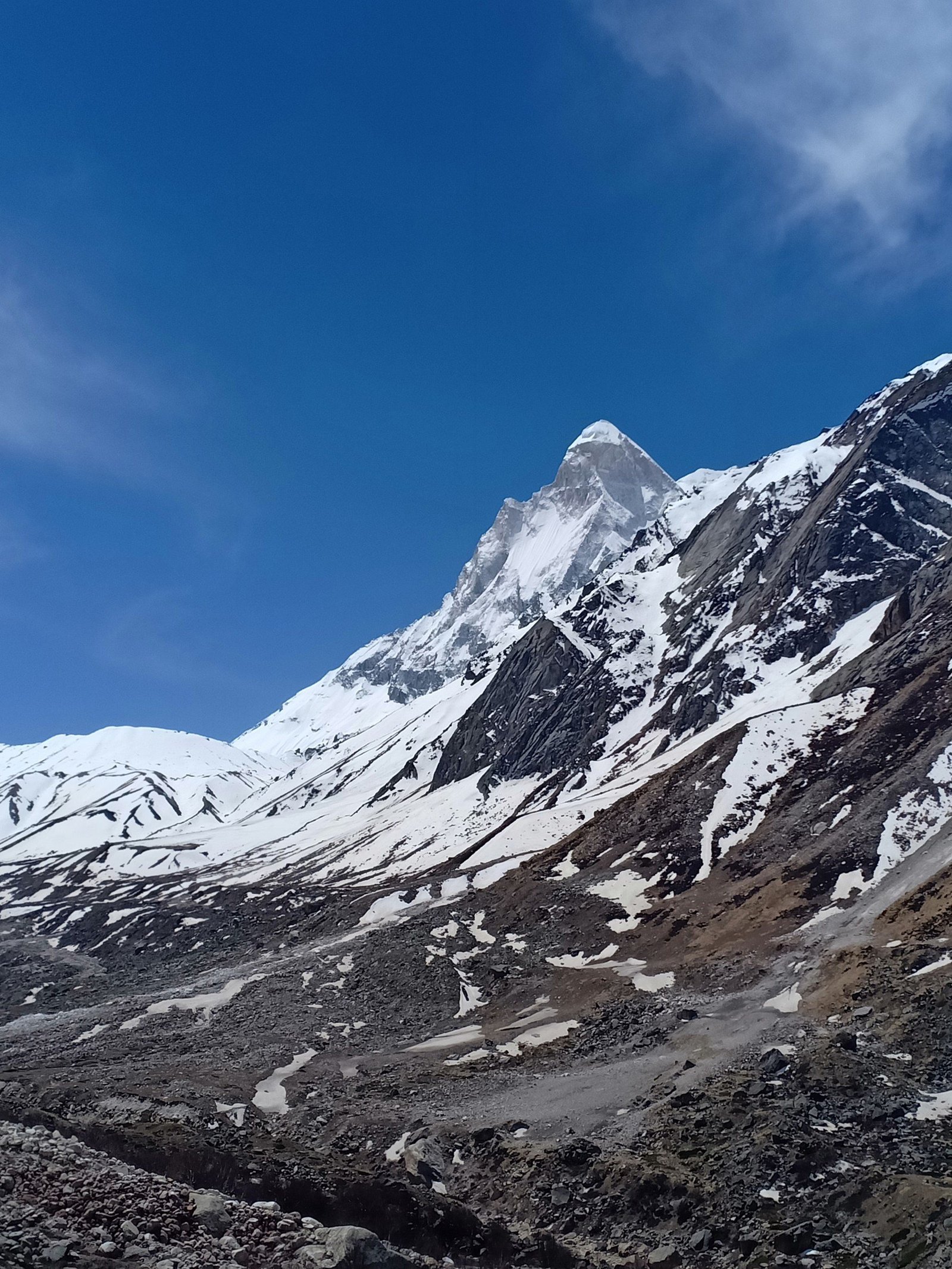
Gaumukh, "cow's mouth", is the snout of the Gangotri Glacier, where the Bhagirathi comes out from under the ice. Tapovan is the high meadow above it, across the moraine, with Shivling (6,543 m) rising straight over the camp. This page is for trekkers who want the numbers before they book: how far each day goes, how high each camp sits, how much height you gain, and what the permit rules say. Every figure comes from Trekkaro's Gaumukh Tapovan trek page or the official page linked below.
How long is the Gaumukh Tapovan trek, day by day?
| Day | From – to | Distance | Time | Altitude change |
|---|---|---|---|---|
| 1 | Dehradun – Gangotri (drive) | About 241 km by road | 10–11 hrs | Up to 3,065 m |
| 2 | Gangotri – Chirbasa | About 9 km | 4–5 hrs | +535 m (to 3,600 m) |
| 3 | Chirbasa – Bhojbasa | About 5 km | 3–4 hrs | +175 m (to 3,775 m) |
| 4 | Bhojbasa – Gaumukh – Tapovan | About 9 km | 6–7 hrs | +688 m (to 4,463 m) |
| 5 | Tapovan – Bhojbasa | About 9 km | 5–6 hrs | −688 m (to 3,775 m) |
| 6 | Bhojbasa – Gangotri | About 14 km | 5–6 hrs | −710 m (to 3,065 m) |
| 7 | Gangotri – Dehradun (drive) | About 241 km by road | 10–11 hrs | Down to Dehradun |
The five walking days add up to about 46 km. The longest day by distance is Day 6, the walk out. The hardest day is Day 4: only about 9 km, but it includes a moraine crossing and a steep climb of 571 m from Gaumukh to Tapovan.
What is the Gangotri to Gaumukh distance?
On Trekkaro's route, you walk 9 km to Chirbasa and 5 km to Bhojbasa, then along the valley floor and over loose glacial debris to the snout. Tapovan is about 4 km beyond Gaumukh, across the moraine and up a steep slope, and the whole Bhojbasa–Gaumukh–Tapovan day is about 9 km. Trekkaro does not walk from Gangotri to Gaumukh in one day. The route splits the approach over two days with a night at Chirbasa and a short acclimatisation day to Bhojbasa, then reaches Gaumukh and Tapovan on the third day on foot.
How high are Gangotri, Gaumukh and Tapovan?
Read the route as an elevation profile, from the road to the highest camp:
- Dehradun: the pickup at Dehradun Railway Station, 6:30 AM on Day 1.
- Gangotri, 3,065 m / 10,056 ft: the temple town where the walk starts and ends. You sleep here on Day 1 and Day 6.
- Chirbasa, 3,600 m / 11,808 ft: a camp on a rocky shelf above the river, where the last real tree cover ends.
- Bhojbasa, 3,775 m / 12,385 ft: the acclimatisation camp, used on the way up and the way down, facing Bhagirathi I (6,856 m), II (6,512 m) and III (6,454 m).
- Gaumukh, 3,892 m / 12,770 ft: the glacier snout and source of the Bhagirathi. You pass it on Day 4 and again on Day 5.
- Tapovan, 4,463 m / 14,640 ft: the highest point and highest camp, one night only, with Shivling (6,543 m) directly above.
From Gangotri to Tapovan you gain about 1,400 m over three trekking days. The largest single-day gain is 688 m, on Day 4. That keeps each walking day inside the 800 to 1,000 m daily limit in the Uttarakhand Health Department's health advisory for travellers going above 3,000 m, which also asks you to rest 5 to 10 minutes every hour, check the weather, dress for cold, rain and sun, and descend if you feel unwell. The Day 1 drive is the exception: it climbs more than 2,000 m by road, so take the evening acclimatisation walk at Gangotri, sleep early, and ask your doctor about altitude medicine before the trek.
What is the ground like on each stage?
Gangotri to Chirbasa (Day 2)
A forest trail and riverside gorge path on the right bank of the Bhagirathi, through pine and birch, with rocky sections above the tree line. Chirbasa gives the first views of the Bhagirathi massif.
Chirbasa to Bhojbasa (Day 3)
An open rocky valley and the lateral moraine. The Gangotri Glacier comes into view on this stretch. The day is short on purpose; an evening health check at Bhojbasa (SpO2, pulse and blood pressure) comes before the glacier days.
Bhojbasa to Tapovan via Gaumukh (Day 4)
Valley trail and boulders to the snout, then the moraine crossing and the steep 571 m climb to the meadow. Poles are your anchors on the loose rock, and the trek leader guides each trekker across.
Tapovan to Gangotri (Days 5 and 6)
The moraine descent from Tapovan is technically demanding and harder on the knees than the climb. Day 6 is the long 14 km walk down the gorge to Gangotri, where completion certificates are issued.
Do you need a permit for Gaumukh and Tapovan?
Yes. The route lies in Gangotri National Park. Entry needs a permit from the Uttarakhand Forest Department, and the Ministry of Tourism's Gangotri National Park page says Gaumukh trail permits are capped at 150 visitors a day. The same page says a registered guide is mandatory for extending the trek to Tapovan, and that the park and temple are closed to tourists in winter. Trekkaro arranges the park permits and Gaumukh entry fees, and a local guide walks with the batch; carry your original photo ID and a photocopy. International trekkers need their passport for the permits. The official page gives no fee amount, so none is printed here.
When can you walk the route?
| Season | Gangotri | Bhojbasa | Tapovan | Trail |
|---|---|---|---|---|
| May–June | 5°C to 15°C | -2°C to 5°C | -5°C to 3°C | Snow above Chirbasa, Tapovan partly under snow, a full river, fewer trekkers |
| September–October | 5°C to 18°C | -3°C to 8°C | -8°C to 2°C | Dry trail, the most stable moraine, the sharpest views |
The route is closed in July and August, when the gorge is exposed to rockfall and wet moraine is dangerous. Trekkaro's batches run from mid-May to June and from mid-September to October; see the trek page for live batch dates. Trekkaro recommends late September to mid-October for the most stable moraine and the sharpest views of Shivling.
What does the Gaumukh Tapovan trek cost?
| Item | Cost |
|---|---|
| Trek fee (stays, meals, permits, camping gear, trek team) | ₹16,500 + 5% GST = ₹17,325 |
| EMI | EMI starts at ₹849 a month |
| Shared cab, Dehradun to Gangotri and back | About ₹8,000 per 5–6 seat vehicle each way, split among trekkers |
| Backpack offloading (optional, up to 9 kg) | ₹2,400 + 5% GST |
| Single tent (optional) | ₹2,000 + 5% GST |
| Buffer day, only if used | ₹2,100 + 5% GST, paid on the spot |
| Free Trekking Gear | ₹3,000 refundable deposit + ₹200 washing charge (+ GST) |
Transport is not included in the trek fee: we help the group book shared cabs, paid directly to the driver and split among trekkers. Keep a buffer day free in case weather or roads delay the higher camps.
What should you carry for a night at 4,463 m?
Free Trekking Gear covers Decathlon trekking shoes, a jacket rated to -10°C, trekking poles, gaiters and microspikes. You bring four warm layers including thermals and a heavy fleece for Tapovan, insulated waterproof gloves, category 3 or 4 UV sunglasses for the glare near the glacier, sunscreen, a headlamp, two 1 litre bottles (one insulated so it does not freeze at Tapovan), ORS sachets and a power bank, because there is no charging on the trail. A medical fitness certificate signed by a doctor is mandatory for all ages, and travel insurance with helicopter evacuation cover is mandatory and not included. Withdraw cash in Dehradun in small notes (Bhatwari has the last reliable ATM), make your calls at Gangotri, and carry your waste back down. Train with regular cardio and uphill walks carrying a loaded backpack.
See Gaumukh Tapovan dates and book | Kedartal trek distance and height | Cold-weather packing list | Best treks in India by season
Frequently asked questions
How far is Tapovan from Gaumukh?
About 4 km, but it is the hardest stretch of the route. You cross loose glacier moraine and climb 571 m from 3,892 m to 4,463 m.
Is the Gaumukh Tapovan trek open in July and August?
No. The route is closed in the monsoon because of rockfall in the gorge and wet moraine. Trekkaro runs it only in May–June and September–October.
Can beginners do the Gaumukh Tapovan trek?
It is not recommended as a first Himalayan trek. The grade is Moderate to Difficult, with a moraine crossing both ways and a night at 4,463 m, so a fit beginner should do an easier high-altitude trek first.
How cold is Tapovan at night?
Temperatures are -5°C to 3°C in May–June and -8°C to 2°C in September–October. Sleeping bags are rated to -20°C, and Free Trekking Gear includes a -10°C jacket.
What is the minimum age for the Gaumukh Tapovan trek?
The minimum age is 16, and trekkers under 18 come with a parent or guardian. There is no upper limit, but trekkers above 60 need good fitness, and an ECG or TMT report is recommended.