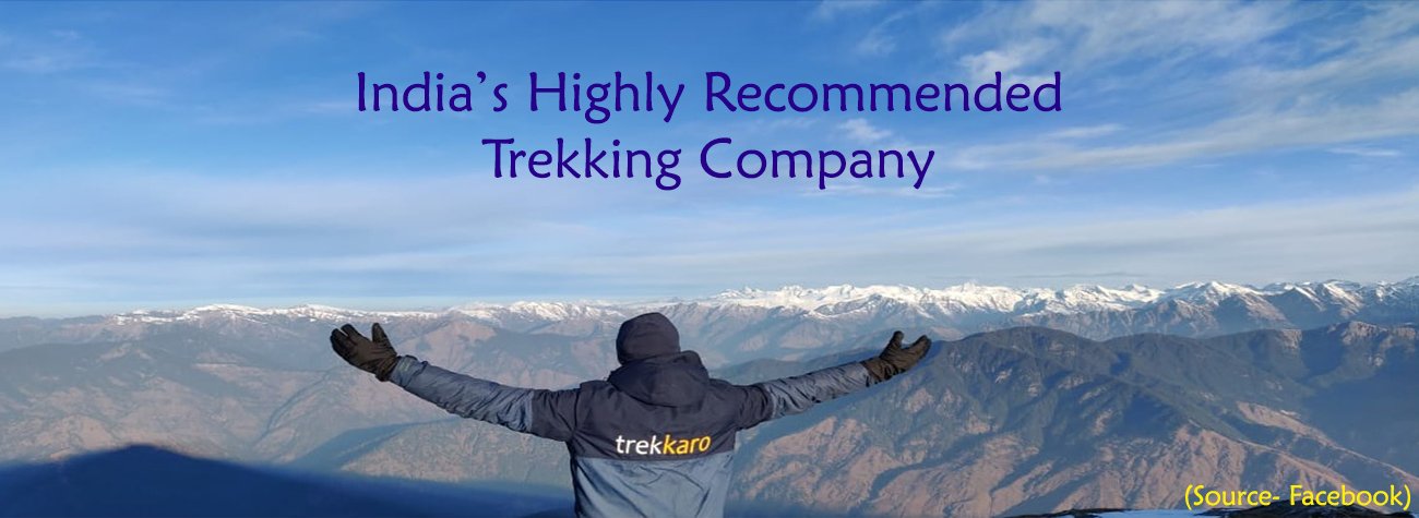
Ranthan Kharak Trek
Inclusion:
Accommodation
Meals
All Permits
Expert Trek Leader & Guide
Notify me on WhatsApp when dates open →
Ranthan Kharak Trek — Guide, Dates & Cost
Region: UttarakhandDistrict: Bageshwar
Duration: 7 Days
Difficulty Level: Moderate
Highest Altitude: 3,928 m / 12,887 ft
Trekking Distance: 36 Km
Temperature: Spring (Mar-Apr): Day 10°C to 15°C, Night below 0°C | Summer (May-Jun): Day 15°C to 20°C, Night around 2°C | Autumn (Sep-Oct): Day 12°C to 18°C, Night around 0°C
The first thing the Ranthan Kharak trek asks of you is to go down. From the stone houses of Gogina the trail drops through fields and forest to the Ramganga river, crosses it on a suspension bridge, and only then begins to climb. For three days it works its way upwards, past a village that sees few visitors, along a stone trail used by villagers and shepherds for generations, across the high grazing meadows known in Kumaoni as kharaks. On the fourth day on foot you stand on a rocky summit at 12,887 ft, with Nanda Devi, Nanda Kot, Trishul and the five peaks of Panchachuli in front of you.
Ranthan Kharak is a little-known trek in the Kumaon Himalaya, and it fits a great deal into a single loop. Gogina, a remote Kumaoni village of stone houses and terraced fields, is where it begins and ends. Namik, set high above the river, is one of the most remote villages on any Trekkaro trek. Above it, rhododendron and oak forest breaks into clearings such as Bajimanian Kharak, then into open meadows and the windswept col of Thal Tok, where the sunrise lights up Nanda Kot and Mrigthuni. The summit, Ranthan Top, faces Nanda Devi, Maiktoli and the Panchachuli range, before a long descent leads through Parava Thor and forest back to Gogina.
The Ranthan Kharak trek is a moderate-grade loop trek in the Bageshwar district of Uttarakhand, in the upper Ramganga valley between the Pindari and Namik glacier areas of Kumaon. Trekkaro runs it as a 7-day trek from Kathgodam, with five trekking days and about 36 km on foot. It starts and ends at Gogina (1,955 m / 6,415 ft), drops to the Ramganga at about 1,810 m, and climbs through Namik (2,252 m / 7,390 ft), Bajimanian Kharak (2,954 m / 9,690 ft) and Thal Tok (3,392 m / 11,130 ft) to Ranthan Top at about 3,928 m (12,887 ft), the highest point, before descending to Parava Thor (2,743 m) and closing the loop at Gogina. Kumaon sees far fewer trekkers than Garhwal, and in our experience Ranthan Kharak shows exactly what that quiet is worth.
Ranthan Top and the Peaks of Kumaon – What Makes the Ranthan Kharak Trek Unmissable
What sets Ranthan Kharak apart is the distance it covers between two very different worlds. It begins among people: the homestay at Gogina, the steep walk down to the river, and the camp near Namik, where the evening belongs to village life, with farmers returning from the fields, children playing and smoke rising from kitchens. It ends on an open, rocky summit facing some of the great peaks of Kumaon. Between the two lie forest, kharak and col, and the view widens the higher you go.
Thal Tok is where the summit starts to feel close. You reach the col at 3,392 m after a narrow ledge walk and a final climb in switchbacks, and the wind meets you the moment you arrive. You pull on your windproof jacket, cap and gloves, eat a good dinner and turn in early, because tomorrow is the long day. Then, if the sky is clear the next morning, you step out of your tent to watch the sunrise light up Nanda Kot and Mrigthuni to the north, one of the most beautiful moments of the trek.
Summit day starts early and stays hard. The climb to Ranthan Top crosses rocky, bouldery ground, and in spring there may be snow or a thin layer of ice on the shaded north face. You test each step on the loose rock before trusting your weight to it, and your trek leader guides the group through the steeper ground. Then the climbing stops, and at about 3,928 m (12,887 ft) the view sweeps across the great peaks of Kumaon: Nanda Devi and Nanda Devi East, Nanda Kot, Trishul, Maiktoli and the five peaks of the Panchachuli range. On a clear day it is one of the finest views in the region. From the top the trail follows a ridge and then begins a long descent to Parava Thor at 2,743 m, about 10 km and 11–12 hours in all. The next day the forest carries you back to Gogina. In our experience, it is that full circle, from a village to a summit and back to the same village, that makes Ranthan Kharak feel complete.
The Upper Ramganga Valley Itself
On the lower trail the landscape changes almost hour by hour. Gogina is a village of stone houses and terraced fields, and the first walk drops through fields and forest to the Ramganga, crosses the river on a suspension bridge and climbs steeply through forest to Namik on the far side. From Namik a stone-paved trail climbs through dense forest of rhododendron and oak; in March and April the rhododendrons cover the hillside in red and pink. The forest is broken by kharaks, clearings where shepherds graze their animals in summer, and Bajimanian Kharak, a meadow surrounded by forest, makes a cool, quiet camp.
Above the forest the valley opens out. A narrow ledge, with a drop on one side, leads onto open meadows, and the trail climbs in switchbacks, the views growing wider at every turn, until it reaches the exposed col of Thal Tok. The descent from Parava Thor runs back through some of the most beautiful forest of the trek, oak and rhododendron with deodar and pine in places, where, if you walk quietly, you may hear or see the Himalayan monal and the verditer flycatcher.
Who Is This Trek For?
The Ranthan Kharak trek is graded Moderate, with a Difficult summit day. Trekking days cover 5–10 km, and apart from summit day they take 5–7 hours, so you should be comfortable walking 6–7 hours a day. The first day on foot goes steeply down to the Ramganga and then steeply up to Namik, and the ledge walk before Thal Tok needs care. The hard day is the summit: about 10 km and 11–12 hours over rocky, bouldery ground to 3,928 m, followed by a long descent to Parava Thor. The highest camp is Thal Tok at 3,392 m. In our experience, the trek suits both fit beginners who train well and trekkers with one or two treks behind them, though one earlier trek helps, because summit day is long and rocky. As a benchmark, aim to jog 5 km in about 35 minutes before the trek, and plan on 4–6 weeks of steady preparation. Fit children aged 10 and above can join with a parent or guardian; trekkers above 60 need a doctor’s fitness certificate, with an ECG or TMT report recommended. Season: March to June and September to October.
Key Highlights of the Ranthan Kharak Trek
- Ranthan Top (3,928 m / 12,887 ft) – a rocky summit with a sweeping view of Nanda Devi and Nanda Devi East, Nanda Kot, Trishul, Maiktoli and the Panchachuli range
- Sunrise at Thal Tok (3,392 m / 11,130 ft) – Nanda Kot and Mrigthuni lit up to the north from a windswept col
- Gogina and Namik – two remote Kumaoni villages of stone houses and terraced fields, with homestay nights in Gogina
- The Ramganga crossing – a suspension bridge over the river at about 1,810 m
- The kharaks – high grazing meadows such as Bajimanian Kharak (2,954 m / 9,690 ft), set among forest
- An old stone trail – through rhododendron and oak, red and pink with bloom in March and April
- Forest birdlife – the Himalayan monal and the verditer flycatcher among oak, rhododendron, deodar and pine
- A complete loop – Gogina to Gogina via Namik, Thal Tok, Ranthan Top and Parava Thor
Best Time to Do the Ranthan Kharak Trek
The Ranthan Kharak trek has two windows: spring and early summer, from March to June, and autumn, from September to October. Within them the trek has three distinct moods: rhododendrons first, then green kharaks, then the sharpest views of the year.
March to April – Rhododendron Season
Early spring is when the forest above Namik is at its most colourful. The rhododendrons are in full bloom, and the stone trail climbs through hillsides of red and pink towards Bajimanian Kharak. Higher up, snow lingers on the upper slopes, and the shaded north face of Ranthan Top may carry snow or a thin layer of ice, so microspikes and gaiters come out on summit day when needed. Nights are the coldest of the season, dropping below freezing.
- Temperatures: Day: 10°C to 15°C | Night: below 0°C
- Trail conditions: Rhododendrons in full bloom; snow lingering high up, with possible snow or ice on the shaded upper slopes.
- Best for: Rhododendron forest in bloom and a touch of snow near the summit.
End of April to June – Green Meadows
As spring turns to summer, the kharaks come into their own. The meadows turn green, wildflowers appear, and from May the trail is usually free of snow all the way to the top. This is the season when shepherds bring their animals up to these high clearings, and the days are at their warmest, with milder nights at camp.
- Temperatures: May–June: Day: 15°C to 20°C | Night: around 2°C
- Trail conditions: Usually snow-free from May; green meadows and wildflowers.
- Best for: Green kharaks, wildflowers and milder days and nights.
Mid-September to October – Clear Mountain Views
Autumn brings the clearest mountain views of the year to Ranthan Kharak. The sunrise on Nanda Kot from Thal Tok and the long view from Ranthan Top have their best chance of being sharp now. The trail is usually snow-free, the days are pleasant for long walking, and nights drop to around freezing. In our experience, this is the season for trekkers who are coming above all for the summit view.
- Temperatures: Day: 12°C to 18°C | Night: around 0°C
- Trail conditions: Usually snow-free; clearest mountain views of the year; cold nights.
- Best for: Sharp views of Nanda Devi, Nanda Kot and Panchachuli from the summit, and sunrise on Nanda Kot from Thal Tok.
Trekkaro Recommendation
For rhododendron forest in full bloom, with a little snow near the summit, book a March or April batch. For green kharaks, wildflowers and the mildest conditions, choose the end of April to June. For the clearest views of Nanda Devi, Nanda Kot and the Panchachuli range, mid-September to October is our pick, provided you are ready for nights around freezing. Whichever window you choose, come prepared for one long, rocky summit day; the view from Ranthan Top is the reward for it.
🏃 Am I ready for the Ranthan Kharak Trek? Take the free 2-minute fitness test and get your readiness score and a personal training plan.
Take the test →Trek Itinerary
A cab can be arranged at an additional cost from Kathgodam Railway Station early in the morning to Gogina Village. The cost is shared among the trekkers; your trek coordinator will confirm the fare.
A cab can be arranged at an additional cost from Gogina to Kathgodam Railway Station, with expected arrival by 07:00 PM. The cost is shared among the trekkers; your trek coordinator will confirm the fare.
Day 1: Kathgodam to Gogina
Route Details:
Drive: Kathgodam → Gogina (~235 km, 10–11 hrs) | Altitude: 1,955 m (6,415 ft) | Stay: Homestay, Gogina
Day 1 is a long road day into the heart of Kumaon. You leave Kathgodam early in the morning. The road climbs into the Kumaon hills through Bhimtal and Almora, then continues to Bageshwar on the Saryu river and on to Kapkot. From Kapkot a smaller road climbs into the upper Ramganga valley and ends at Gogina.
Plan for 10–11 hours on the road, with stops for breakfast and lunch. The views change as you go higher, from pine-covered foothills to deep, terraced valleys. Network is weak beyond Kapkot and absent on the trail, so make your calls and tell your family your plans before then. There are no ATMs near Gogina. Bageshwar and Kapkot are the last towns on the route, and we recommend you withdraw all the cash you need in Haldwani or Kathgodam.
Gogina, at about 1,955 m, is a remote Kumaoni village of stone houses and terraced fields. You stay in a homestay, which gives you a first taste of local food and village life before the trail begins. Meals on the drive are not included, and dinner at the homestay is the first meal of the trek. Sleep early. Tomorrow starts with a steep walk down to the river.
What to Expect:
- Early start from Kathgodam and a 10–11 hour drive into the Kumaon hills
- Bhimtal, Almora, Bageshwar on the Saryu river and Kapkot along the way
- A smaller road up the upper Ramganga valley to Gogina
- Weak network beyond Kapkot and no ATMs near Gogina – carry cash from Haldwani or Kathgodam
- Homestay dinner and a first look at Kumaoni village life
- Overnight: Homestay in Gogina (1,955 m / 6,415 ft)
Day 2: Gogina to Namik
Route Details:
Altitude: 1,955 m → 1,810 m → 2,252 m (7,390 ft) | Distance: 6.5 km | Duration: 6 hrs | Terrain: steep descent through fields and forest, suspension bridge, steep forest climb | Stay: Tents near Namik
The trek begins by going down, not up. From Gogina the trail drops steeply through fields and forest to the Ramganga river, at about 1,810 m. Take this section slowly and use your trekking poles. Let them take some of the load off your knees, and keep your steps short on the steeper parts. The day is 6.5 km and takes about 6 hours.
At the river you cross on a suspension bridge, one of the highlights of the day. The Ramganga runs below you, and the bridge is the lowest point of the walking route. On the far side the trail climbs steeply through forest to Namik. This is the hard section of the day. Today goes down and then up, so save some energy for the climb after the bridge. Walk slowly, breathe steadily and stop when you need to. Lunch is usually packed and eaten on the trail.
Namik sits high above the river at about 2,252 m. It is a village of stone houses and terraced fields, and one of the most remote villages on any Trekkaro trek. The people here see few visitors. Please be respectful: ask before taking photos of people and homes, and keep the village clean. Namik is the last village on the loop before the forest and the high clearings. There is no mobile network from here on.
Camp tonight is near the village. When you arrive there is hot tea and snacks, and your trek leader begins the daily oxygen and pulse checks. The team boils or treats the camp water. In the evening, watch village life around you: farmers returning from the fields, children playing, smoke rising from the kitchens. It is a rare chance to see a remote Kumaoni village up close, and in our view it is one of the quiet rewards of this trek.
What to Expect:
- Steep descent through fields and forest from Gogina to the Ramganga river (1,810 m)
- Suspension-bridge crossing of the Ramganga
- Steep forest climb to Namik – save energy for the climb after the bridge
- Packed lunch on the trail; hot tea and snacks at camp
- First evening oxygen and pulse checks, and a close look at village life
- Overnight: Tents near Namik village (2,252 m / 7,390 ft)
Day 3: Namik to Bajimanian Kharak
Route Details:
Altitude: 2,252 m → 2,954 m (9,690 ft) | Distance: 5.4 km | Duration: 6–7 hrs | Terrain: steep stone-paved trail through rhododendron and oak forest, forest clearings | Stay: Tents at Bajimanian Kharak
From Namik a stone-paved trail climbs into dense forest of rhododendron and oak. Villagers and shepherds have used this trail for generations. Parts of it are steep, and the numbers tell the story: 5.4 km takes 6–7 hours. Walk at a steady pace and take short breaks in the shade. On the stone steps, we recommend short strides over long ones. Wear full sleeves and a cap in the forest. They protect you from sun and branches.
In March and April the rhododendrons are in full bloom, and the hillside turns red and pink. The forest is broken by clearings, called kharaks in Kumaoni, where shepherds graze their animals in summer. Each clearing gives you a breather and a patch of open sky before the trees close in again. Keep an eye out for birds. The Himalayan monal is sometimes seen in these forests. From end April to June the clearings turn green, with wildflowers in the meadows.
Water is available from streams along the way. Your trek leader tells you where it is safe to refill, so ask before you fill your bottle. On a long, steady climb like this one, we recommend small sips at every break rather than big gulps at the end of the day.
Camp tonight is at Bajimanian Kharak, at about 2,954 m, a meadow surrounded by forest. It is an open clearing with trees all around, and evenings here are cool and quiet. After 6–7 hours on the stone trail, rest well. Your trek leader continues the evening oxygen and pulse checks, and the team boils or treats the camp water. Nights on this trek drop below 0°C in spring, so put on your warm layers as the light goes. Eat a good dinner and get to bed early. Tomorrow the trail leaves the clearing for a narrow ledge and open meadows.
What to Expect:
- Steep, stone-paved trail out of Namik, used by villagers and shepherds for generations
- Dense rhododendron and oak forest, in full bloom in March and April
- Forest clearings (kharaks) where shepherds graze their animals in summer
- Stream water along the way – refill only where your trek leader says it is safe
- Full sleeves and a cap for sun and branches; watch for the Himalayan monal
- Overnight: Tents at Bajimanian Kharak (2,954 m / 9,690 ft)
Day 4: Bajimanian Kharak to Thal Tok
Route Details:
Altitude: 2,954 m → 3,392 m (11,130 ft) | Distance: 5 km | Duration: 6–7 hrs | Terrain: narrow ledge, open meadows, switchbacks to a col | Stay: Tents at Thal Tok
Leaving Bajimanian Kharak, the trail follows a narrow ledge for a while. This is the section to watch today. In places the ledge is narrow, with a drop on one side. Walk carefully, keep your eyes on the path and keep your poles on the inside. There is no need to hurry here. Leave a little space between you and the person ahead.
After the ledge the trail crosses open meadows. Higher up the meadows open out, and the views grow wider with every switchback. The last section climbs in switchbacks to Thal Tok, at about 3,392 m. Take the turns at an even pace. Short stops to look back are a good excuse to catch your breath and drink some water. The day is only 5 km, but at 6–7 hours it is not a short one.
Thal Tok is a windy col with wide views. It is exposed, so the team sets up the tents in the most sheltered spot available. Keep your windproof jacket, cap and gloves on as soon as you reach camp. Keep everything you need for the night inside your tent before dark. This is the highest camp of the trek.
Tomorrow is summit day, and tonight is about preparation. Rest well, eat a good dinner and go to bed early. Your trek leader briefs the group and checks everyone’s oxygen levels in the evening. Listen to the briefing closely and ask about anything you are unsure of. Lay out your warm layers, snacks and at least two litres of water before you sleep, so you can leave quickly in the morning. If the sky is clear in the morning, sunrise lights up Nanda Kot and Mrigthuni to the north. In our view it is one of the most beautiful moments of the trek, so keep your camera within reach.
What to Expect:
- Narrow ledge walk with a drop on one side – poles on the inside
- Open meadows, then switchbacks up to the Thal Tok col
- Windswept, exposed campsite, with tents pitched in the most sheltered spot
- Windproof jacket, cap and gloves on as soon as you reach camp
- Summit briefing, oxygen checks and an early night; sunrise on Nanda Kot and Mrigthuni if the sky is clear
- Overnight: Tents at Thal Tok (3,392 m / 11,130 ft)
Day 5: Summit Day - Thal Tok to Parava Thor via Ranthan Top
Route Details:
Altitude: 3,392 m → 3,928 m (12,887 ft) → 2,743 m | Distance: 10 km | Duration: 11–12 hrs | Terrain: rocky, bouldery climb, summit ridge, long descent | Stay: Tents at Parava Thor
This is the hardest day of the trek, so you start early. Eat breakfast even if you are not hungry. If the sky is clear, sunrise lights up Nanda Kot and Mrigthuni to the north as you set off from the col. The climb to Ranthan Top crosses rocky, bouldery ground. In spring there may be snow or a thin layer of ice on the shaded north face. You wear microspikes and gaiters when needed, and your trek leader guides each step.
The rocky climb is the hard section, and it rewards patience. On loose rock, test each step before you put your full weight on it. Keep your pace slow and even. The ground sets your speed here, not your fitness. If you feel unsteady, stop, look for the next solid step and follow your trek leader’s line.
From the summit, at about 3,928 m (12,887 ft), the view sweeps across the great peaks of Kumaon: Nanda Devi and Nanda Devi East, Nanda Kot, Trishul, Maiktoli and the five peaks of the Panchachuli range. On a clear day it is one of the finest views in the region. Take your time at the top. The climbing is done, but the day is far from over.
From the top, the trail follows a ridge and then begins a long descent to Parava Thor, at about 2,743 m. Stay focused on the way down. Short steps and planted poles make the long descent easier on tired legs. With 11–12 hours on the trail, carry at least two litres of water, plenty of snacks and warm layers. The trek leader sets a turn-around time and may change the plan if the weather turns. Camp tonight is at Parava Thor, well below Thal Tok. After the longest day of the trek, a hot dinner and an early night are all you need.
What to Expect:
- Early start from the Thal Tok col; sunrise on Nanda Kot and Mrigthuni if the sky is clear
- Rocky, bouldery climb to Ranthan Top, with possible snow or ice on the shaded north face in spring
- Summit view of Nanda Devi, Nanda Devi East, Nanda Kot, Trishul, Maiktoli and the Panchachuli range
- Ridge walk and a long descent to Parava Thor
- Turn-around time set by your trek leader; carry at least 2 litres of water, snacks and warm layers
- Overnight: Tents at Parava Thor (2,743 m)
Day 6: Parava Thor to Gogina
Route Details:
Altitude: 2,743 m → 1,955 m (6,415 ft) | Distance: 9.5 km | Duration: 5–6 hrs | Terrain: mostly downhill forest trail | Stay: Homestay, Gogina
The last day on the trail closes the loop. From Parava Thor the trail descends through forest back to Gogina. At about 9.5 km it is a long walk, but it is mostly downhill and easier than the days before. Your legs still carry summit day, so keep the pace easy and use your poles on the steeper parts. There are streams on the lower trail. Refill only where your trek leader says it is safe.
This stretch passes through some of the most beautiful forest of the trek. Oak and rhododendron line the trail, with deodar and pine in places. Walk quietly and you may hear or see birds such as the Himalayan monal and the verditer flycatcher.
You reach Gogina in the afternoon and return to the homestay. Lunch is at Gogina, and a hot meal and rest are waiting. The afternoon is free, so stretch, wash and repack your bag for the drive. In the evening the group celebrates the summit together. Mobile network stays absent until Kapkot, so calls home wait for tomorrow’s drive.
Before the evening ends, thank your local guides and support team. The local guide, the cook, the helpers and the mules carried this trek through remote country. They make treks like this possible.
What to Expect:
- Long but mostly downhill 9.5 km walk that closes the loop
- Oak and rhododendron forest, with deodar and pine in places
- Birds such as the Himalayan monal and verditer flycatcher
- Lunch at Gogina and a free afternoon at the homestay
- Summit celebration in the evening, and a thank-you to the local guides and support team
- Overnight: Homestay in Gogina (1,955 m / 6,415 ft)
Day 7: Gogina to Kathgodam
Route Details:
Drive: Gogina → Kathgodam (~235 km, 10–11 hrs) | Altitude: 1,955 m → 554 m | Stay: Trek ends at Kathgodam
After an early breakfast you leave Gogina and drive back down the upper Ramganga valley. The road runs through Kapkot, Bageshwar and Almora to Kathgodam, the same way you came on Day 1. The views run in reverse, from deep, terraced valleys back to pine-covered foothills. The drive takes 10–11 hours with short stops.
Breakfast is the last meal of the trek. Meals on the drive are not included, so keep snacks, water and a light jacket in your daypack. Mobile network returns as you get past Kapkot, so this is the time to let your family know you are off the mountain.
You usually reach Kathgodam around 7 pm. Mountain roads can bring delays, so we recommend you book onward trains for late night or the next day. Overnight trains from Kathgodam to Delhi work well after the drive. If you are flying, Pantnagar Airport is about 40 minutes from Kathgodam.
What to Expect:
- Early breakfast at the Gogina homestay
- A 10–11 hour drive via Kapkot, Bageshwar and Almora
- Mobile network back after Kapkot
- Meals on the drive not included – keep snacks and water handy
- Arrival at Kathgodam around 7 pm; overnight trains to Delhi work well
- Trek ends at Kathgodam
How To Reach
Nearest airport: Pantnagar Airport (PGH), about 30 km and roughly 1 hour from Kathgodam. Flights are limited, so if they don’t suit you, fly to Delhi and take an overnight train to Kathgodam instead.
From Kathgodam to Gogina: about 235 km via Almora, Bageshwar and Kapkot, a 10–11 hour drive. A cab can be arranged at an additional cost from Kathgodam Railway Station early in the morning; the cost is shared among the trekkers and your trek coordinator will confirm the fare.
Return: on Day 7 the cab from Gogina is expected to reach Kathgodam Railway Station by 07:00 PM. Book a late-night train or bus, or travel the next day if you want a buffer for road delays.
Nearest railway station: Kathgodam (KGM), where the cab picks you up, with overnight and day trains from Delhi. The cab leaves early in the morning, so an overnight train is the easiest option; check current timings and book early in season.
- Ranikhet Express – overnight from Delhi
- Kathgodam Shatabdi – a day train; take it the day before and stay overnight in Kathgodam or Haldwani
From Kathgodam to Gogina: about 235 km via Almora, Bageshwar and Kapkot, a 10–11 hour drive. A cab can be arranged at an additional cost from Kathgodam Railway Station early in the morning; the cost is shared among the trekkers and your trek coordinator will confirm the fare.
Return: on Day 7 the cab from Gogina is expected to reach Kathgodam Railway Station by 07:00 PM. Book a late-night train or bus, or travel the next day if you want a buffer for road delays.
Bus route: buses run from Delhi ISBT Anand Vihar and Kashmere Gate to Haldwani and Kathgodam in about 7–8 hours. Take an overnight bus and get down at Kathgodam (or take an auto from Haldwani) to reach the railway station in time for the early-morning cab. There are no direct buses to Gogina; on your own you would need a bus to Bageshwar and then a jeep to Gogina (about 80 km).
From Kathgodam to Gogina: about 235 km via Almora, Bageshwar and Kapkot, a 10–11 hour drive. A cab can be arranged at an additional cost from Kathgodam Railway Station early in the morning; the cost is shared among the trekkers and your trek coordinator will confirm the fare.
Return: on Day 7 the cab from Gogina is expected to reach Kathgodam Railway Station by 07:00 PM. Book a late-night train or bus, or travel the next day if you want a buffer for road delays.
Things To Carry
This 7-day Kumaon loop has a long, rocky 11–12 hour summit day, and the shoes, poles and snow gear come with Trekkaro’s Free Trekking Gear.
- Backpack – 50–60 L with a rain cover and padded hip belt
- Day pack – 20–30 L; needed if you offload your main backpack (₹1,800 + 5% GST for the full trek, max 9 kg, no suitcases, trolleys or duffel bags)
- Trekking shoes – Provided free with Trekkaro’s Free Trekking Gear (one refundable deposit of ₹3,000 + ₹200 washing charge covers the whole kit)
- Trekking poles – Provided free with the Free Trekking Gear; they save your knees on the bouldery descent from Ranthan Top
- Gaiters and microspikes – Provided free with the Free Trekking Gear when the trail needs them, mainly for snow or ice on the shaded upper slopes in March and April
- Headlamp – with spare batteries, for camp evenings and the long summit day
- Water bottles – 2 bottles of 1 L each; make one insulated in March and April
- Lunch box – reusable, for packed lunches on the trail
Nights at the high camps drop below 0°C in March–April and stay around 0–2°C from May to October, so dress in layers you can add and remove.
- -10°C padded jacket – Provided free with Trekkaro’s Free Trekking Gear
- Thermal innerwear – 1 set, top and bottom, for nights at camp
- Fleece or woollen layers – 2 in March–April and September–October; 1 is usually enough in May–June
- Rain jacket or poncho – for sudden showers on the trail
- Trek pants – 2 pairs, quick-dry; no jeans
- T-shirts – 3 quick-dry collared T-shirts; full sleeves protect you from the sun
- Socks – 3–4 pairs of cotton or sports socks for walking, plus 2 pairs of woollen socks for the night
- Caps – a sun cap for the day and a woollen cap for evenings, plus a buff or scarf for the wind
- Gloves – a fleece or woollen pair, plus waterproof gloves in March–April for snow
Sun and wind are strong on the open kharaks and at Ranthan Top, and Bageshwar and Kapkot are the last towns on the route, so pack these before you leave home.
- Sunglasses – UV-protected; essential if there is snow in March–April
- Sunscreen – SPF 50+
- Lip balm – with SPF, to prevent chapped lips
- Quick-dry towel – small and light
- Toiletries – toothbrush, toothpaste and biodegradable soap; no wet wipes, as they are not biodegradable
- Plastic or ziploc bags – to keep wet clothes apart and to carry back your waste
- Personal medical kit – your regular medicines and a small first-aid pouch; consult your doctor before the trek
Gogina is a remote village with weak network beyond Kapkot and none on the trail, so carry what you need for all 7 days.
- Snacks – dry fruits, energy bars and chocolates, especially for summit day
- ORS or electrolyte sachets – a few, to stay hydrated on long days
- Power bank – there is no charging at the campsites
- Cash – withdraw in Haldwani or Kathgodam; Bageshwar and Kapkot are the last towns and there are no ATMs near Gogina. Keep enough for your share of the cab, offloading if needed and small expenses
- Government photo ID – original and a photocopy (Aadhaar, passport, driving licence or voter ID)
- Medical / fitness certificate – signed by a doctor (download it from your booking)
- Disclaimer form – signed
- Travel insurance – a copy of your policy; it is mandatory and must cover high-altitude trekking and emergency evacuation
Frequently Asked Questions
Ranthan Kharak Trek is a 7-day moderate trek in Bageshwar, Uttarakhand, reaching 3,928 m (12,887 ft). It covers about 36 km on foot and starts and ends at Gogina. Best time: March to June and September to October. Trekkaro price: ₹9,160 per person + 5% GST, with free trekking gear (Decathlon shoes, -10°C jacket and poles).
Updated
The Ranthan Kharak trek is in Bageshwar district, Kumaon, Uttarakhand, in the upper Ramganga valley between the Pindari and Namik glacier areas. It starts from Gogina village, about 235 km (10–11 hours) by road from Kathgodam.
The trek is a loop: Gogina, Namik, Bajimanian Kharak, Thal Tok, over Ranthan Top to Parava Thor and back to Gogina.
The Ranthan Kharak trek takes 7 days from Kathgodam to Kathgodam, with 5 trekking days covering about 36 km.
- Day 1 and Day 7: drive between Kathgodam and Gogina (10–11 hours)
- Days 2–6: trekking, 5–10 km a day
- Longest day: summit day (Day 5), about 10 km and 11–12 hours
The highest point of the Ranthan Kharak trek is Ranthan Top at about 3,928 m (12,887 ft). The trek starts at Gogina (1,955 m / 6,415 ft).
- Namik camp: 2,252 m
- Bajimanian Kharak: 2,954 m
- Thal Tok: 3,392 m
- Parava Thor: 2,743 m
The Ranthan Kharak trek is graded Moderate, with a difficult summit day of 11–12 hours over rocky, bouldery ground. It suits fit beginners who train well and trekkers with one or two treks behind them.
Fit beginners can do the Ranthan Kharak trek if they train well, but one earlier trek helps, because summit day is long and rocky.
For the Ranthan Kharak trek you should be able to walk 6–7 hours a day, and 11–12 hours on summit day, and aim to jog 5 km in about 35 minutes before the trek.
- Train for 4–6 weeks: brisk walks, stairs or uphill walking
- Strength: add squats and lunges for the descents
- Fitness test: take our free 2-minute test at Am I Ready?
‘Kharak’ is the Kumaoni word for a high grazing meadow. The Ranthan Kharak trek passes several of them, such as Bajimanian Kharak, where shepherds bring their animals in summer.
The best time for the Ranthan Kharak trek is March to June and mid-September to October. The trek is closed in the monsoon and in winter.
- March–April: rhododendrons in bloom, snow lingering up high
- End April–June: green meadows and wildflowers
- Mid-September–October: the clearest mountain views
The Ranthan Kharak trek can have snow or ice on the shaded upper slopes in March and April. From May to October the trail is usually snow-free.
Microspikes and gaiters from our Free Trekking Gear are used when needed.
On the Ranthan Kharak trek, nights drop below 0°C in spring and are around 0–2°C in summer and autumn.
- March–April: days 10–15°C, nights below 0°C
- May–June: days 15–20°C, nights around 2°C
- September–October: days 12–18°C, nights around 0°C
From Ranthan Top you see Nanda Devi and Nanda Devi East, Nanda Kot, Trishul, Maiktoli and the five peaks of the Panchachuli range.
The Ranthan Kharak trail goes from village fields to a suspension bridge over the Ramganga, stone trails through rhododendron forest, open kharaks and a rocky summit.
The risk of altitude sickness on the Ranthan Kharak trek is low to moderate; you sleep at up to 3,392 m and reach 3,928 m on summit day.
Your trek leader checks oxygen and pulse every evening.
Fit children aged 10 and above can join the Ranthan Kharak trek with a parent or guardian.
Trekkers above 60 need a doctor’s fitness certificate; an ECG or TMT report is recommended.
To reach the Ranthan Kharak trek, travel to Kathgodam; Gogina is about 235 km (10–11 hours) away via Almora, Bageshwar and Kapkot.
- Train: Kathgodam, overnight trains from Delhi
- Air: Pantnagar Airport, about 40 minutes from Kathgodam
- Bus: to Bageshwar, then a jeep to Gogina (no direct buses)
Plan to reach Kathgodam early on Day 1.
No, transport is not included in the Ranthan Kharak trek fee. A cab can be arranged from Kathgodam Railway Station to Gogina and back early in the morning; the cost is shared among the trekkers and your trek coordinator confirms the fare.
On the Ranthan Kharak trek you stay 2 nights in a homestay in Gogina (Day 1 and Day 6) and 4 nights in tents at Namik, Bajimanian Kharak, Thal Tok and Parava Thor.
Tents are shared by 3 trekkers, with dining and toilet tents. Sleeping bags and mats are provided.
Fixed departures of the Ranthan Kharak trek run with 6 to 20 trekkers – never more than 20 – led by a certified Trekkaro trek leader.
The leader is supported by a local guide, a cook, helpers and mules that carry the camp. Private groups of any size can also be arranged.
Yes. On the Ranthan Kharak trek, female trekkers share tents only with other female trekkers, and male trekkers with males; couples and families get their own tents.
We keep three trekkers to a tent, and our guides and support staff are carefully selected and trusted.
On the Ranthan Kharak trek we serve simple, freshly cooked vegetarian meals, with eggs available on request at camp.
- Breakfast: at camp
- Lunch: packed, on trekking days
- Evening: tea with snacks
- Dinner: hot, in the dining tent
Meals on the drive to and from the base are not included.
On the Ranthan Kharak trek there are streams on the lower trail, but carry at least 2 litres on summit day.
Our team boils or treats the water at every campsite.
Yes. Free Trekking Gear is included on the Ranthan Kharak trek, free of rental charges:
- Shoes: Decathlon trekking shoes
- Jacket: Decathlon -10°C trekking jacket
- Poles: trekking poles
- Snow gear: gaiters and microspikes when the trail needs them
There is a ₹3,000 refundable deposit and a ₹200 washing charge. You only bring your personal clothes, a backpack and a water bottle.
Yes. Backpack offloading on the Ranthan Kharak trek costs ₹1,800 + 5% GST for the full trek, for up to 9 kg.
- Bags: no suitcases, trolleys or duffel bags
- Booking: tell us at least 15 days before the trek; last-minute requests may cost more
- Daypack: you still carry water, snacks and a warm layer
No doctor joins the Ranthan Kharak trek, but our trek leaders are trained in wilderness first aid and carry a full first-aid kit and a pulse oximeter.
Carry your own regular medicines and tell your trek leader about any health condition before the trek.
For the Ranthan Kharak trek, carry an original government photo ID (with a photocopy), a medical certificate signed by a doctor, and the signed disclaimer form.
Trekkaro arranges the forest and camping permissions.
Mobile network on the Ranthan Kharak trek is weak beyond Kapkot and absent on the trail, and there is no ATM near Gogina.
Withdraw all the cash you need in Haldwani or Kathgodam.
The Ranthan Kharak trek passes Gogina and Namik, two remote Kumaoni villages of stone houses and terraced fields.
Please ask before photographing people and homes, and keep the villages clean.
Terms & Conditions
1. Free Trekking Gear (FTG) – Save on Gear Rentals
Trekkaro’s Free Trekking Gear (FTG) lets you trek without buying or renting gear. Included free of rental charges:
- Decathlon trekking shoes
- Decathlon -10°C jacket
- Trekking poles, and gaiters / microspikes when the trail needs them
- ₹3,000 refundable deposit + ₹200 washing charge
2. Accommodation
- Day 1 and Day 6: Homestay in Gogina on a triple/quad sharing basis
- Day 2 to Day 5: Camping in 3-person tents, with dining and toilet tents
3. Meals
- All meals from Day 1 dinner to Day 7 breakfast
- Simple, freshly cooked vegetarian food
- Tea, coffee, soup and snacks on the trail and at camp
4. Permits & Camping Fees
- All forest permits and camping charges for the trek
5. Trek Team & Safety
- Certified trek leader and local guide throughout all 7 days
- Cook, helpers and support staff
- First-aid kit, pulse oximeter and blood-pressure checks during the trek
- Tents, sleeping bags and mats for the camping nights
1. Food During Transit
- Meals on the drive between Kathgodam and Gogina are not included.
2. Transport
- Not included: Kathgodam to Gogina and back.
- We help the group book shared cabs; the fare is paid directly to the driver and split among trekkers.
3. Backpack Offloading (optional)
- ₹1,800 + 5% GST for the full trek
- Max weight: 9 kg
- No suitcases, trolleys or duffel bags
4. Single Tent Occupancy (optional)
- ₹2,000 + 5% GST per tent for the whole trek
5. Anything Not Mentioned Under Inclusions
- Personal expenses, tips and anything not listed under inclusions.
- Travel insurance: mandatory and not included. Your policy must cover high-altitude trekking and emergency evacuation.
Free rescheduling up to 7 days before · TrekCash voucher · refunds — tap to read
We know that cancelling a trek can be genuinely disappointing. Plans change, life intervenes, and sometimes the mountains have to wait. That is why Trekkaro has designed one of the most trekker-friendly cancellation policies in the industry — to reduce the financial impact on you and give you real options when things do not go as planned.
Important: Bookings made on trekkaro.com are cancelled online from My Bookings. Bookings made offline with our team must be cancelled in writing by e-mail by the person who originally booked the trek. Requests over the phone, via WhatsApp, or through third parties are not accepted.
How to Cancel Your Trek
Booked online on trekkaro.com:
- Log in and open My Bookings.
- Choose Cancel Booking on the trek you want to cancel.
- Pick a refund (as per the charges below) or Get TrekCash Voucher instead — the voucher is issued instantly and appears under My TrekCash Vouchers.
Booked offline with our team:
- Compose an e-mail from the registered e-mail ID used at the time of booking.
- Attach a copy of your tax invoice to the e-mail.
- Send both to info@trekkaro.com.
- Your cancellation is effective from the date Trekkaro receives and acknowledges your e-mail.
How to Reschedule Your Trek (Free)
- Once per booking, to another batch of the same trek, free of charge. A request we decline doesn’t count.
- Up to 7 days before departure — both your current and new batch must be at least 7 days away.
- Subject to seat availability for every trekker on the booking.
- Not available for bookings paid fully or partly with a TrekCash Voucher.
- No fee or price difference; add-ons and the number of trekkers stay as booked.
Booked online: My Bookings → Reschedule free → pick a batch. Our team confirms by e-mail and your booking moves once approved. Booked offline: e-mail info@trekkaro.com.
Cancellation Charges
| Cancellation Timeline | Refund | Details |
|---|---|---|
| 30 days or more before departure | 70% Refund | 30% cancellation charge |
| 15 to 29 days before departure | 50% Refund | 50% cancellation charge |
| Within 14 days / No-Show | No Refund | Free rescheduling (once per booking), transfer of booking, or a TrekCash Voucher (100% value, 1-year validity) — available until 7 days before departure |
Free rescheduling or a 100% voucher instead of a refund. At any time from the date of booking until 7 days before departure, you can reschedule to another batch free of charge (once per booking, subject to seat availability), transfer your booking to another trekker, or take a TrekCash Voucher worth 100% of the amount paid, valid for 1 year — whichever refund slab would otherwise apply. Online bookings take the voucher themselves from My Bookings → Cancel Booking (issued instantly); offline bookings request it by e-mail to info@trekkaro.com.
Cancellation of Voucher-Based Bookings
- The standard cancellation policy applies to voucher-based bookings in the same way it applies to direct bookings.
- Any remaining balance after the applicable cancellation charge has been deducted will be credited back to your Trekkaro account as a new voucher.
- If your voucher has already expired at the time of cancellation, no refund, credit, or extension will be issued under any circumstance.
- If a voucher is set to expire on a Sunday or public holiday, it must be redeemed before the expiry date.
Additional Terms
- Free Rescheduling: Switching to a different batch of the same trek is free of charge once per booking, up to 7 days before departure, subject to seat availability. Not available for bookings paid with a TrekCash Voucher. See “How to Reschedule Your Trek” above.
- Trek Transfers: Transferring your booking to another person is permitted, subject to Trekkaro's eligibility criteria. The new trekker must meet the fitness, age, and documentation requirements for that particular trek.
- No Refund Post-Commencement: Once the trek has commenced from Day 1 of your confirmed itinerary, no refunds or TrekCash Vouchers will be issued for any reason, including early exit, illness, or dissatisfaction with services.
- Policy Changes: Trekkaro reserves the right to amend or withdraw this cancellation policy at any time without prior notice. The version in effect at the time of your booking confirmation governs your booking.
Early Exit or Removal from Trek
A trekker may be required to leave the trek before completion for health concerns (AMS, hypertension, cardiac symptoms, or fitness that poses a safety risk), rule violations (alcohol or non-prescribed drugs on trail, smoking in prohibited zones, reckless behaviour, or misconduct), or by their own decision. In all cases of early exit or removal, no refund, partial refund, or TrekCash Voucher will be provided, and any additional transport or exit expenses are the trekker's responsibility. The trek leader's decision on health and safety grounds is final.
If Trekkaro Cancels Your Trek
In rare circumstances beyond our control — natural disasters (extreme snowfall, avalanche, floods, landslides, earthquakes) or unforeseen civil events (government curfews, lockdowns, political unrest) — Trekkaro will issue a TrekCash Voucher for the full trek fee paid, valid for 12 months on any trek listed on Trekkaro.com. If the new trek costs more, the difference is payable by the trekker. The voucher is sent to your registered e-mail within 10 working days and may be transferred to another person who meets Trekkaro's eligibility requirements.
Refund Processing
Refunds are processed within 10 working days of cancellation approval and credited to the original payment method only (credit card, debit card, net banking, UPI, or wallet). Your bank may take another 3–5 business days. Office hours: Monday to Saturday, 10:00 AM to 7:00 PM IST.
The full policy is part of our Terms & Conditions (Section 09).
Oxygen, first aid, daily SpO₂ checks, trained leaders — tap to read
Why Trekking With Trekkaro Just Hits Different
Let’s skip the romanticising for a second.
The Himalayas are brutal, beautiful, and brutally expensive. Before you have even laced up for Day 1, you have already bled out on boots that actually grip ice, a jacket that won’t quit at -10°C, and poles that won’t snap on a ridge at 14,000 feet. For most people, the gear bill alone is enough to bury the dream.
We built Trekkaro to kill that excuse.
Our Free Trekking Gear (FTG) initiative is the only one of its kind in the industry. We don’t hand you a dusty rental bag and wish you luck – we kit you out in full, premium Decathlon gear, so the only thing you are spending on the mountain is energy.
1. Premium Gear. Zero Compromise. No Rental Fee.
When you show up to base camp with Trekkaro, you’re showing up equipped:
- ₹6,999 Quechua TREK 100 trekking shoes – built for altitude, not Instagram
- Quechua SH 100 insulated jackets (₹3,299) – rated to -10°C, because “a little chilly” at 13,000 feet is a lie
- Professional-grade trekking poles – the kind that give, not break
This isn’t charity. It’s a safety standard. Cheap gear doesn’t fail gracefully – it fails suddenly, in the cold, far from help. Our high-altitude tents and sleeping bags are rated from -5°C to -20°C, because when the wind is tearing through camp at 3 AM, the difference between good gear and great gear is the difference between sleeping and suffering.
2. Your Health Gets Checked – Every Single Day. No Exceptions.
The mountain doesn’t care about your fitness routine or your iron will. Altitude sickness doesn’t negotiate. It hits the first-timer and the seasoned trekker the same way – quietly, then all at once.
That’s why we don’t wait for symptoms. We track.
- Daily vitals: Pulse and blood oxygen (SpO2) checks for every trekker, every day
- Early detection over emergency reaction: A dip in your SpO2 is caught and addressed before it becomes Acute Mountain Sickness (AMS)
- Guides trained to make hard calls: If you’re not 100%, we don’t push you. We have the medical backup to act on the mountain, not after you’ve come down
Prevention isn’t cautious. It’s what separates a great trek from a dangerous one.
3. Real Safety Infrastructure – Not a Bag of Band-Aids
Most operators carry a first-aid kit. We carry a system.
- Portable oxygen cylinders – moving with the group at all times
- Emergency stretchers – staged at every campsite, not just the base
- Radio communication across all camps – because mobile signal disappears the moment the real terrain begins
Our camps are always in contact. A weather change, a medical flag, a gear issue – our team knows before it becomes a crisis. When you’re with Trekkaro, you’re never truly off-grid where it matters.
4. Technical Muscle on the Hard Sections
Icy ridges. Steep snow slopes. The sections that look straightforward on a map and feel anything but underfoot.
We don’t just warn you and move on. We deploy a dedicated technical team to the sections that demand it — fixing ropes, cutting steps, and physically supporting trekkers through exposed terrain. This isn’t hand-holding. It’s the difference between a team that prepares for the mountain and one that just shows up to it.
A Word Before You Book
We’ll carry the gear and the safety infrastructure. But the mountain still asks something from you.
Start training at least 3 weeks out. Cycling, running, swimming – anything that works your cardiovascular system. At 12,000 feet, your lungs become the limiting factor, not your legs. The trekkers who put in the work before the trek are the ones who arrive at the summit with enough breath left to actually take it in.
The Himalayas are for everyone. But they reward the prepared.
That’s what Trekkaro is built on.
What a day on the trek feels like — tap to read
What to Expect When You Trek with Trekkaro
Most people spend more time researching a laptop purchase than they do choosing who they hand their safety to at 13,000 feet. We think that deserves to change.
When you trek with Trekkaro, you’re not buying a package. You’re entering a relationship with a team that has thought carefully, sometimes obsessively, about every variable between the trailhead and the summit. This section is our honest, specific answer to the question every serious trekker should be asking before they book: what actually happens when I’m up there?
What You Can Expect From Us
1. Safety That Goes Beyond Reassurance
We’ve said it elsewhere on this page, and we’ll say it again here because it bears repeating: safety at altitude is not a vibe. It is a system.
Our guides don’t just “know the mountains". They hold NIM (Nehru Institute of Mountaineering) certification or equivalent accreditation, which means their training covers casualty assessment, high-altitude medical response, rope mechanics and anchor building, and multi-team evacuation coordination specific to the terrain we operate in. They’ve been trained to make difficult calls, including the one no trekker wants to hear: you need to descend now.
On the trail, safety looks like this: twice-daily SpO2 and pulse checks at every camp. Portable oxygen cylinders carried with the group in motion, not staged at basecamp. An emergency stretcher is pre-positioned at every campsite before the trekking group arrives. HF radio contact is maintained between the trek leader, sweep guide, and base operations at all times because mobile signal above 10,000 feet is not a plan.
The calm, professional demeanour you’ll notice in our guides isn’t composure for its own sake. It is the result of training and preparation thorough enough that very few situations on the mountain come as a surprise. That is what you feel. That is what lets you actually enjoy the trek.
2. Personalised Attention – Not Group Management
Trekkaro caps every batch at a maximum of 20 trekkers. This is not a selling point. It is a structural decision that makes everything else on this list possible.
At a 1:8 guide-to-trekker ratio, your trek leader knows your pace by Day 2. They know whether you tend to push too hard on the ascent and fade in the afternoon. They know whether you’re someone who needs encouragement on technical sections or someone who needs to be quietly reined in. They know what you ate at breakfast and whether you filled your water bottle before leaving camp.
Altitude acclimatisation, gear fit, meal timing, and hydration monitoring – these aren’t items on a checklist. They are the continuous, low-key background work of a trekkaro guide throughout every day on the trail. You don’t have to ask for most of it. It simply happens, and you notice its absence only if you’ve ever trekked without it.
3. Guides Who Are Leaders, Not Just Route-Knowers
There’s a version of a trekking guide who walks fast, knows the path, and assumes everyone is keeping up. That is not the Trekkaro guide.
Our guides understand that a group of twelve people at 12,000 feet are experiencing twelve different physiological experiences simultaneously. One trekker is managing a blister they haven’t mentioned. Another is slightly dehydrated and doesn’t know it yet. A third is having the single best day of their life and just needs to be left in it. A guide who can read all three of those simultaneously and respond to each of them differently is the difference between a trek that is merely completed and one that is genuinely unforgettable.
Our guides are trained motivators, yes. But more fundamentally, they are trained observers. The moment your stride changes, the moment your breathing pattern shifts, the moment you start answering questions with fewer words than usual, they notice. That attentiveness is what keeps you safe. It also, incidentally, makes for extraordinary mountain companionship.
4. An Itinerary Built Around How the Body Actually Works at Altitude
There is a temptation in trek design to maximise distance, minimise days, and push the daily elevation gain as high as the trail allows. The result is an itinerary that looks efficient on paper and feels brutal in practice.
Trekkaro itineraries are built around the golden rule of altitude acclimatisation: climb high, sleep low, and give the body time to adapt before demanding more of it. The daily elevation gains on our routes are calibrated to physiological reality, not to route efficiency. Rest and acclimatisation time is built into the schedule as a non-negotiable, not as padding that gets cut when groups run late.
Campsite selection is similarly intentional. We choose sites for their drainage, their shelter from prevailing winds, their proximity to clean water sources, and, where possible, views that make the effort of getting there feel immediate and earned. Some campsites will simply take your breath away, and not because of the altitude.
5. Real Value – Which Means Transparency, Not Discounts
We are not the cheapest trekking company in India. We’re also not trying to be. What we are is genuinely transparent about what your money funds.
The cost of a Trekkaro trek covers all meals on trail (breakfast, lunch, snacks, and dinner, planned for both caloric density and palatability at altitude), accommodation at all campsites, -20°C rated sleeping bags, NIM-certified leadership, medical infrastructure including portable oxygen and emergency stretchers, HF radio communication, forest permits, and the full Free Trekking Gear initiative – a premium Decathlon kit with no rental fee (₹3,000 refundable deposit + ₹200 washing charge).
We do not charge separately for things that should be standard. We do not add line items after booking. And we do not cut corners on the things that determine whether your trek is safe and memorable. The value in trekking with Trekkaro is not in paying less. It is in knowing exactly what you are getting and getting all of it.
What We Expect From You
Trekkaro will prepare you, equip you, monitor you, and carry the weight of your safety across every metre of trail. But the Himalayas are not a theme park, and a trek is not a performance staged for your benefit. You are a participant in something genuinely serious and genuinely extraordinary, and your contribution matters.
1. Show Up With a Willing Attitude
The Himalayas will not always cooperate. A weather window will close. A campsite will be windier than expected. A stream crossing will be colder than the photographs suggested. A summit morning will begin in darkness at temperatures that test every layer in your pack.
None of this is failure. All of it is the trek. The trekkers who look back on their Har Ki Dun Trek experience as transformative are almost always the ones who met discomfort with curiosity rather than resistance. They leaned into the hard morning. They asked questions at camp. They were present for the difficult parts as well as the spectacular ones and discovered reliably that the difficult parts often become the stories they tell most.
Bring flexibility. Bring patience with yourself and with the group. Bring the version of yourself that is willing to be surprised.
2. Prepare Your Body Honestly
You do not need to be an athlete to trek with Trekkaro. You do need to be honest with yourself about your current fitness level and put in the preparation that brings you to the trailhead in a condition to enjoy the experience, not merely endure it.
The single most important thing you can do is cardiovascular training over a sustained period, not a crash fitness programme in the final two weeks. Start six weeks out. Run, cycle, swim, or hike – any sustained aerobic activity that elevates your heart rate for 45 minutes or more, four to five days per week. Add stair climbing and uphill walking in the final three weeks. Introduce strength work for your quads and ankles, which will carry the real load on the descent.
Arrive in Dehradun at least one day before your batch departs. Sleep well, hydrate properly, and avoid alcohol the night before Day 1. You are not starting a holiday. You are beginning an acclimatisation process, and the first 24 hours set its trajectory.
3. Trust Your Guide’s Judgement – Including the Decisions You Don’t Want to Hear
Our guides make decisions based on complete information: your health readings, current weather data from base operations, the condition of the trail ahead, and five or more years of specific mountain experience. You make decisions based on how you feel and how badly you want to reach the summit.
These two information sets will occasionally conflict. When they do, the guide’s judgement takes precedence, not because we are authoritarian, but because the mountain has no interest in how determined you are.
If your guide adjusts the departure time, changes the route, slows the group’s pace, or recommends you descend rather than continue, it is because something in their complete picture warrants it. Pushing through that recommendation does not make you brave. It makes the situation harder for everyone, including the trekkers who are depending on the group moving as a coordinated unit.
Trust is not passive on a Trekkaro trek. It is an active choice you make every morning when you lace up your boots, and it is the foundation on which everything else – the safety, the experience, the memories – is built.
We are genuinely excited to be on the trail with you. The mountains will do the rest.
Last ATM and phone network on the route — tap to read
Important Pre-Trek Information
- ATM: Withdraw cash in Haldwani or Kathgodam. Bageshwar and Kapkot are the last towns on the route; there are no ATMs near Gogina.
- Mobile network: Network is weak beyond Kapkot and absent on the trail. Inform your family before the drive from Bageshwar.
Related Treks You May Like
What Our Trekkers Say
Recent reviews left on trekkaro.com by trekkers who booked with us.
"Trekkaro did a great job organising Kuari Pass Trek. Food was awesome"
"Winter Kuari Pass trek with the team of Trekkaro. Food was amazing for breakfast, lunch and diner. Views on top and during the track are amazing. Trek in total was completely amazing. Big thanks to all of hard work from trek leader, superhuman cooks, the mule team, our driver."
"I have trek with Trekkaro for kuari pass and it was an amazing experience ,food was excellent and experience trek trainer."
"Trekkaro was simply amazing from the guidance to food to stay everything was very good!!! Local guides and trek leaders where always motivating, fun and made sure entire group had always been together and interacted with each other!!!"
"Had an amazing experience! Thanks for making this an amazing experience - Trekkaro Team"
"Trekkaro has a amazing team capable of leading anyone over a trek. Had an amazing experience!"
Why Trekkaro?
Leaders in providing Free Trekking Gear for 8+ years — redefining the way everyone must trek.

World's first free trekking gear company — Decathlon shoes, jackets, poles, gaiters & microspikes. All included, zero cost.

Up to 7 days before departure, reschedule to another batch for free or take a TrekCash Voucher worth 100% of your amount — valid for 1 year on any future trek.

Rated 4.9/5 on Facebook & 4.7/5 on Google — India's most trusted trekking company by thousands of happy trekkers.

We keep you safe from the moment you book to the moment you head home — certified leaders, first aid & emergency support.

Well-planned itineraries balanced with the freedom to make the experience your own — no matter the trek difficulty.

Every decision we make is guided by our commitment to making trekking a force for good — for people and the planet.
Welcome to Trekkaro
Login or create an account to manage your bookings and profile
Login Create AccountTalk to an Expert
Enter your number — we'll call you back shortly.
*Free to use on the trek, returned after · refundable deposit
AI can make mistakes · don’t share personal details · Talk to a person