Quick answer: Chandrashila is a 3,962 m (13,000 ft) summit in Rudraprayag district, Uttarakhand. It is a 1 km walk and 282 m of climbing above Tungnath temple (3,680 m), and the trail to both starts at Chopta (2,679 m). Trekkaro's 5-day trek starts at Sari village, 185 km by road from Rishikesh, and summits on Day 4.
This page is for anyone who has seen Chandrashila in a photo and wants to place it on the map: which state and district, how it connects to Chopta and Tungnath, how far it is from Rishikesh, Haridwar and Delhi, and where our trek starts. The trek altitudes, distances and times below come from our Chopta Chandrashila trek page, which has batches listed from 24 October 2026 to 28 February 2027; the sanctuary figures come from the Wildlife Institute of India.
Chandrashila at a glance
| Question | Answer |
|---|---|
| State | Uttarakhand |
| District | Rudraprayag |
| Summit altitude | 3,962 m / 13,000 ft |
| Temple just below | Tungnath, 3,680 m / 12,073 ft |
| Nearest road point | Chopta, 2,679 m / 8,790 ft |
| Where our trek starts | Sari village, 2,012 m / 6,601 ft |
| Pickup | Jumping Heights, Tapovan, Rishikesh, 07:00 AM on Day 1 |
| Rishikesh to Sari | About 185 km, 8 to 9 hours by road |
| Trekking distance | About 30 km over three walking days |
| Grade and minimum age | Moderate; 10 years |
Which district and region is Chandrashila in?
Chandrashila is in Rudraprayag district, Uttarakhand. The Day 1 drive from Rishikesh runs through Devprayag, Srinagar and Rudraprayag town before it reaches Sari, the village where our walk begins.
Part of the trek runs through a protected forest. The Wildlife Institute of India describes the Kedarnath Wildlife Sanctuary as lying in Rudraprayag and Chamoli districts, set up in 1972 and covering 975.20 km² in the upper catchment of the Alaknanda and Mandakini rivers. The same page lists Kedarnath (6,940 m) and Chaukhamba (7,068 m) on its northern boundary. On our route, the Day 3 forest walk from Deoriatal to Baniyakund passes through the sanctuary. Trekking permits and forest camping fees are included in the trek fee.
How do Chopta, Tungnath and Chandrashila fit together?
Chopta, Tungnath and Chandrashila sit one above the other on the same climb:
- Chopta (2,679 m) is the road point where the trail starts and climbs through rhododendron and oak forest.
- Tungnath (3,680 m), a stone shrine and one of the Panch Kedar temples, comes after a steady climb through forest and meadow.
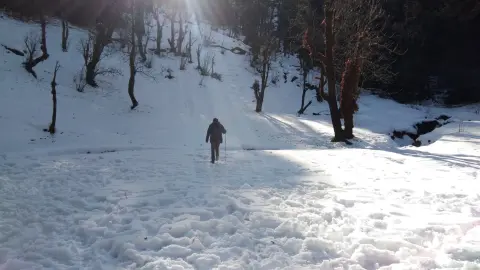
- Chandrashila (3,962 m) is the summit, 1 km beyond Tungnath. The trek page calls this last kilometre the hard section of summit day.
From Chopta to the summit you climb about 1,280 m. On our itinerary you sleep at Baniyakund (2,610 m) the night before, take a short drive to Chopta, climb to Tungnath and Chandrashila, and walk back to Baniyakund. That summit day is about 11 km and takes 8 to 9 hours, with about 1,352 m of climbing counted from Baniyakund.
Why our trek starts at Sari, not Chopta
A visit to Chandrashila can be a single climb from Chopta. Our trek is longer on purpose: it starts lower, at Sari, and adds Deoriatal lake and the Rohini Bugyal ridge before the summit, so you sleep three nights between 2,012 m and 2,610 m before you go above 3,000 m on Day 4.
Day 1 is the 185 km drive to Sari, Day 2 the 3 km walk to Deoriatal, Day 3 the 16 km ridge to Baniyakund and Day 4 the summit. The day-wise distances and heights are in our Chandrashila distance and height guide.
Day 1 ends in a homestay or guesthouse in Sari. Days 2 to 4 are in 3-person tents at Deoriatal and Baniyakund, with men and women in separate tents and sleeping bags rated to -20°C.
How far is Chandrashila from Rishikesh, Haridwar and Delhi?
Rishikesh is the gateway. The shared cab leaves Jumping Heights, Tapovan, at 07:00 AM on Day 1. On Day 5 it leaves Baniyakund at 06:30 AM and reaches Tapovan around 05:00 PM.
| From | To | Distance or time |
|---|---|---|
| Delhi ISBT Kashmere Gate | Rishikesh | About 6 to 7 hours by overnight Volvo or Uttarakhand Roadways bus |
| Haridwar Junction | Rishikesh | About 25 to 30 km, around 1 hour |
| Jolly Grant Airport (DED), Dehradun | Rishikesh | About 20 to 25 km, around 45 minutes |
| Rishikesh | Sari (trek start) | About 185 km, 8 to 9 hours |
| Baniyakund (trek end) | Rishikesh | About 200 km, 8 to 9 hours |
By train, Haridwar Junction has the most options from Delhi: Shatabdi, Jan Shatabdi and overnight trains stop there. Yog Nagari Rishikesh (YNRK) is closer to the pickup but has only a few trains, such as the Yoga Express and the Kalinga Utkal Express. If you fly, land at Jolly Grant the day before, so you are at the 07:00 AM pickup on time.
Transport is not included in the trek fee: we help the group book shared cabs, paid directly to the driver and split among trekkers. The fare is about ₹6,500 per 5–6 seat vehicle one way, so about ₹1,083 each when six share and ₹1,300 each when five share.
What can you see from the top?
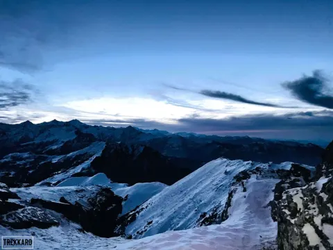
The summit gives a 360° view. The trek page names Chaukhamba, Kedarnath, Trishul, Bandarpoonch and Nanda Devi. You get an early look on Day 2, when Chaukhamba is reflected in Deoriatal on a clear day, and again on Day 3, when Chaukhamba and Mount Kedar show above the forest ridges. The trek page calls October and November the most dependable time for the clearest summit views.
Trekkaro tip: start the final kilometre above Tungnath with short steps and steady breathing, with short, regular pauses. On the way down, take the steep upper section slowly, and in snow plant your poles and follow the guide's line. On the 16 km Day 3, stop for a short break at regular intervals. Microspikes and gaiters come with your Free Trekking Gear.
Last ATM, signal and papers
- Cash: Rudraprayag is the last reliable ATM before Sari. Cards are not accepted on the trail, so carry small notes for the road meals on Day 1 and Day 5.
- Phone: Sari is the last place with a stable signal. After Sari it is patchy to nil, so make your calls there.
- ID: carry an original government photo ID (passport, Aadhaar, driving licence or voter ID) and a photocopy in a waterproof pouch. It is checked at forest check posts.
- Insurance: travel insurance is mandatory and not included. It must cover high-altitude trekking and emergency evacuation.
- Health: each trekker brings a doctor-signed medical certificate; above 60, an ECG or TMT report is recommended. Ask your doctor before the trek and carry any altitude medicine they prescribe, plus your regular medicines. No doctor joins the trek; our trek leaders are trained in Wilderness First Aid, and each camp has a first-aid kit, oxygen cylinders and a stretcher.
- Water: drinking water at camp is boiled or treated with chlorine tablets. Check with the trek leader before you refill anywhere else.
Is this the right way to reach Chandrashila for you?
Choose our 5-day trek if you want the full ridge: a lake camp, a forest traverse and the summit, with gear, meals and camps handled. Day 3 is the longest day, about 16 km with steep descents that work the knees, so train for it.
It is not the right plan if you only have a weekend or want just the temple and the summit from Chopta. It also does not suit children under 10. If you have knee trouble, the 16 km ridge day and the steep upper section on the way down are the parts to think about before you book.
What the trek costs
The trek fee is ₹8,250 per person + 5% GST = ₹8,662.50 (Sari to Baniyakund). The trek page shows EMI from ₹425 a month. It includes Day 1 dinner to Day 4 dinner (simple vegetarian food), the Sari stay, tents, sleeping bags, permits and forest camping fees, trek leaders with local certified mountain guides, and Free Trekking Gear: Decathlon trekking shoes, a -10°C jacket, trekking poles, gaiters and microspikes, against a ₹3,000 refundable deposit and a ₹200 washing charge (+ GST). Backpack offloading (up to 9 kg) is ₹1,000 + 5% GST and a single tent is ₹2,000 + 5% GST.
This season has 3 open batches in October (from 24 October), 9 in November, 17 in December, 11 in January and 8 in February. Each batch has up to 20 trekkers, with one leader or guide for every 8, and booking closes at 5 PM (India time) the day before the start.
If you cancel 30 or more days before departure, you get a 70% refund; at 15 to 29 days, 50%; at 8 to 14 days, no cash refund. At any point up to 8 days before departure you can take a 100% TrekCash voucher (valid 1 year), a free reschedule (once per booking) or a transfer to another trekker instead of the cash refund. At 7 days or less, or a no-show, there is no refund, voucher, reschedule or transfer.
See Chopta Chandrashila dates and book | Chandrashila best time by month | Chandrashila distance and height | Chopta Chandrashila trek cost
Frequently asked questions
Which is the nearest airport to Chandrashila?
Jolly Grant Airport (DED) near Dehradun, about 20 to 25 km and around 45 minutes from Rishikesh. Fly in the day before, because our shared cab to Sari leaves Tapovan at 07:00 AM on Day 1.
Is Chandrashila in Chamoli or Rudraprayag district?
Our trek page places Chandrashila in Rudraprayag district. The Kedarnath Wildlife Sanctuary, which our Day 3 forest walk crosses, spans both Rudraprayag and Chamoli districts.
What is the nearest railway station to Chandrashila?
Haridwar Junction has the most trains from Delhi, and Yog Nagari Rishikesh is closer to our pickup but has only a few. From Rishikesh it is about 185 km by road to Sari, where our trek starts.
Can you drive all the way to Chandrashila?
No. The nearest you can drive is Chopta (2,679 m) on the road; from there you walk 1 km past Tungnath to the summit. On our trek, Day 4 starts with a short drive from Baniyakund to Chopta.
Does the Trekkaro Chandrashila trek start from Delhi?
No. The shared cab leaves Jumping Heights, Tapovan, in Rishikesh at 07:00 AM on Day 1. From Delhi, an overnight bus from ISBT Kashmere Gate takes about 6 to 7 hours to Rishikesh.