Quick answer: Kedarkantha is a 3,810 m (12,500 ft) peak in Uttarkashi district, Uttarakhand, in the western Garhwal Himalaya. It rises from Govind Pashu Vihar National Park. The trek starts at Sankri village (1,950 m), about 200 km and 7–8 hours by road from Dehradun via Purola and Mori. The summit sits near 31.02° N, 78.17° E.
This page is for anyone placing Kedarkantha on the map before planning: which state and district, which protected area, where the camps are, how far it is from Dehradun and what lies around it. The coordinates come from the pins on Trekkaro's route map for this trek; every other figure is from the Kedarkantha trek page.
Which state and district is Kedarkantha in?
Kedarkantha is in Uttarakhand, in Uttarkashi district. The trek page puts it this way: Kedarkantha "rises from the Govind Pashu Vihar National Park in the Uttarkashi district of Uttarakhand, deep in the western Garhwal Himalayas."
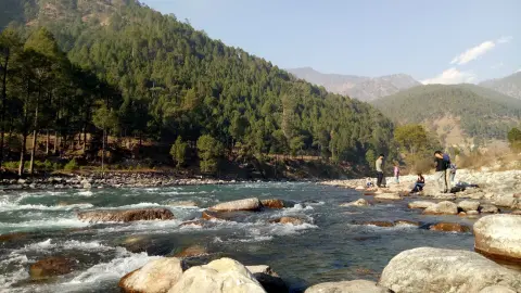
The road in tells you where you are. From Dehradun it follows NH-707 along the Tons River, past the towns of Purola and Mori, and ends at Sankri, the base village. The trek begins and ends at Sankri.
Is Kedarkantha inside Govind Pashu Vihar National Park?
Yes. The trek page says the peak "rises from the Govind Pashu Vihar National Park", and the trek fee includes Govind Pashu Vihar National Park entry permits and forest checkpost fees, which Trekkaro arranges. You don't apply for a permit yourself, but you carry a government photo ID.
According to the Wildlife Institute of India's page on Govind National Park, Govind National Park and Govind Wildlife Sanctuary are situated in Uttarkashi district, covering an area of about 958 km². Part of the Upper Tons valley was notified as a sanctuary in 1955, and the national park in 1991. The same page names the Rupin and Supin valleys as an important catchment of the Tons River and identifies the region as an area of importance for snow leopard conservation.
Where is Kedarkantha on the map?
These are the four points of the trek, with the altitudes from the trek page's itinerary and the coordinates of the pins on our route map.
| Point | What it is | Altitude | Coordinates (approx.) |
|---|---|---|---|
| Sankri | Base village; start and end of the trek; last mobile signal | 1,950 m / 6,400 ft | 31.0771° N, 78.1849° E |
| Juda Ka Talab | First camp (nights of Day 2 and Day 4); a lake that freezes solid in winter | 2,773 m / 9,100 ft | 31.0518° N, 78.1788° E |
| Kedarkantha Base Camp | Second camp (night of Day 3) | 3,429 m / 11,250 ft | 31.0409° N, 78.1751° E |
| Kedarkantha summit | Highest point of the trek | 3,810 m / 12,500 ft | 31.0225° N, 78.1719° E |
Paste a pair of coordinates into any map app to see the place. They are for finding your way around a map before the trek, not for navigation on the trail. In a straight line the summit is a little over 6 km south of Sankri, but the trail covers 20 km over four walking days (4 km, 3 km, 9 km and 4 km) and climbs about 1,860 m from Sankri to the top. Summit day starts at 2:00 AM from base camp and covers 9 km in 8–9 hours, back down to Juda Ka Talab.
How far is Kedarkantha from Dehradun?
Sankri is about 200 km from Dehradun, a drive of 7–8 hours. Transport is not included in the trek fee: we help the group book shared cabs at ₹1,000 per person each way (₹2,000 return), paid directly to the driver. The cab leaves Dehradun Railway Station at 06:30 AM on Day 1 and reaches Sankri by late afternoon.
The nearest railway station is Dehradun (DDN), which is also the pickup point. Jolly Grant Airport (DED) is about 25 km, 45–60 minutes, from Dehradun city. Purola has the last reliable ATM before Sankri, so draw cash there and carry small notes: cards are not accepted on the trail. Sankri is the last place with mobile signal, and only Jio works there consistently. There is no signal on the trail after Sankri.
Is Kedarkantha the same as Kedarnath?
No. The names sound alike, but they are different places. Kedarkantha is a summit trek from Sankri in Uttarkashi district, and its route runs Sankri, Juda Ka Talab, base camp, summit and back. It does not go to Kedarnath.
What you see from the top is the link between them. At sunrise on summit day the trek page names Swargarohini, Black Peak, Bandarpunch and Kalanag catching the first light, and it lists the distant Kedarnath range among the winter views.
Which other treks start from Sankri?
Sankri is the road head for more than one Trekkaro trek. Har Ki Dun, Bali Pass and Phulara Ridge use the same Dehradun–Sankri road and the same shared cab fare of ₹1,000 per person one way. Har Ki Dun and Bali Pass start walking at Taluka (2,107 m), about 12 km by road beyond Sankri.
| Trek from Sankri | Highest point | Grade | Months with batches listed (Oct 2026–Sep 2027) |
|---|---|---|---|
| Kedarkantha | 3,810 m / 12,500 ft | Easy–Moderate | October to February |
| Har Ki Dun | 3,536 m / 11,600 ft | Easy–Moderate | October–November, March–June |
| Phulara Ridge | 3,763 m / 12,345 ft | Moderate | October–November, March–June, September |
| Bali Pass | 4,950 m / 16,241 ft | Difficult | May–June, September |
Of the four, Kedarkantha is the only one with batches listed for December, January and February, so it is the Sankri trek for a winter trip this season.
Kedarkantha is not the trek for a spring trip this season: no batches are listed after February 2027. For March to June, Har Ki Dun and Phulara Ridge have batches from the same road head. It is also not for anyone who hasn't trained for a long, cold day: winter nights on the trek page are -15°C to -10°C, and the summit day above is the longest of the trek.
When can you trek to Kedarkantha?
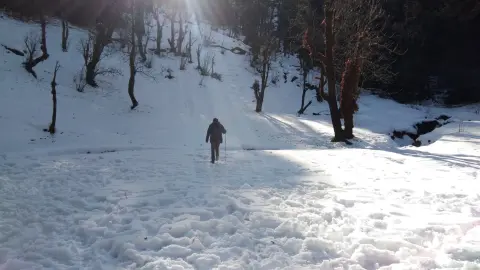
The trek page gives the best time as September to June. From December to February heavy snowfall covers the whole trail; in March and April residual snow still covers the upper trail and summit.
Batches listed on the trek page on 16 October 2026:
- October 2026: 5
- November 2026: 9
- December 2026: 31
- January 2027: 31
- February 2027: 28
No batches are listed yet after February 2027, so check the trek page before you plan a spring trip.
What it costs
| Item | Amount |
|---|---|
| Trek fee (5 days, Sankri to Sankri) | ₹9,000 + 5% GST = ₹9,450 |
| EMI | The trek page shows EMI from ₹463 a month |
| Shared cab Dehradun–Sankri | ₹1,000 per person each way (₹2,000 return), paid to the driver |
| Free Trekking Gear (shoes, -10°C jacket, poles, gaiters, microspikes) | ₹3,000 refundable deposit + ₹200 washing charge (+ GST) |
| Backpack offloading (add-on) | ₹1,500 + GST |
| Single tent (add-on) | ₹2,000 + GST |
The fee covers meals from Day 1 dinner to Day 5 breakfast, a triple-sharing guesthouse in Sankri on Day 1, tents shared by 3 trekkers (men and women separate) with -20°C sleeping bags, and the park permits. Batches take at most 20 trekkers, with one trek leader or guide for every 8, and booking closes at 5 PM India time the day before the trek. Travel insurance that covers high-altitude trekking and helicopter evacuation is mandatory and not included.
Cancellation: 30 days or more before departure, a 70% refund; 15–29 days, 50%; 8–14 days, no cash refund. At any point up to 8 days before departure you can instead take a 100% TrekCash voucher (valid 1 year), a free reschedule (once per booking) or a transfer to another trekker. At 7 days or less, or on a no-show, there is no refund, voucher, reschedule or transfer.
See Kedarkantha dates and book | How to reach Sankri | Kedarkantha distance and height | Kedarkantha trek guide
Frequently asked questions
Is Kedarkantha in Himachal Pradesh or Uttarakhand?
Kedarkantha is in Uttarakhand, in Uttarkashi district. You reach it by road from Dehradun, through Purola and Mori to Sankri.
Which village is the base for the Kedarkantha trek?
Sankri, at 1,950 m (6,400 ft). You spend the first night there in a guesthouse and walk up to Juda Ka Talab on Day 2.
Do I need a permit to trek to Kedarkantha?
Yes, because the trek is in Govind Pashu Vihar National Park, but Trekkaro arranges the park entry permits and forest checkpost fees as part of the trek fee. You bring a government photo ID, a medical fitness certificate signed by a doctor, travel insurance and a signed disclaimer form.
Which river flows near Kedarkantha?
The Tons. The road from Dehradun follows NH-707 along the Tons River to Sankri, and the Wildlife Institute of India describes the Tons as the main tributary of the Yamuna.
What is the nearest town to Kedarkantha?
Sankri is the village at the trailhead, and Mori and Purola are the towns on the road in from Dehradun. Purola is the last town on the way with a reliable ATM, so draw cash there.