Quick answer: On our Chopta Chandrashila trek you walk about 30 km in three days: 3, 16 and 11 km. Chandrashila summit is 3,962 m (13,000 ft). Summit day is 11 km up and back from Chopta (2,679 m) past Tungnath temple (3,680 m), about 1,283 m of climbing. Tungnath to Chandrashila is about 1 km, the hardest part of the day.
If you are checking whether the distances and climbs suit your fitness, start with summit day: it decides the trek. Every distance and height below is from our trek page and itinerary, or worked out from its figures.
How far is Chandrashila from Chopta and Tungnath?
On our itinerary, summit day starts at the Baniyakund camp with a short drive to Chopta. From Chopta you walk up to Tungnath, carry on to the Chandrashila summit and come back down, about 11 km on foot in 8 to 9 hours. Since you come back the same way, that works out to about 5.5 km each way.
Two parts of the climb feel very different. From Chopta to Tungnath you gain about 1,001 m. From Tungnath, Chandrashila is only about 1 km away, but that kilometre climbs another 282 m and is the hard section of the day. Our trek page gives no separate figure for Chopta to Tungnath. Working from the page's numbers, it is roughly 4.5 km each way (5.5 km less the last 1 km).
| Point on summit day | Altitude | Climb from the point before |
|---|---|---|
| Baniyakund camp (start, by road to Chopta) | 2,610 m (8,562 ft) | — |
| Chopta (walking starts) | 2,679 m (8,790 ft) | 69 m by road |
| Tungnath temple | 3,680 m | about 1,001 m on foot |
| Chandrashila summit | 3,962 m (13,000 ft) | about 282 m in about 1 km |
You will also see "1,352 m" on our trek page. That figure is measured from Baniyakund, so it includes the drive to Chopta. The climb on foot is about 1,283 m from Chopta to the summit (3,962 m less 2,679 m; the page FAQ rounds it to about 1,280 m).
Day-wise distance and height on the 5-day trek
The trek runs Rishikesh to Rishikesh. It starts walking at Sari and ends at Baniyakund, and the three walking days add up to about 30 km.
| Day | Route | Distance | On foot so far | Height change |
|---|---|---|---|---|
| 1 | Rishikesh (313 m) to Sari (2,012 m / 6,601 ft) | 185 km by road via Devprayag, Srinagar and Rudraprayag (8–9 hrs) | 0 km | by road |
| 2 | Sari to Deoriatal (2,390 m / 7,841 ft) | 3 km (2–3 hrs) | 3 km | about 378 m up |
| 3 | Deoriatal to Baniyakund (2,610 m / 8,562 ft) via Rohini Bugyal | 16 km (7–8 hrs) | 19 km | about 220 m net gain, with steep descents |
| 4 | Drive to Chopta, trek via Tungnath to Chandrashila (3,962 m) and back to Baniyakund | 11 km (8–9 hrs) | 30 km | about 1,283 m up and down |
| 5 | Baniyakund to Rishikesh | 200 km by road (8–9 hrs) | 30 km | by road |
How high is Chandrashila, and how high do you sleep?
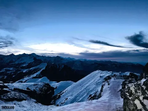
Chandrashila summit at 3,962 m (13,000 ft) is the highest point of the trek. From the top our trek page lists a 360° view of Nanda Devi, Trishul, Chaukhamba, Bandarpoonch and the Kedarnath peaks. Tungnath, at 3,680 m, is described on the page as the highest Shiva temple in the world.
You never sleep above 2,610 m on this trek. The nights are at Sari (2,012 m), Deoriatal (2,390 m) and Baniyakund (2,610 m, the highest camp). You spend only the hours of summit day above 3,000 m.
That said, some risk of altitude sickness exists. The Uttarakhand Health Department's advisory for travellers above 3,000 m suggests no more than 800–1,000 m of elevation gain a day, a 5–10 minute rest for each hour of trekking, and to descend if you feel unwell rather than go higher. Summit day climbs about 1,283 m, more than that range, even though you sleep low again. So walk slowly, take the hourly rest, and tell your trek leader at once about breathlessness, chest pain, a persistent cough, dizziness or vomiting. Carry your regular medicines and any altitude medicine your doctor advises.
Which day is harder: the 16 km day or the 11 km summit day?
They are hard in different ways. Day 3 is the longest: about 16 km through rolling forest, with gentle climbs and steep descents that tire the knees. Take a proper break at Rohini Bugyal, the alpine meadow on the way.
Day 4 is the biggest climb and the highest day. The gradient above Chopta is steep and the altitude is high, and the final kilometre from Tungnath is the hardest part. Take short steps and keep your breathing steady. On the way down, take the steep upper section slowly.
The two big days come back to back, so the real fitness test is walking 7 to 9 hours on two days in a row. The trek is graded Moderate. Our trek page asks for basic fitness (walking 4–5 km a day with a small backpack) and 6 to 8 weeks of preparation. Trekkaro tip: train with two long walks on consecutive weekend days, not one.
This trek is not for children under 10 (the minimum age), anyone under 18 without a parent or guardian, or anyone who cannot yet manage two long days in a row. Trekkers above 60 are welcome with good fitness and a doctor's certificate; an ECG or TMT report is recommended. If you want a gentler first trek, Dayara Bugyal is graded Easy–Moderate with about 20 km on foot.
What changes when there is snow?
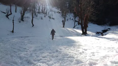
Snow can reach Rohini Bugyal and the higher sections from December and stay on the summit into April; from January to March it covers the whole route. The distances stay the same. Free Trekking Gear on this trek includes microspikes and gaiters, along with Decathlon trekking shoes, a -10°C jacket and trekking poles.
The trek page gives winter (December to February) days of 8°C to 14°C and nights of -10°C to -6°C, and autumn (October and November) days of 10°C to 15°C with nights around 0°C. Carry two 1 L bottles, with one insulated in the snow months. Cold drains phone batteries fast, so pack a power bank and a headlamp.
Practical notes for the long days
- Rudraprayag is the last reliable ATM before Sari, and cards are not accepted on the trail. Carry cash in small notes.
- Sari is the last place with a stable mobile signal.
- Drinking water at camp is boiled or treated with chlorine tablets. Check with your trek leader before you refill anywhere else. Put on warm layers before sunset at the Deoriatal camp.
- Carry an original government photo ID and a photocopy in a waterproof pouch; it is checked at forest check posts. Each trekker also brings a medical certificate signed by a doctor.
- Travel insurance is mandatory and not included. It must cover high-altitude trekking and emergency evacuation.
- Each camp has a first-aid kit, medical support and oxygen cylinders, with a stretcher for evacuation. Our trek leaders are trained in Wilderness First Aid; no doctor joins the trek.
- On Day 5 the cab leaves Baniyakund at 6:30 AM and reaches Rishikesh by about 5:00 PM. Meals on the road are not included. Book a late-evening or next-day departure from Rishikesh to leave a margin for road delays.
What the Chandrashila trek costs
The trek fee is ₹8,250 per person + 5% GST, which comes to ₹8,662.50, Sari to Baniyakund. The trek page shows EMI from ₹425 a month. Meals run from Day 1 dinner to Day 4 dinner, with a guesthouse or homestay at Sari and 3-person tents at Deoriatal and Baniyakund (men and women in separate tents) with -20°C sleeping bags.
Free Trekking Gear needs a ₹3,000 refundable deposit and a ₹200 washing charge (+ GST). The deposit is refunded by UPI within 2 working days of the gear check.
Transport is not included in the trek fee: we help the group book shared cabs, paid directly to the driver and split among trekkers. The cab costs about ₹6,500 per vehicle one way, which is about ₹1,083 each for six trekkers or ₹1,300 each for five. It leaves Jumping Heights, Tapovan (Rishikesh) at 7:00 AM on Day 1. Backpack offloading is ₹1,000 + GST for the whole trek (up to 9 kg), and a single tent is ₹2,000 + GST.
The trek page lists batches on 18, 24, 25 and 31 October 2026, 9 in November, 17 in December (weekends to 13 December, then daily from 19 to 31 December), 11 in January 2027 and 8 in February. No dates are listed yet for March onwards. Each batch has at most 20 trekkers and 1 trek leader or guide for every 8, and online booking closes at 5 PM (India time) the day before the start.
Cancel 30 days or more before departure and you get a 70% refund; at 15 to 29 days, 50%; at 8 to 14 days, no cash refund. At any point up to 8 days before departure you can take a 100% TrekCash voucher (valid 1 year), a free reschedule (once per booking) or a transfer to another trekker instead. At 7 days or less, or a no-show, there is no refund, voucher, reschedule or transfer.
See Chopta Chandrashila dates and book | Chandrashila trek in December | Chopta Chandrashila trek cost | Dayara Bugyal trek (Easy–Moderate)
Frequently asked questions
Is the Chandrashila summit climb steep?
Yes. The whole climb from Chopta is steep, and the last kilometre from Tungnath, about 282 m of climbing, is the hard section of the day. In snow, plant your poles and walk in the line your guide sets.
Can you visit Tungnath and Chandrashila on the same day?
Yes. Tungnath temple sits on the way to the summit, so both are on Day 4 of our trek. You pass Tungnath at 3,680 m and carry on for about 1 km to Chandrashila at 3,962 m.
Is the Chandrashila trek open in winter?
Yes. Batches are listed through December, January and February, with daily departures from 19 to 31 December. Snow lies on the higher sections from December to April, and Free Trekking Gear includes microspikes and gaiters.
Can a beginner do the Chandrashila trek?
Yes, if you prepare. It is graded Moderate, and the real test is walking 7 to 9 hours on two days in a row, so start training 6 to 8 weeks before your batch. The minimum age is 10.
Where does the Chandrashila trek start?
The walking starts at Sari village in Rudraprayag district, Uttarakhand, and ends at Baniyakund. The shared cab to Sari leaves Jumping Heights, Tapovan in Rishikesh at 7:00 AM on Day 1.