Quick answer: Rohini Bugyal is an open alpine meadow inside the Kedarnath Wildlife Sanctuary, reached partway through Day 3 of the Chopta Chandrashila trek, on the 16 km walk from Deoriatal (2,390 m) to the Baniyakund camp (2,610 m). It turns red and pink with rhododendrons in April and May, and lies under snow from January to March.
Rohini Bugyal is not a village, a temple or a campsite. It is a broad alpine meadow, a "bugyal" in the local word, where the oak, maple and rhododendron forest of the Day 3 trail breaks open. On Trekkaro's Chopta Chandrashila trek it is the highlight of Day 3, the longest walking day of the five, and the group stops there to rest and eat. Below: where the meadow sits, how the Day 3 walk works, how it looks in each season and what the trek costs.
Where is Rohini Bugyal?
Rohini Bugyal lies on the forest ridges between Deoriatal lake and the Baniyakund camp, in the Garhwal Himalaya of Uttarakhand. The whole stretch runs through the Kedarnath Wildlife Sanctuary. The Wildlife Institute of India puts that sanctuary in Rudraprayag and Chamoli districts, spanning heights from 1,160 m to 7,068 m, with alpine meadows making up 7.7% of its area.
Trekkaro's route reaches it from the Deoriatal side. Day 1 is the drive from Rishikesh to Sari (2,012 m). Day 2 is the 3 km climb to the Deoriatal camp, about 200 m from the lake. Day 3 leaves Deoriatal, crosses Rohini Bugyal and ends at Baniyakund. Day 4 starts with a short drive from Baniyakund to Chopta (2,679 m) for the climb to Tungnath and Chandrashila.
How long is the walk to Rohini Bugyal on Day 3?
Day 3 is about 16 km and takes 7 to 8 hours, the longest walking day of the five. The trail climbs gently out of Deoriatal, then rolls along forested ridges with some steep descents before it reaches Baniyakund. Rohini Bugyal comes partway along and is the main rest and food stop of the day.
| Point on the route | Height | When you are there |
|---|---|---|
| Sari village | 2,012 m (6,601 ft) | Night of Day 1 |
| Deoriatal camp | 2,390 m (7,841 ft) | Night of Day 2, start of Day 3 |
| Rohini Bugyal | On the forest ridge between the two camps | Partway through Day 3 (rest and food stop) |
| Baniyakund camp | 2,610 m (8,562 ft) | End of Day 3, nights of Day 3 and Day 4 |
| Chopta | 2,679 m | Start of the Day 4 summit walk |
| Chandrashila summit | 3,962 m (13,000 ft) | Day 4 |
Day 3 has the most kilometres of the trek, so fill your bottles with the boiled or treated water at Deoriatal before you leave.
What will you see at Rohini Bugyal?
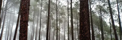
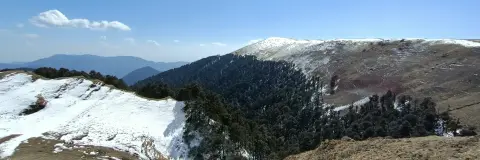
The meadow is a broad opening in the forest. On a clear day the Day 3 trail gives views of the Chaukhamba massif and Mount Kedar. The forest on either side is oak, maple and rhododendron, and this is the stretch where trekkers stand a chance of seeing the Himalayan monal, the state bird of Uttarakhand.
The bigger panorama comes a day later. From Chandrashila on Day 4 the skyline takes in Chaukhamba, Kedarnath, Trishul, Bandarpoonch and Nanda Devi.
What does Rohini Bugyal look like in each season?
Trekkaro runs this trek from January to June and from October to December. Of everything on the route, the forest around the meadow changes most with the season.
| Months | What Rohini Bugyal looks like | Day temperature | Night temperature |
|---|---|---|---|
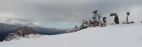
| December to February | Under an even cover of snow from January | 8°C to 14°C | -10°C to -6°C |
| March and April | Snow cover into March; rhododendrons from April | 13°C to 17°C | Around 0°C |
| May and June | Rhododendrons in red and pink through May; the warmest months on the route | 18°C to 24°C | 3°C to 8°C |
| October and November | Autumn on the route; October to December give the clearest mountain views | 10°C to 15°C | Around 0°C |
Trekkaro suggests April and May for a first Himalayan trek, when the rhododendrons around the meadow bloom red and pink. For snow underfoot, pick January to March.
These figures are for the route as a whole, not a reading taken at the meadow itself. You cross Rohini Bugyal in daylight, so the night figures apply to the camps. For the month-by-month picture, read the best time for the Chandrashila trek.
Can you camp at Rohini Bugyal?
Trekkaro does not camp at Rohini Bugyal. The meadow is a walk-through stop, and the Day 3 night is spent in tents at Baniyakund, 2,610 m. Tents are shared by three trekkers, with men and women in separate tents, and the sleeping bags are rated to -20°C. Drinking water at camp is boiled or chlorine-treated.
All the trekking permits and forest camping fees the route needs are part of the Trekkaro fee. Carry an original government photo ID and a photocopy. For the sanctuary itself, its wildlife and how high it climbs, see the Kedarnath Wildlife Sanctuary guide.
Is there mobile signal at Rohini Bugyal?
No. Sari is the last place with a stable mobile signal, and beyond it the network is patchy to non-existent, so you are out of reach at Rohini Bugyal and on the rest of the Day 3 trail. Make your calls and tell your family your plans in Sari before Day 2. Rudraprayag has the last reliable ATM, and cards are not accepted on the trail, so carry the cash you need.
What should you know before the Rohini Bugyal day?
The trek starts at Sari and ends at Baniyakund, so it does not loop back. Anything you leave at Sari cannot be brought to the end of the trek, which means you carry everything you bring, or hand it to the offloading service if you book one. The minimum age is 8, and trekkers under 18 come with a parent or guardian. Each trekker brings a medical certificate signed by a doctor.
Snow days need grip. Trekkaro's Free Trekking Gear on this trek covers Decathlon trekking shoes, a -10°C jacket, trekking poles, gaiters and microspikes, against a ₹3,000 refundable deposit and a ₹200 washing charge.
What does the trek to Rohini Bugyal cost?
The Chopta Chandrashila trek fee is ₹8,250 per person plus 5% GST (₹8,662.50 with GST). EMI starts at ₹425 a month. The fee covers the stays and camps, pure vegetarian meals, tents, -20°C sleeping bags, and the permits and forest camping fees.
Transport is not part of the fee. On Day 1 the cab leaves Rishikesh early in the morning for the drive of about 185 km (8 to 9 hours) to Sari. Trekkaro helps the group book shared cabs at ₹6,500 per 5 to 6 seat vehicle one way, paid directly to the driver and split among the trekkers in it, which comes to ₹1,083 each with six people. On Day 5 the group drives from Baniyakund back to Rishikesh. Travel insurance is compulsory and is not included in the fee. The full break-up is in the Deoriatal Chandrashila trek cost guide.
See Chopta Chandrashila trek dates and book | Deoriatal lake guide | Kedarnath Wildlife Sanctuary
Frequently asked questions
On which day of the Chopta Chandrashila trek do you reach Rohini Bugyal?
You reach Rohini Bugyal partway through Day 3, on the walk from Deoriatal to Baniyakund. Day 3 is about 16 km and takes 7 to 8 hours.
When do the rhododendrons bloom at Rohini Bugyal?
The rhododendrons around the meadow bloom in April and May. The flowers are red and pink, and Trekkaro suggests these two months for a first Himalayan trek.
Is there snow at Rohini Bugyal in winter?
Yes. From January to March the meadow lies under snow. Microspikes and gaiters are part of Trekkaro's Free Trekking Gear on this trek.
Which peaks can you see from Rohini Bugyal?
On a clear day the Day 3 trail shows the Chaukhamba massif and Mount Kedar. The wider view of Trishul, Nanda Devi and Bandarpoonch comes from Chandrashila on Day 4.
Where do you sleep after crossing Rohini Bugyal?
The night after Rohini Bugyal is spent in tents at Baniyakund, 2,610 m. The group stays there for two nights and drives to Chopta for the summit on Day 4.