This guide is about the Gulabi Kantha Trek — dates, price, day-by-day itinerary and booking are on the trek page.
Quick answer: The Gulabi Kantha trek covers about 24 km on foot over 5 days, starting and ending at Hanuman Chatti (2,134 m / 7,000 ft), a 162 km drive from Dehradun. The summit stands at 3,658 m (12,000 ft). Summit day is the big one: 14 km and about 1,068 m of climbing from Kandola camp.
Gulabi Kantha (also written Gulabikantha) sits in Uttarkashi district, above the Yamuna Valley. Its height gain is not spread evenly: summit day climbs about 1,068 m, more than twice the 456 m of Day 2. Every distance, time and altitude below comes from the Gulabikantha trek page; the height changes are worked out from its altitudes and marked "about".
How long is the Gulabi Kantha trek, in km and days?
The trip runs 5 days from Dehradun and back. Three of those days are on foot, adding up to about 24 km (5 + 14 + 5). Days 1 and 5 are the 162 km road journey between Dehradun and Hanuman Chatti, 7–8 hours each way.
| Day | Route | Distance | Time | End point | Height change |
|---|---|---|---|---|---|
| 1 | Dehradun to Hanuman Chatti (drive) | 162 km | 7–8 hrs | 2,134 m / 7,000 ft | Road day |
| 2 | Hanuman Chatti to Kandola | 5 km | 3–4 hrs | 2,590 m / 8,500 ft | About +456 m |
| 3 | Kandola to the summit via Seema Thatch and back | 14 km (7 up, 7 down) | 7–8 hrs | Top at 3,658 m / 12,000 ft; night at 2,590 m | About +1,068 m and -1,068 m |
| 4 | Kandola to Hanuman Chatti | 5 km | 2–3 hrs | 2,134 m / 7,000 ft | About -456 m |
| 5 | Hanuman Chatti to Dehradun (drive) | 162 km | 7–8 hrs | Dehradun | Road day |
The route is an out-and-back. You walk up and down the same 5 km between Hanuman Chatti and Kandola, and the summit climb returns to the camp it left from.
How high is Gulabi Kantha, and how high are the camps?
The summit is 3,658 m, which the trek page gives as 12,000 ft. There are only two overnight points, and you sleep at each of them twice:
- Hanuman Chatti, 2,134 m (7,000 ft), the base village. Nights 1 and 4 are in a guesthouse or homestay here.
- Kandola, 2,590 m (8,500 ft), the forest tent camp for nights 2 and 3.
Seema Thatch, at 3,200 m (10,500 ft), is not a camp. It is the alpine meadow where the forest opens out on the way up, passed on the summit climb and again on the descent.
The highest night is spent at 2,590 m, and the trek page rates the risk of altitude sickness on this route as "relatively low".
What is the trail like on each walking day?
Each of the three walking days has its own gradient and ground. The descriptions below are the trek page's; the height splits are worked out from its altitudes.
Day 2: Hanuman Chatti to Kandola, 5 km, about +456 m
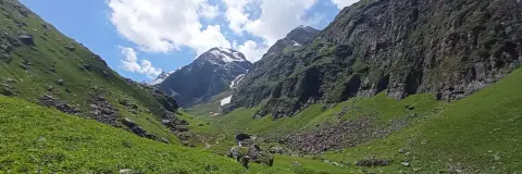
You set off at 7:00 AM after a light breakfast and a short briefing. The trek page calls this "a gradual ascent of about 456 m (1,500 ft) over 5 km". Soon after Hanuman Chatti the trail enters dense forest of tall pine, oak and maple, and the path is "covered with fallen brown maple and pine leaves, soft and quiet underfoot." Kandola camp sits among forest and mountain slopes, with views of the surrounding ridges.
Day 3: Kandola to the summit and back, 14 km, about +1,068 m
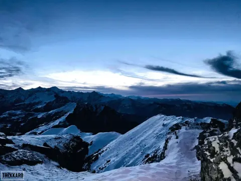
The climb comes in two parts. The first, about 610 m from Kandola (2,590 m) to Seema Thatch (3,200 m), "winds through dense pine and oak forest at a steady gradient" before the forest opens onto the alpine meadows. The second, about 458 m from the meadow to the top (3,658 m), is where the trail turns steeper. On the summit the page describes a full 360° view, with Bandarpoonch, Black Peak, Swargarohini, Kalindi Srikala and Chaukhamba on the skyline. You then retrace your steps through Seema Thatch to Kandola, the same 1,068 m down.
Day 4: Kandola to Hanuman Chatti, 5 km, about -456 m
The shortest walk, 2–3 hours, is "a steady descent of about 456 m (1,500 ft) over 5 km" with some steep descending patches. On the way, the trees open to views over the Yamuna Valley.
Drinking water at the camps is boiled or treated with chlorine tablets, and the trek page asks you to check with the trek leader before refilling anywhere else on the trail, so fill your bottles at camp before each walk.
Which is the toughest day on Gulabi Kantha?
Day 3. The trek page states it plainly: "The hard day is the summit day: about 14 km (7 km up and 7 km down) in 7–8 hours". That one day holds more than half the trek's walking distance (14 of 24 km) and all of its climbing above 2,590 m. You leave Kandola early with a packed lunch and eat it on the summit.
Within that day, the page points to the slope above Seema Thatch: "This is the hard section of the day, and it stays with you until the top." It is the last 458 m or so of climbing, at the far end of 7 km uphill, and the descent back to camp follows the same 7 km.
Days 2 and 4 are 5 km each, so the preparation that counts is for one long day with a sustained climb and an equally long descent. The minimum age is 8, and the page grades the trek Easy–Moderate.
Which months have snow on the route?
The trek page's Season line reads "January to April and October to December". Its snow wording, by stretch of the year:
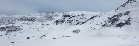
- December to February is the snow season. The page says snow lies "on the upper trail from December to February" and describes the winter trail as "Snow on the upper trail and summit; slower climbing; very cold nights."
- In March and April, "snow can still lie on the higher slopes".
- The page gives no snow depth in feet for any month.
Snow on the upper trail lands on the same day as the big climb, so in winter the 7–8 hour summit day is slower. Free Trekking Gear on this trek includes microspikes and gaiters for that stretch.
How far is Hanuman Chatti from Dehradun?
The trek page gives 162 km and 7–8 hours by road, with pickup at Dehradun Railway Station at 6:30 AM on Day 1. Dehradun is also where the district itself points travellers: the Uttarkashi district How to Reach page names Dehradun as the nearest railway station and Jollygrant airport, Dehradun, as the nearest airport.
Road transport sits outside the trek fee. The trek page puts a shared cab at about ₹6,500 one way per 5–6 seat vehicle; Trekkaro helps the group book it, paid directly to the driver and split among the trekkers in it. Because the trek returns to Hanuman Chatti, luggage you do not need on the trail can stay in Trekkaro's store at the base camp free of charge.
What does the trek cost?
The trek fee is ₹8,500 per person plus 5% GST, so ₹8,925 in total. Free Trekking Gear (Decathlon trekking shoes, a -10°C jacket, trekking poles, gaiters and microspikes) is given against a ₹3,000 refundable deposit plus a ₹200 washing charge. Each trekker brings a medical certificate signed by a doctor; the form is in My Bookings. The Gulabikantha cost breakdown works through the cab split, insurance and add-ons.
See Gulabikantha dates and book | Gulabikantha trek cost | Winter treks for beginners
Frequently asked questions
What is the total distance of the Gulabi Kantha trek?
About 24 km on foot across three walking days. Add the 162 km drive from Dehradun to Hanuman Chatti at each end of the 5-day trip.
What is the height of Gulabi Kantha in feet?
The trek page gives the top as 12,000 ft, or 3,658 m. The base village, Hanuman Chatti, is at 7,000 ft.
How many hours does the Gulabi Kantha summit day take?
Plan on 7–8 hours for the round trip from Kandola. It is 7 km to the top and 7 km back.
Where is the base camp for Gulabi Kantha?
The trek starts and ends at Hanuman Chatti in Uttarkashi district. The only tent camp on the route is Kandola, at 2,590 m.
Is Gulabi Kantha a good first high-altitude trek?
The page grades it Easy–Moderate and keeps the highest night at 2,590 m. The one demanding day is the summit push, so build stamina for a long climb and descent.