This guide is about the Hampta Pass Trek — dates, price, day-by-day itinerary and booking are on the trek page.
Quick answer: The Hampta Pass trek is 26.5 km on foot over 4 trekking days (2 + 8.5 + 10 + 6 km) in a 5-day trip from Manali and back, plus about 208 km of driving that is included in the fee. Hampta Pass is 4,298 m (14,100 ft) above sea level, about 1,310 m above the Jobra trailhead at 2,990 m (9,800 ft). From Manali it is 23 km by road to Jobra and two days on foot to Balu Ka Ghera below the pass, which you cross on the morning of Day 3; Chandratal Lake (about 4,300 m) is a 60 km drive from Chhatru, where the trail ends.
Every figure comes from the itinerary and route map on our Hampta Pass trek page. The day-by-day story is in our Hampta Pass trek guide.
What is the Hampta Pass trek distance in km?
| Day | Stretch | On foot | By road | Walked so far | Time |
|---|---|---|---|---|---|
| 1 | Manali to Jobra (drive), Jobra to Chika | about 2 km | about 23 km | 2 km | 45 min drive + 1–2 hrs walk |
| 2 | Chika to Balu Ka Ghera | about 8.5 km | – | 10.5 km | about 6 hrs |
| 3 | Balu Ka Ghera over Hampta Pass to Shea Goru | about 10 km | – | 20.5 km | 7–8 hrs |
| 4 | Shea Goru to Chhatru, then Chandratal and back | about 6 km (+ about 2 km each way between the road and the lake shore) | about 60 km each way | 26.5 km | 3–4 hrs walk + about 2 hrs drive each way |
| 5 | Chhatru to Manali via the Atal Tunnel | – | about 65 km | 26.5 km | 3–4 hrs |
| Total | Manali to Manali | 26.5 km | about 208 km | – |
The 26.5 km is the trail from Jobra to Chhatru. The short walk from the road to the Chandratal shore on Day 4 is extra and is not counted in it. Pass day alone is 10 km, more than a third of the walking; Day 1 is only 2 km, a deliberate easy start.
How high is Hampta Pass?
Hampta Pass is 4,298 m (14,100 ft) above sea level. It is the highest point of the trek, but you do not sleep there: the highest camp is Balu Ka Ghera at 3,720 m (12,200 ft), and on Day 3 you climb 578 m from it to the pass, then drop 698 m to Shea Goru (3,600 m / 11,800 ft) on the Lahaul side.
Hampta Pass is sometimes called a summit or a peak. It is neither. The trek page describes the pass as the lowest point on the skyline ridge between the Kullu valley and Lahaul, a narrow, rocky crossing. Peaks rise on either side, and from Balu Ka Ghera you can see Deo Tibba (6,001 m / 19,688 ft) and Indrasan (6,221 m / 20,410 ft) in clear weather. You may see slightly different heights for the pass on other websites; the figures on this page are the ones on our route map.
What is the altitude of each point on the route?
This is the height profile of the trek, with the height gained or lost on each stretch and the average climb per kilometre where the trek page gives the distance.
| Point | Altitude | Change | Distance | Average gradient |
|---|---|---|---|---|
| Manali (start and end) | about 2,040 m (6,700 ft) | – | – | – |
| Jobra (road head) | 2,990 m (9,800 ft) | +950 m by road | 23 km by road | – |
| Chika camp | 3,170 m (10,400 ft) | +180 m | 2 km | about 90 m per km |
| Balu Ka Ghera camp | 3,720 m (12,200 ft) | +550 m | 8.5 km | about 65 m per km |
| Hampta Pass | 4,298 m (14,100 ft) | +578 m | first part of the 10 km pass day | steepest climb of the trek |
| Shea Goru camp | 3,600 m (11,800 ft) | −698 m | rest of the 10 km pass day (the trek page does not split it) | steep scree descent |
| Chhatru camp | 3,320 m (10,900 ft) | −280 m | 6 km | about 47 m per km down |
| Chandratal Lake (by road) | about 4,300 m (14,100 ft) | +980 m by road | about 60 km by road | – |
On foot you climb a total of 1,308 m and descend 978 m. The Kullu side is a gradual approach: Day 2 spreads 550 m over 8.5 km of meadows, moraine and glacial stream crossings. The trek page does not split the 10 km at the pass, but it describes the climb as about 2,000 ft on snow, scree and exposed rock, with fixed ropes on the steepest section below the top, and the way down as a steep chute of loose scree and snow that is harder on the knees than the ascent. That is why pass day starts at 5:30 to 6:00 AM, while the snow is firm.
How far is Hampta Pass from Manali?
By the trek route, Hampta Pass is about 23 km by road from Manali to Jobra, then 10.5 km on foot to Balu Ka Ghera over Days 1 and 2, and then the morning climb on Day 3. In time, that is a 45-minute drive and two short-to-moderate walking days before the crossing.
You do not come back the same way. The trail ends at Chhatru on the Lahaul side, and the drive back is about 65 km through the 9.02 km Atal Tunnel, 3 to 4 hours, reaching Manali by early afternoon on Day 5. The group reports at Manali Bus Stand at 10:00 AM on Day 1.
How far is Chandratal from Hampta Pass?
From the pass to Chandratal Lake is the descent to Shea Goru (the second half of the 10 km pass day), then about 6 km on foot to Chhatru on Day 4, then about 60 km by road, about 2 hours, and a walk of about 2 km from the road to the shore. The group has about 2 hours at the lake and drives back to Chhatru for the night. You reach Chandratal by road from Chhatru plus the short walk from the road, not on the trek trail, and the drive is included in the fee.
The lake sits almost exactly as high as the pass. The Spiti Wildlife Division's page on Chandratal Wildlife Sanctuary puts it at about 4,300 m, lists it as a Ramsar wetland of international importance, and says the sanctuary is reached by road from Manali over a distance of 130 km. By our route, Chhatru to Manali (about 65 km) plus Chhatru to Chandratal (about 60 km) gives about 125 km, which agrees.
What does the Hampta Pass trek route map look like?
The route is a one-way crossing over the ridge, with road legs at both ends. In order:
- Manali to Jobra (road, 23 km): a 45-minute drive to the road head near Hampta village above Manali, at 2,990 m.
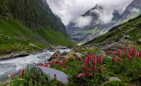
- Jobra to Chika (2 km): oak, birch and conifer forest beside the Hampta stream, opening onto the Chika meadow at 3,170 m.
- Chika to Balu Ka Ghera (8.5 km): meadows, braided glacial streams and a boulder field to the camp at 3,720 m.
- Balu Ka Ghera to Hampta Pass: snowfields, scree and rock up the glacial valley above camp to 4,298 m.
- Hampta Pass to Shea Goru: a steep scree descent into treeless Lahaul, to the dry camp at 3,600 m.
- Shea Goru to Chhatru (6 km): a mostly flat walk along the Chandra River to the road at Chhatru, 3,320 m.
- Chhatru to Chandratal and back (road): about 60 km each way, then about 2 km on foot to the lake.
- Chhatru to Manali (road, 65 km): west along the Chandra, through the Atal Tunnel and down to Manali.
The trail follows the Hampta stream on the Kullu side and the Chandra River, the headwater of the Chenab, on the Lahaul side.
Is the driving included in the price?
Yes. The fee of ₹9,000 + 5% GST = ₹9,450 per person covers all three drives above. Batches run from June to September; see the trek page for live dates and the cost breakdown for extras.
See Hampta Pass dates and book | Hampta Pass trek guide | Hampta Pass trek cost | Hampta Pass weather by month
Frequently asked questions
What is the total distance of the Hampta Pass trek in km?
You walk 26.5 km in four trekking days, from Jobra to Chhatru. On top of that the trip includes about 208 km of driving: Manali to Jobra, the Chandratal round trip and the return to Manali.
What is the height of Hampta Pass in metres and feet?
Hampta Pass stands at 4,298 m, which is 14,100 ft. You sleep no higher than Balu Ka Ghera at 3,720 m and cross the pass in the early morning of Day 3.
How far is Chandratal Lake from Hampta Pass?
After the pass you descend to Shea Goru, walk about 6 km to Chhatru the next morning, then drive about 60 km and walk about 2 km to the lake. The lake is at about 4,300 m, almost the same height as the pass.
Is Hampta Pass a peak or a summit?
No, it is a mountain pass: a gap in the ridge that separates the Kullu valley from Lahaul. You cross it and descend the other side instead of returning the way you came.
How many km do you walk on Hampta Pass crossing day?
About 10 km in 7 to 8 hours, the longest day of the trek. It combines a 578 m climb to 4,298 m with a 698 m descent on loose scree to Shea Goru.