Gaumukh Tapovan Trek
Inclusion:
Accommodation
Meals
All Permits
Expert Trek Leader & Guide
Gaumukh Tapovan Trek — Guide, Dates & Cost
Gaumukh Tapovan Trek is a 7-day moderate–difficult trek in Uttarkashi, Uttarakhand, reaching 4,463 m (14,640 ft). It covers about 46 km on foot and starts and ends at Gangotri. Best time: May to June and September to October. Trekkaro price: ₹16,500 per person + 5% GST, with Free Trekking Gear (Decathlon shoes, -10°C jacket, poles, gaiters and microspikes; ₹3,000 refundable deposit + ₹200 washing). Next batch: 17 Oct 2026 (17 upcoming batches).
Updated
District: Uttarkashi
Duration: 7 Days
Difficulty Level: Moderate–Difficult
Highest Altitude: 4,463 m / 14,640 ft
Trekking Distance: 46 km
Temperature: May-Jun: Gangotri 5°C to 15°C, Tapovan -5°C to 3°C | Sep-Oct: Gangotri 5°C to 18°C, Tapovan -8°C to 2°C
Gaumukh is the mouth of the Ganges. Not a river mouth – the actual source, a tongue of glacial ice at 12,770 feet from which the Bhagirathi River emerges, cold and white, at the foot of the Gangotri Glacier. To stand at Gaumukh is to stand at the origin of one of the most sacred and significant rivers on earth. To continue to Tapovan is to enter a high-altitude meadow at 14,640 feet that exists in the immediate presence of Shivling Peak, 6,543 metres of near-vertical rock and ice that rises from the meadow floor so directly and so completely that it fills the entire visual field above you.
The Gaumukh-Tapovan trek is one of the most spiritually and visually significant treks in India, not just as a Himalayan adventure but as a journey to a place that has drawn Hindu pilgrims, mountaineers, sadhus, and seekers of all kinds for centuries. The Gangotri Glacier, at 30 kilometres, one of the longest glaciers in the Garhwal Himalayas, is the source of the Bhagirathi River, a primary tributary of the Ganga, and the trail to Gaumukh follows the river upstream through the Bhagirathi gorge in one of the most dramatically enclosed and geologically exposed valleys in the entire Himalayan range. In seven days, Trekkaro takes you from the temple town of Gangotri to the glacier snout at Gaumukh, up onto the high meadows of Tapovan beneath Shivling, and back, an experience that combines physical challenge, natural grandeur, and a depth of significance unlike any other route in the accessible Indian Himalayas.
The Gaumukh Tapovan trek begins and ends at Gangotri (3,065 m / 10,050 ft), the sacred Shaivite temple town in the Uttarkashi district of Uttarakhand, positioned at the head of the Bhagirathi Valley approximately 100 km from the district headquarters. The route follows the right bank of the Bhagirathi River upstream through the Bhagirathi gorge to Chirbasa and Bhojbasa, then continues to Gaumukh at 3,892 m / 12,770 ft, the snout of the Gangotri Glacier and the source of the Bhagirathi River. From Gaumukh, the route crosses the glacier moraine and ascends to Tapovan at 4,463 m / 14,640 ft, the extraordinary high-altitude meadow beneath Shivling Peak (6,543 m). The return follows the same route back to Gangotri. The total trekking distance is approximately 46 km across five trekking days.
Gaumukh – The Mouth of the Ganga
Gaumukh – literally 'cow's mouth' in Sanskrit – is the terminal snout of the Gangotri Glacier at 3,892 m (12,770 ft), from which the Bhagirathi River emerges as a roaring, white glacial torrent from beneath the ice. The glacier itself is one of the primary glacial systems of the Garhwal Himalayas: 30 km long, up to 4 km wide, and fed by the accumulated snowfall and ice of the surrounding 6,000- and 7,000-metre peaks. The snout at Gaumukh is not static; the glacier has been retreating at a documented rate for decades, making the current location of the ice face visibly different from photographs taken even a decade ago. To stand at Gaumukh is to stand at one of the most geographically and spiritually significant points in India: the origin of the sacred Ganga, at the foot of a 30-kilometre river of ice, in a valley that has been a destination of pilgrimage for more than two thousand years.
Tapovan – Where Shivling Fills the Sky
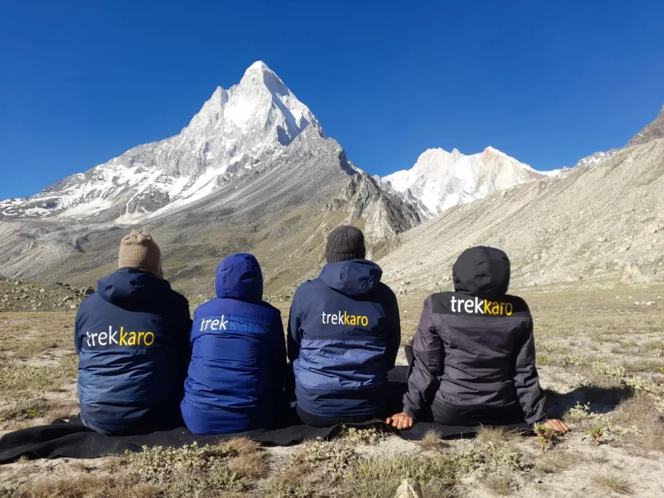
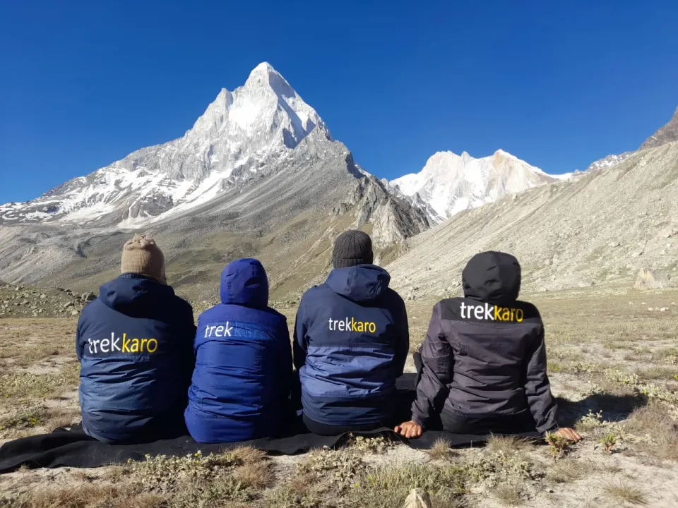
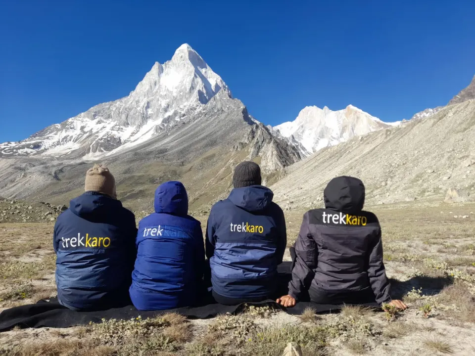
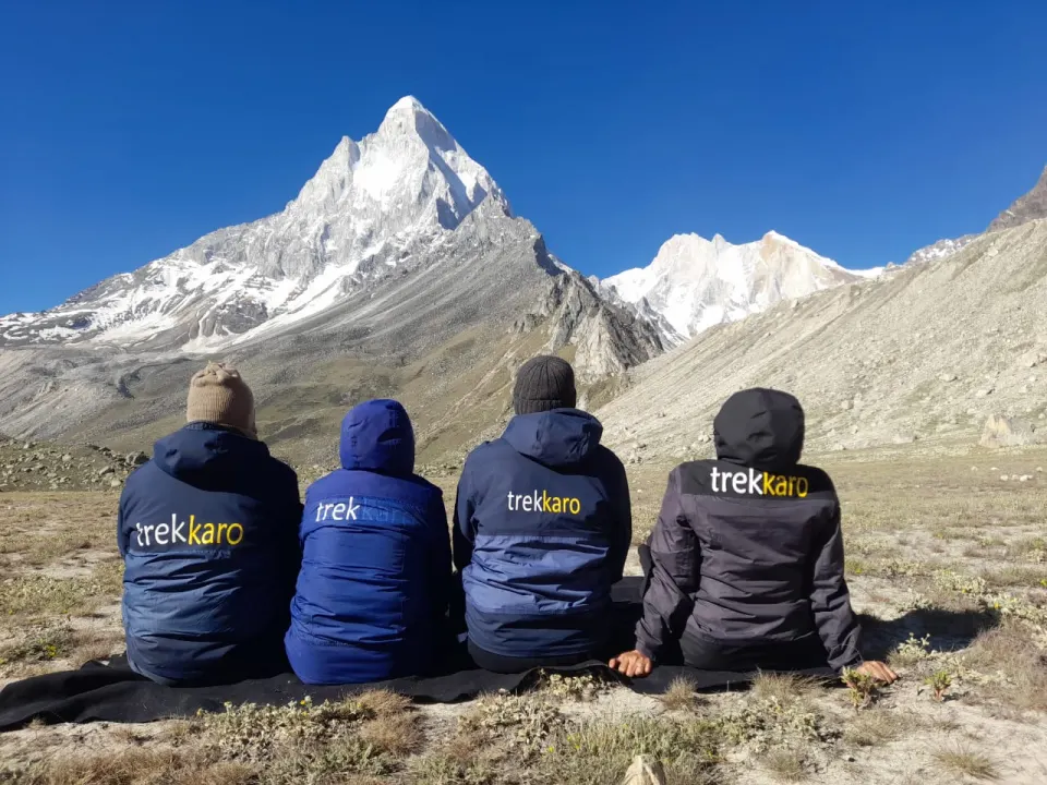
Tapovan is a high-altitude alpine meadow at 4,463 m (14,640 ft) situated above the Gangotri Glacier, approximately 3 kilometres from Gaumukh across the glacier moraine. It is the base camp for mountaineering expeditions attempting Shivling, Meru, and Bhagirathi group peaks, but it is also, for trekkers, simply one of the most extraordinary places in the Himalayas to arrive and be present. Shivling (6,543 m), the peak that defines Tapovan's visual character, rises immediately above the meadow in a nearly vertical column of rock, ice, and light that changes colour and character continuously from dawn through to dusk. The name Shivling references its uncanny resemblance, from the Tapovan meadow floor to the iconic form of the Shivalinga. At 14,640 feet, in a meadow bordered by glaciers on three sides and by Shivling directly above, the word 'extraordinary' becomes inadequate. You simply have to be there.
Who Is This Trek For?
The Gaumukh-Tapovan trek is graded moderate-difficult. It is not recommended for first-time Himalayan trekkers. The route involves sustained altitude above 12,000 feet for multiple consecutive days, a glacier crossing on loose moraine between Gaumukh and Tapovan that requires careful foot placement and technical awareness, and overnight camping at Tapovan at 14,640 feet, the highest camp on this route and among the highest standard trekking camp sites in Uttarakhand. Additionally, this is a restricted forest area under the Gangotri National Park authority, and entry is subject to permit quotas. Trekkaro arranges all permits. Minimum recommended age: 16 years. There is no upper age limit; trekkers above 60 need good fitness, and a medical fitness certificate signed by a doctor is mandatory for all ages on this route. Daily trekking hours: 4 to 8 hours. Best season: mid-May to June and mid-September to October.
Key Highlights of the Gaumukh Tapovan Trek
- Gaumukh Glacier snout (3,892 m / 12,770 ft) – the source of the Ganga, one of the most significant points in India
- Tapovan meadow (4,463 m / 14,640 ft) – with Shivling (6,543 m) rising directly above the campsite
- Shivling Peak views from Tapovan – among the most dramatic mountain compositions in accessible Indian trekking
- The Bhagirathi Gorge Trail – one of the most geologically exposed and visually dramatic valley walks in the Himalayas
- Glacier moraine crossing from Gaumukh to Tapovan – technical terrain requiring careful guidance
- Bhojbasa camp (3,775 m / 12,385 ft) – the acclimatisation night with views of the Gangotri peaks
- Bhagirathi I, II, III and Meru peak views from multiple points on the upper route
- Gangotri temple town (3,065 m / 10,050 ft) – one of the Char Dham pilgrimage sites, start and end point
- Certified Trekkaro trek leader & guides, twice-daily health monitoring, and FTG gear with no rental fee
Best Time to Visit Gaumukh Tapovan
The Gaumukh Tapovan trekking season is shaped by three factors: the opening of the Gangotri temple (which determines road access), the monsoon, and the onset of winter snowfall above 12,000 feet. There are two distinct trekking windows, a pre-monsoon window from mid-May to June and a post-monsoon window from mid-September to October. The route is closed during the monsoon (July to August) when the Bhagirathi Gorge trail becomes hazardous with rockfall, flash flooding, and unstable ground.
Mid-May to June - Pre-Monsoon Window (Snow on Tapovan)
The Gangotri temple opens in late April or early May (determined by the Char Dham pilgrimage calendar), making the pre-monsoon window available from mid-May. The trail carries residual winter snow above Chirbasa, and the Tapovan meadow in May and early June is partially snow-covered, which adds a dramatic visual quality to the Shivling views but also requires microspikes and careful movement on the moraine crossing. The Bhagirathi River runs at its most powerful in late May and June, fed by snowmelt; the sound of the river through the gorge in this season is extraordinary. Wildflowers begin appearing on the lower trail from late May, and the air quality is sharp and clear before the pre-monsoon haze builds. This window has fewer trekkers than the post-monsoon period.
- Temperatures: Gangotri: 5°C to 15°C | Bhojbasa camp: -2°C to 5°C | Tapovan: -5°C to 3°C
- Trail conditions: Snow above Chirbasa. Powerful river flow. Clear air. Fewer trekkers.
- Best for: Shivling in snow conditions, powerful Bhagirathi River views, and pre-monsoon clarity.
July to August - Monsoon Season (CLOSED)
The Gaumukh-Tapovan route is closed during the monsoon. The Bhagirathi gorge trail is exposed to rockfall from the unstable canyon walls above Chirbasa, and the glacier moraine above Gaumukh becomes extremely dangerous when wet. Trekkaro does not operate Gaumukh Tapovan batches during July and August under any circumstances.
- Status: CLOSED. No Trekkaro batches operate July–August.
Mid-September to October - Post-Monsoon Window (Most Recommended)
This is Trekkaro's most recommended window for Gaumukh Tapovan. The monsoon ends in early to mid-September, and the trail dries within approximately two weeks. By late September, the upper route is clear, the glacier moraine is at its most stable, and the mountain visibility is at its sharpest of the entire year. Shivling from Tapovan in October light, the low-angle sun of early autumn illuminating the peak's south face in shades of orange and rose at dawn and dusk, is among the most photographed mountain compositions in India. The nights at Tapovan in September and October are genuinely cold, making the sleeping bag rating critical, but the days are crisp, clear, and extraordinarily rewarding. The Gangotri temple closes for the winter in late October or early November, marking the hard end of this window.
- Temperatures: Gangotri: 5°C to 18°C | Bhojbasa: -3°C to 8°C | Tapovan: -8°C to 2°C
- Trail conditions: Fully dry trail. Stable moraine. Sharpest visibility. Best Shivling light.
- Best for: Peak mountain views, stable glacier crossing, autumn light on Shivling.
Trekkaro Recommendation
For the best combination of trail conditions, mountain visibility, and Shivling views, book a late September to mid-October batch. For the powerful pre-monsoon river and early-season snowscapes, mid-May to early June is a rewarding alternative. Both windows deliver an extraordinary experience; the deciding factor is whether you prefer snow conditions or the sharp clarity of post-monsoon light.
📅 Best months for the Gaumukh Tapovan Trek: May to June and September to October. Still choosing dates? Compare all treks in May, treks in June, treks in September and treks in October.
🏃 Am I ready for the Gaumukh Tapovan Trek? Take the free 2-minute fitness test and get your readiness score and a personal training plan.
Take the test →Trek Itinerary
Transport is not included in the trek fee: we help the group book shared cabs (about ₹8,000 one way per 5–6 seat vehicle), paid directly to the driver and split among trekkers. The cab leaves Dehradun Railway Station at 06:30 AM for Gangotri.
Transport is not included in the trek fee: we help the group book shared cabs (about ₹8,000 one way per 5–6 seat vehicle), paid directly to the driver and split among trekkers. The cab leaves Gangotri at 06:30 AM for Dehradun Railway Station, with an expected arrival by 07:00 PM.
Day 1: Dehradun to Gangotri
Route Details:
Pickup: Dehradun Railway Station, 6:30 AM | Drive: Dehradun → Gangotri (3,065 m / 10,050 ft) | Activity: Temple visit, gear check, health baseline, acclimatisation walk | Overnight: Gangotri
The drive to Gangotri is an approach that earns its own place in the experience. From Dehradun, the road climbs through Mussoorie and Dharasu before joining the Bhagirathi River at Uttarkashi. From Uttarkashi onwards, the road follows the Bhagirathi upstream through a gorge that narrows and deepens progressively as altitude increases, the river visible far below in stretches of churning white water between sheer canyon walls of granite and schist. The scale of the valley tightens around the road as you climb. By the time Gangotri appears, a cluster of stone buildings and temple structures in a high valley at 3,065 metres, the contrast between the narrow gorge behind you and the relative openness of the Gangotri basin provides an immediate and visceral sense of arrival.
Gangotri is one of the Char Dham pilgrimage sites, the four sacred destinations of Hindu tradition. The Gangotri Temple, dedicated to the goddess Ganga, sits at the bank of the Bhagirathi River and has been a site of religious significance for centuries. The town itself exists at the intersection of two worlds: the pilgrimage world of the Char Dham circuit and the mountaineering world that uses Gangotri as the base for expeditions to Shivling, Meru, Bhagirathi, and the surrounding peaks. This duality of devotion and mountaineering, ancient tradition and modern adventure, gives Gangotri a character unlike any other trek gateway in India.
The afternoon is structured for acclimatisation, gear check, and preparation. Trekkaro's health baseline is taken at Gangotri: SpO₂, pulse, and blood pressure for every trekker, recorded as the individual reference point for all subsequent daily readings. The trek briefing covers the route, daily structure, health monitoring protocol, AMS awareness specific to the altitudes ahead (Tapovan at 14,640 feet is a serious high-altitude camp), and a review of the glacier crossing on Day 4. An evening acclimatisation walk along the Bhagirathi River to the temple and back is recommended. Sleep early. The trail begins tomorrow.
What to Expect:
- Drive through the Bhagirathi gorge to Gangotri – progressively narrowing, geologically dramatic
- Gangotri Temple (3,065 m / 10,050 ft) – one of the Char Dham, on the bank of the Bhagirathi River
- FTG gear check and fitting at Gangotri assembly point before Day 2 departure
- Health baseline: SpO₂, pulse, and blood pressure recorded for every trekker
- Trek briefing: route overview, AMS protocol, glacier crossing awareness, daily structure
- Evening acclimatisation walk along the Bhagirathi River to the temple and back
- Overnight: Gangotri (3,065 m / 10,050 ft) - first night of altitude adjustment
Day 2: Gangotri to Chirbasa
Route Details:
Altitude: 3,065 m (10,050 ft) → 3,600 m (11,808 ft) | Distance: ~9 km | Duration: 4–5 hrs | Terrain: Forest trail, riverside gorge path, rocky sections above treeline
The trail from Gangotri to Chirbasa follows the right bank of the Bhagirathi River upstream through the Bhagirathi gorge, one of the most dramatically enclosed and geologically exposed valley walks in the entire Himalayan range. The gorge walls above the trail are vertical in sections, composed of ancient granite, gneiss, and schist in layered formations that display hundreds of millions of years of geological history in visible cross-section. The river below is fast, white, and extraordinarily loud in the early sections where the gorge is at its narrowest, a sound so constant and so powerful that it becomes a kind of baseline noise that shapes the entire character of the day's walk.
The trail through the gorge passes through birch and pine forest in the lower sections before the treeline retreats and the terrain opens to bare rock and alpine scrub. Chirbasa – 'place of the chir pine' in the local dialect – sits at the point where the last significant tree cover ends, at 3,600 metres. The campsite is positioned on a rocky shelf above the river with the first clear views of the Gangotri peaks: the Bhagirathi massif is visible from Chirbasa, its glacially carved ridgelines rising above the upper valley in a sequence that previews the scale of what lies ahead. The Gangotri Glacier itself is not yet visible from Chirbasa, but the landscape has already become one that the lower valley, for all its drama, did not contain.
Day 2 is a sustained but manageable introduction to the route; the altitude gain of approximately 1,800 feet over 9 km is within the range most prepared trekkers handle comfortably. Use the day to establish your rhythm on the gorge path, to begin adapting to the reduced oxygen at Chirbasa's altitude, and to observe the geological and ecological changes that occur across the 9 kilometres between Gangotri and camp. Tomorrow the trail leaves the forest entirely.
What to Expect:
- Gorge trail along the Bhagirathi River – vertical canyon walls, powerful white water, extraordinary geology
- Forest transition from pine and birch to open alpine terrain above Chirbasa treeline
- First views of the Bhagirathi massif and upper Gangotri Valley peaks from Chirbasa camp
- Chirbasa camp (3,600 m / 11,808 ft) on a rocky shelf above the Bhagirathi River
- Overnight: Chirbasa – last significant tree cover; first open glacier peak views
Day 3: Chirbasa to Bhojbasa
Route Details:
Altitude: 3,600 m (11,808 ft) → 3,775 m (12,385 ft) | Distance: ~5 km | Duration: 3–4 hrs | Terrain: Open rocky valley, lateral moraine, last section above treeline
The trail from Chirbasa to Bhojbasa is shorter in distance than the previous day but no less significant in what it reveals. The gorge walls that enclosed the lower route open gradually as altitude increases, and the valley floor, previously narrow and forested, widens into a broad, open glacial valley that frames the upper mountain terrain on all sides. The Gangotri Glacier, one of the longest glaciers in the Garhwal Himalayas at approximately 30 kilometres, becomes visible in the middle section of this day's walk as the lateral moraine of its lower terminus appears on the right side of the valley. The scale of the glacier, even seen from a lateral distance, is immediately and genuinely astonishing. This is not a small alpine snowfield. This is a river of ice that has carved the valley you are walking through over geological time.
Bhojbasa, named for the birch (bhoj) trees that are the last surviving vegetation at this altitude, sits at 3,775 metres in a flat, open section of the valley with the full span of the Gangotri Glacier visible in the distance and the Bhagirathi group of peaks rising above it. Bhagirathi I (6,856 m), Bhagirathi II (6,512 m), and Bhagirathi III (6,454 m) form a spectacular vertical wall of rock and ice on the valley's eastern side that is visible in full from the Bhojbasa campsite. Shivling, still partially obscured by the valley ridgeline at this point, shows its upper reaches, enough to understand what is coming tomorrow.
Bhojbasa is the acclimatisation camp before the Gaumukh day. The altitude here, 3,775 m / 12,385 ft, is a significant step above Chirbasa and requires a rest afternoon rather than further exertion. Eat a full dinner, drink 3 litres minimum, and be in your sleeping bag by 9:00 PM. The evening health check at Bhojbasa is among the most important of the trek: it establishes whether every trekker's body is responding to altitude appropriately before the push to Gaumukh and Tapovan that begins tomorrow.
What to Expect:
- Shorter day (5 km) – designed for acclimatisation. Do not rush. Rest is the priority.
- First view of the Gangotri Glacier lateral moraine as the valley opens above Chirbasa
- Bhagirathi I, II, and III visible in full from Bhojbasa camp – 6,856 m wall of rock and ice directly ahead
- Shivling upper reaches become visible from Bhojbasa – the first indication of what Tapovan will deliver
- Critical evening health check: SpO₂, pulse, and BP before Gaumukh and Tapovan days begin
- Overnight: Bhojbasa (3,775 m / 12,385 ft) – acclimatisation camp before the glacier
Day 4: Bhojbasa to Gaumukh & Ascent to Tapovan
Route Details:
Altitude: 3,775 m (12,385 ft) → Gaumukh (3,892 m / 12,770 ft) → Tapovan (4,463 m / 14,640 ft) | Distance: ~9 km | Duration: 6–7 hrs | Terrain: Valley trail to glacier, glacier moraine crossing, steep ascent to Tapovan meadow
Day 4 is the physical and emotional centrepiece of the Gaumukh Tapovan trek and one of the most memorable single trekking days in the accessible Indian Himalayas. The day begins with the walk from Bhojbasa to Gaumukh, approximately 4 kilometres along the valley floor, with the Gangotri Glacier growing in scale and proximity with every step. The glacier snout at Gaumukh sits at 3,892 metres, and the approach to it requires walking across the loose, unstable terrain of boulders and glacial debris that demands careful foot placement and the use of trekking poles as constant anchors. Your trek leader guides every trekker through the moraine crossing individually, assessing line choices in real time.
Gaumukh itself, the terminal face of the Gangotri Glacier from which the Bhagirathi River emerges as a white torrent from beneath the ice, is an experience that resists adequate description. The scale of the ice is the first thing: walls of grey-white glacial ice three to five storeys high, fractured and fissured and groaning with the slow movement of 30 kilometres of accumulated ice pressing from above. The sound is constant, the roar of the river emerging beneath, the occasional crack of ice fracture, and the movement of meltwater in channels across the glacier surface. And beneath all of it, the knowledge of what this place is: the source of the sacred Ganga, the origin point of a river that has defined civilisation in northern India for millennia. Most trekkers stand at Gaumukh for longer than they planned to. The ice, the river, the scale, and the significance of the place combine in a way that is genuinely difficult to move away from.
From Gaumukh, the route continues across the glacier moraine and begins the steep 571-metre ascent to Tapovan. This section, climbing from 3,892 m to 4,463 m across loose moraine and occasional boulder fields, is the most physically demanding section of the entire trek. The altitude makes every upward step harder than the last. The terrain requires concentration.
The Tapovan meadow at 4,463 m is a flat, grass-covered plateau of extraordinary character. To the east, south, and west: glaciers on three sides, their lateral moraines forming the meadow's borders. Above the meadow, directly north: Shivling. At 6,543 metres, the peak rises from the meadow floor in a near-vertical composition of rock and ice that fills the entire upper visual field. The light on Shivling from Tapovan changes continuously throughout the afternoon and evening: direct sun on the south face in the morning, side-lit ridges in the afternoon, the peak catching alpenglow in shades of orange and rose as the sun descends, and a last blue-white gleam of the ice cap as the light fades. There is nothing at Tapovan except the meadow, the glaciers, and Shivling. It is sufficient. It is more than sufficient.
What to Expect:
- Walk from Bhojbasa to Gaumukh (~4 km) – glacier moraine approach, careful foot placement required
- Gaumukh glacier snout (3,892 m / 12,770 ft) - source of the Bhagirathi/Ganga, walls of glacial ice
- Tapovan meadow (4,463 m / 14,640 ft) – with Shivling (6,543 m) directly above the campsite
- Shivling alpenglow: the peak changes colour continuously from afternoon through to dusk
- Overnight: Tapovan (4,463 m / 14,640 ft) – the highest and most extraordinary camp on the route
Day 5: Tapovan to Bhojbasa
Route Details:
Altitude: 4,463 m (14,640 ft) → 3,775 m (12,385 ft) | Distance: ~9 km | Duration: 5–6 hrs | Terrain: Moraine descent from Tapovan, glacier crossing, valley trail to Bhojbasa
The morning of Day 5 begins with the final dawn at Tapovan. One night at the high meadow, watching Shivling catch the first light is an experience that compresses days of trekking into a single, defining image. Be outside before first light one last time. The mountain deserves a proper farewell. After breakfast, the descent begins.
The descent from Tapovan to Gaumukh reverses the Day 4 ascent: down the moraine from the meadow edge, across the loose boulder terrain above the glacier snout, past Gaumukh for a second view of the ice face, and then along the valley trail back toward Bhojbasa. The descent covers approximately 9 km and takes 5 to 6 hours, with the moraine section requiring the same careful attention as the ascent. At altitude, descents are physically harder on the knees than the climb; the eccentric load on the quad muscles through the moraine sections demands deliberate foot placement and the constant use of trekking poles for shock absorption.
Bhojbasa at 3,775 m feels different on the return: warmer than Tapovan, with the reappearance of vegetation and the sound of the Bhagirathi River reasserting the familiar acoustic landscape of the lower valley. Dinner at Bhojbasa on Day 5 is a different kind of meal from the meals at Tapovan, the relief of lower altitude, the sense of having done what you came to do, and the knowledge that Gangotri and the road home are now only two days away, all contributing to an atmosphere at the Bhojbasa camp on the return that is warmer and more expansive than the focused, demanding nights of the ascent.
What to Expect:
- Dawn at Tapovan: be outside 45 minutes before sunrise for one final view of Shivling in first light
- Moraine descent from Tapovan: careful foot placement required – same terrain as ascent, technically demanding going down
- Second view of Gaumukh glacier snout: the ice face seen for the second time on the descent, with the Bhagirathi River emerging below
- Lower altitude relief: body moves easier at 3,775 m – breathing noticeably freer at Bhojbasa after nights at 4,463 m
- Trekking poles essential for knee protection on the 9 km moraine and valley descent
- Overnight: Bhojbasa (3,775 m / 12,385 ft) - return to the valley camp; Gangotri is one day away
Day 6: Bhojbasa to Gangotri
Route Details:
Altitude: 3,775 m (12,385 ft) → Gangotri (3,065 m / 10,050 ft) | Distance: ~14 km | Duration: 5–6 hrs | Terrain: Gorge trail along the Bhagirathi River — Bhojbasa to Chirbasa to Gangotri
The final trekking day of the Gaumukh Tapovan circuit reverses the approach route from Bhojbasa to Chirbasa to Gangotri – 14 kilometres along the Bhagirathi gorge, with altitude falling steadily from 12,385 feet to 10,050 feet over 5 to 6 hours. The gorge trail on the return is the same trail you walked on Days 2 and 3, but the body walking it is different. Five days at altitude, one night at 14,640 feet, a glacier crossing, and a Tapovan dawn have accumulated into a physical and psychological state that perceives the return route differently from the approach.
The reappearance of the forest, birch first at Chirbasa, then pine, progressively denser as altitude falls, is one of the more affecting transitions of the return. Above Chirbasa, the landscape is bare rock, glacier, and sky. Below Chirbasa, life returns in increments: the first scrubby alpine plants, then the birch trees, then the sound of birds in the lower forest. By the time you reach Gangotri, you are back in a world that contains trees and buildings and the specific smell of a sacred river town incense, pine smoke, temple flowers, and the ever-present roar of the Bhagirathi below the temple steps.
The trek officially concludes at Gangotri. Trekkaro issues completion certificates at the assembly point. The valley that brought you here in anticipation now returns you with experience, the specific, unrepeatable, permanent experience of having stood at the source of the Ganga and slept one night in a meadow beneath Shivling at 14,640 feet. The drive to Dehradun begins from Gangotri tomorrow. Tonight, rest in the temple town at the foot of the Bhagirathi gorge.
What to Expect:
- Final trekking day: 14 km from Bhojbasa to Gangotri through the Bhagirathi gorge
- Forest returns: birch at Chirbasa, then pine, then the full gorge vegetation on the lower trail
- Altitude drops ~730 m from Bhojbasa to Gangotri – oxygen visibly easier with every hour of descent
- Gangotri Temple: the trek concludes at the temple town where it began – completion certificates issued here
- Overnight: Gangotri (3,065 m / 10,050 ft) – the trek ends where it began; drive to Dehradun tomorrow
- Drive out tomorrow: Gangotri to Dehradun – ~241 km, ~10–11 hrs on Day 7
Day 7: Gangotri to Dehradun
Route Details:
Altitude: 3,065 m (10,050 ft) → Dehradun (~460 m) | Distance: ~241 km by road | Duration: ~10–11 hrs drive | Departure: Gangotri → Uttarkashi → Dharasu → Dehradun
The final day of the Gaumukh-Tapovan trek is the drive from Gangotri back to Dehradun, approximately 241 km through the Bhagirathi Valley and out to the plains. The road descends through Uttarkashi, Chinyalisaur, and Dharasu and down through the Doon Valley to Dehradun, reversing the approach journey. Where the drive in was charged with anticipation, the drive out carries a different weight: the accumulated experience of seven days, one glacier crossing, one high-altitude camp, and a dawn beneath Shivling.
The Bhagirathi gorge, encountered in full on the drive out, is the same geological drama that bordered the trek on Days 2 and 6, the same vertical canyon walls, the same roaring river far below, and the same sequence of narrowing and widening as the road descends. From a vehicle window, the scale of what you trekked through becomes newly visible. The gorge that took two days to walk out takes a few hours to drive. The body knows what the car does not.
The trek officially concluded yesterday at Gangotri. Today’s drive is the final chapter, Gangotri to Dehradun, the Bhagirathi Valley to the Doon Valley, and mountain air to the plains. The journey that brought you here in anticipation now takes you back with experience, the specific, unrepeatable, permanent experience of having stood at the source of the Ganga and slept one night in a meadow beneath Shivling at 14,640 feet. The valley looks different going out. It is the same valley. You are different.
What to Expect:
- Drive day: Gangotri to Dehradun – ~241 km, ~10–11 hours through the Bhagirathi Valley
- The gorge on the drive: the Bhagirathi gorge visible from the road – the same valley that enclosed the trek
- Altitude drops ~2,600 m from 3,065 m at Gangotri down to Dehradun in the Doon Valley – lungs fully restored
- Gangotri Temple: departure from the temple town where the trek ended yesterday
- Trek completion certificates issued at Gangotri on Day 6 – carry yours home
- The shared cab (not included in the trek fee) reaches Dehradun Railway Station by about 07:00 PM
How To Reach
Nearest airport: Jolly Grant Airport (DED), about 25 km and 45–60 min from Dehradun city, with direct flights from Delhi and other metros. The drive to Gangotri takes 10–11 hrs, so fly in the day before and stay the night in Dehradun.
From Dehradun to Gangotri: The 241 km drive takes 10–11 hrs. Transport is not included in the trek fee: we help the group book shared cabs from Dehradun to Gangotri (about ₹8,000 one way per 5–6 seat vehicle), paid directly to the driver and split among trekkers. The pickup is at Dehradun Railway Station at 06:30 AM on Day 1.
Return: On the last day the cab leaves Gangotri at 06:30 AM and reaches Dehradun Railway Station by about 07:00 PM (about ₹8,000 one way per vehicle, shared). Book your flight for the next day.
Nearest railway station: Dehradun Railway Station (DDN), with direct trains from Delhi. With a 10–11 hr drive ahead, take the overnight train or reach Dehradun a day early; book ahead in peak season and check current timings.
- Nanda Devi Express – overnight from Delhi, arriving early in the morning.
- Dehradun Shatabdi, Jan Shatabdi or Vande Bharat – good choices if you travel the day before and stay the night in Dehradun.
From Dehradun to Gangotri: The 241 km drive takes 10–11 hrs. Transport is not included in the trek fee: we help the group book shared cabs from Dehradun to Gangotri (about ₹8,000 one way per 5–6 seat vehicle), paid directly to the driver and split among trekkers. The pickup is at Dehradun Railway Station at 06:30 AM on Day 1.
Return: On the last day the cab leaves Gangotri at 06:30 AM and reaches Dehradun Railway Station by about 07:00 PM. Book a late-night train with a few hours of margin, or travel the next day – check current timings.
Bus route: Delhi ISBT Kashmere Gate to Dehradun ISBT takes about 6–7 hrs. Uttarakhand Roadways (government) Volvo and ordinary buses run through the night; with a 10–11 hr drive to Gangotri ahead, arriving the day before is more relaxed.
- Take a government bus – board from inside ISBT Kashmere Gate; avoid private buses that leave from outside the ISBT premises, as they are less reliable.
- Dehradun ISBT to the pickup – take an app cab, an auto rickshaw or a shared three-wheeler to Dehradun Railway Station for the 06:30 AM pickup.
From Dehradun to Gangotri: The 241 km drive takes 10–11 hrs. Transport is not included in the trek fee: we help the group book shared cabs from Dehradun to Gangotri (about ₹8,000 one way per 5–6 seat vehicle), paid directly to the driver and split among trekkers. The pickup is at Dehradun Railway Station at 06:30 AM on Day 1.
Return: On the last day the cab leaves Gangotri at 06:30 AM and reaches Dehradun Railway Station by about 07:00 PM. For a night bus back to Delhi, allow time to reach Dehradun ISBT and for road delays, or travel the next day – check current timings.
Things To Carry
The trail climbs from Gangotri (3,065 m) over rocky glacier moraine to Tapovan at 4,463 m, so you need sturdy footwear and gear for cold, uneven ground.
- Backpack – 50–60 L with a rain cover and a padded hip belt.
- Day pack – 20–30 L for water, snacks and a layer on day walks; needed if you offload your main backpack.
- Trekking shoes – Provided free with Trekkaro’s Free Trekking Gear (one refundable deposit of ₹3,000 + ₹200 washing charge covers the whole kit); waterproof with ankle support for the moraine and stream crossings.
- Trekking pole – Provided free with Trekkaro’s Free Trekking Gear; helps a lot on loose moraine and on the descent.
- Microspikes and gaiters – Provided free with Trekkaro’s Free Trekking Gear, for snow and ice on the trail.
- Headlamp – with spare batteries, for early starts and camp.
- Water bottles – two 1 L bottles; make one insulated so your water does not freeze at Tapovan.
Even in May–June and September–October, nights at Tapovan (4,463 m) are very cold, so carry 4 warm layers.
- Padded jacket (-10°C) – Provided free with Trekkaro’s Free Trekking Gear; your main warm layer at Tapovan.
- Thermal innerwear – 2 sets, top and bottom, in a moisture-wicking fabric; avoid cotton.
- Fleece or woollen layers – 2, including one heavy fleece for Tapovan nights.
- Trek pants – 2, quick-dry (one to wear, one spare); a fleece-lined pair is useful for cold camp evenings. Avoid jeans.
- Collared T-shirts – 3, quick-dry, full-sleeved to protect against the sun.
- Rain jacket and rain pants (or a poncho) – for rain on the trail along the Bhagirathi gorge.
Glare off snow and ice near the Gaumukh glacier is intense and the wind on the open moraine is cold, so protect your eyes, face and hands.
- Sunglasses – UV-protected (category 3 or 4) to prevent snow blindness.
- Sun cap – wide-brimmed or with a neck flap.
- Woollen cap – covering the ears, for early mornings and nights.
- Balaclava or buff – for wind on the moraine and cold early mornings at Tapovan.
- Gloves – 1 fleece pair plus 1 insulated waterproof pair; ordinary trekking gloves are not enough at Tapovan.
- Socks – 4 pairs: 2 cotton or sports pairs for walking and 2 woollen pairs for camp.
- Sunscreen – SPF 50+; reapply through the day.
- Lip balm – with SPF, to prevent chapped lips.
ATMs are few in the hills and there is no charging on the trail, so carry cash and a charged power bank from Dehradun.
- Lunch box – reusable, for packed lunches on the trail.
- Toiletries – toothbrush, toothpaste, biodegradable soap, hand sanitiser and toilet paper; no wet wipes, as they are not biodegradable.
- Quick-dry towel – small and light.
- Plastic or ziploc bags – to keep electronics, documents and spare clothes dry, and to carry your waste back down; Trekkaro follows a zero-waste policy on the trail.
- Personal medical kit – your regular medicines, blister plasters and ORS; ask your doctor about altitude medicine before the trek.
- Snacks and electrolytes – dry fruits, energy bars and electrolyte or ORS sachets to stay hydrated at altitude.
- Power bank – cold drains batteries fast; keep spares close to your body.
- Camp slippers – light sandals for the tent and camp.
- Cash – withdraw enough in Dehradun, in small notes, for the shared cab fare and small expenses; cards are not accepted in the mountains.
- Original government photo ID – Aadhaar card, passport, voter ID or driving licence.
- Photocopy of the same ID – keep it with the original in a waterproof pouch.
- Passport – for international trekkers; needed for forest entry permits and in case of medical evacuation.
- Trekkaro booking confirmation – your e-ticket or tax invoice.
- Medical fitness certificate – strongly recommended.
- Travel insurance policy – mandatory, with emergency evacuation cover.
- Disclaimer form – with your emergency contact details filled in.
Frequently Asked Questions
Gaumukh Tapovan Trek is a 7-day moderate–difficult trek in Uttarkashi, Uttarakhand, reaching 4,463 m (14,640 ft). It covers about 46 km on foot and starts and ends at Gangotri. Best time: May to June and September to October. Trekkaro price: ₹16,500 per person + 5% GST, with Free Trekking Gear (Decathlon shoes, -10°C jacket, poles, gaiters and microspikes; ₹3,000 refundable deposit + ₹200 washing). Next batch: 17 Oct 2026 (17 upcoming batches).
The Gaumukh Tapovan trek is in Uttarkashi district, Uttarakhand. It starts from Gangotri (3,065 m / 10,050 ft), one of the Char Dham temple towns, about 241 km (10–11 hours) by road from Dehradun.
From Gangotri the trail follows the Bhagirathi gorge to Chirbasa and Bhojbasa, reaches the Gaumukh glacier snout (3,892 m) and climbs to the Tapovan meadow at 4,463 m (14,640 ft).
The Gaumukh Tapovan trek takes 7 days from Dehradun to Dehradun, with 5 trekking days covering about 46 km.
- Day 1 and Day 7: drive between Dehradun and Gangotri (241 km, 10–11 hours)
- Day 3: a short 5 km day to Bhojbasa, kept easy for acclimatisation
- Day 4: Bhojbasa to Tapovan via Gaumukh, about 9 km in 6–7 hours
- Longest day: Day 6, about 14 km from Bhojbasa back to Gangotri
The highest point of the Gaumukh Tapovan trek is the Tapovan meadow at 4,463 m (14,640 ft). From Gangotri (3,065 m) you gain about 1,400 m over three trekking days.
- Chirbasa camp: 3,600 m (11,808 ft)
- Bhojbasa camp: 3,775 m (12,385 ft)
- Gaumukh glacier snout: 3,892 m (12,770 ft)
- Tapovan camp: 4,463 m (14,640 ft)
The Gaumukh Tapovan trek is graded Moderate–Difficult. Some sections are gradual, but others involve steep climbs, boulder fields and rocky glacial terrain.
- Day 4: a glacier moraine crossing and a steep ascent from Gaumukh to Tapovan
- Day 5: the moraine descent from Tapovan is technically demanding
- Tapovan camp: one night at 4,463 m, the highest camp on the route
The Gaumukh Tapovan trek is possible for beginners with good fitness, but the Gaumukh to Tapovan section is challenging. It is more comfortable if you have done hikes or treks at high altitude before.
A short acclimatisation day to Bhojbasa (Day 3) and health checks before the glacier days help first-timers adjust.
For the Gaumukh Tapovan trek you need good fitness to walk 5–7 hours a day on rocky trail and glacial moraine, including a steep climb to 4,463 m.
- Hardest day: about 9 km and 6–7 hours from Bhojbasa to Tapovan
- Longest day: about 14 km from Bhojbasa to Gangotri in 5–6 hours
- Train before the trek: regular cardio and uphill walks with a loaded backpack
The best time for the Gaumukh Tapovan trek is May–June (late spring) and September–October (autumn), for favourable weather and clear views.
These months avoid the worst of the snow, ice and monsoon disruption on the trail.
The Gaumukh Tapovan trek season avoids the worst of the snow, but you can still meet snow or ice near the Gaumukh glacier, so microspikes and gaiters are provided free.
- Glare: glare off snow and ice near the glacier is intense, so carry category 3 or 4 UV sunglasses
- Hands: carry an insulated waterproof pair of gloves for Tapovan
On the Gaumukh Tapovan trek, Gangotri sees about 5–15°C in May–June and 5–18°C in September–October. It gets much colder as you climb: Bhojbasa drops to about -3°C at night, and Tapovan (4,463 m) to -5°C in early summer and as low as -8°C in autumn.
- Layers: carry 4 warm layers, including thermals and a heavy fleece for Tapovan nights
- Jacket: a -10°C padded jacket comes free with Trekkaro’s Free Trekking Gear
- Water: use an insulated bottle so your water does not freeze at Tapovan
The main sight on the Gaumukh Tapovan trek is Shivling (6,543 m), which rises directly above the Tapovan campsite, along with Bhagirathi I, II and III.
- Chirbasa: first views of the Bhagirathi massif and the upper Gangotri valley peaks
- Bhojbasa: Bhagirathi I, II and III in full, a 6,856 m wall of rock and ice
- Tapovan: Shivling changing colour from afternoon to dusk, and again in first light at dawn
The Gaumukh Tapovan trek follows a gorge trail along the Bhagirathi through pine and birch forest, then crosses rocky glacier moraine and climbs steeply to the Tapovan meadow.
- Gangotri to Chirbasa: gorge trail along the river, from pine and birch forest to open alpine ground
- Bhojbasa to Gaumukh: about 4 km of moraine that needs careful foot placement
- Gaumukh to Tapovan: a glacier moraine crossing and a steep ascent to the meadow
Yes, the Gaumukh Tapovan trek camps at 4,463 m, so altitude sickness is a risk; the itinerary builds in a short acclimatisation day and regular health checks.
- Day 1: SpO2, pulse and blood pressure recorded for every trekker, plus a briefing on the AMS protocol
- Day 3: a short 5 km day to Bhojbasa, designed for acclimatisation
- Before the glacier: an evening health check at Bhojbasa before the Gaumukh and Tapovan days
- Descent: one night at Tapovan, then back down to Bhojbasa (3,775 m)
Trekkers above 60 can consider the Gaumukh Tapovan trek if they have good fitness and some high-altitude experience, as it is a Moderate–Difficult trek to 4,463 m over rocky glacier moraine.
- Medical fitness certificate: mandatory, signed by a doctor
- Doctor’s advice: ask your doctor about altitude medicine before the trek
- Health checks: SpO2, pulse and blood pressure are recorded on Day 1 and Day 3
The Gaumukh Tapovan trek starts from Gangotri, 241 km (10–11 hours) by road from Dehradun. The pickup is at Dehradun Railway Station at 6:30 AM on Day 1, so reach Dehradun the day before and stay the night.
- By air: Jolly Grant Airport (DED), about 25 km and 45–60 minutes from Dehradun city
- By train: Dehradun Railway Station (DDN), with the overnight Nanda Devi Express or the Shatabdi, Jan Shatabdi and Vande Bharat
- By bus: government buses from Delhi ISBT Kashmere Gate to Dehradun ISBT (6–7 hours)
- Return: the cab leaves Gangotri at 6:30 AM and reaches Dehradun Railway Station by about 7:00 PM
No, transport is not included in the Gaumukh Tapovan trek fee: we help the group book shared cabs between Dehradun and Gangotri, paid directly to the driver and split among trekkers. The fare is about ₹8,000 one way per 5–6 seat vehicle.
The cab leaves Dehradun Railway Station at 6:30 AM on Day 1. Carry cash in small notes for your share of the fare.
On the Gaumukh Tapovan trek you stay in a guesthouse or hotel at Gangotri and in triple-sharing tents on the trail.
- Gangotri (Day 1 and Day 6): guesthouse or hotel
- Chirbasa (Day 2): camp on a rocky shelf above the Bhagirathi
- Bhojbasa (Day 3 and Day 5): camp with Bhagirathi I, II and III in view
- Tapovan (Day 4): meadow camp below Shivling, the highest camp on the route
Vegetarian meals are included for the full Gaumukh Tapovan trek: breakfast, lunch, dinner and snacks.
- Hot drinks: soups and hot beverages help with the cold and altitude
- On the trail: packed lunches, so carry a reusable lunch box
Yes, water refills are available on the Gaumukh Tapovan trek, but carry two 1 L bottles for each day’s walk.
- Insulated bottle: make one bottle insulated so your water does not freeze at Tapovan
- Day pack: carry water, snacks and a layer in a 20–30 L day pack
- Hydration: carry electrolyte or ORS sachets for the altitude
Yes, the Gaumukh Tapovan trek includes Trekkaro’s Free Trekking Gear: trekking shoes, a -10°C padded jacket and a trekking pole, plus microspikes and gaiters for snow and ice.
- Deposit: one refundable deposit of ₹3,000 + ₹200 washing charge covers the whole kit
- Fitting: gear check and fitting at the Gangotri assembly point on Day 1
- Shoes: waterproof with ankle support for the moraine and stream crossings
Yes, backpack offloading is available on the Gaumukh Tapovan trek for ₹2,400 + 5% GST.
If you offload your main backpack, carry a 20–30 L day pack for water, snacks and a warm layer.
A doctor is not listed for the Gaumukh Tapovan trek. Instead, every trekker’s SpO2, pulse and blood pressure are recorded at Gangotri on Day 1 and checked again at Bhojbasa before the glacier days.
- Briefing: the trek briefing covers the AMS protocol and glacier crossing awareness
- Your kit: regular medicines, blister plasters and ORS; ask your doctor about altitude medicine
- Insurance: mandatory, with emergency evacuation cover
For the Gaumukh Tapovan trek carry an original government photo ID with a photocopy, your Trekkaro booking confirmation, travel insurance and a filled disclaimer form.
- Photo ID: Aadhaar card, passport, voter ID or driving licence, plus a photocopy in a waterproof pouch
- International trekkers: passport, needed for forest entry permits and in case of medical evacuation
- Travel insurance: mandatory, with emergency evacuation cover
- Medical fitness certificate: mandatory, signed by a doctor
- Disclaimer form: with your emergency contact details filled in
Yes, the Gaumukh Tapovan trek needs forest entry permits, so carry your original government photo ID and a photocopy.
International trekkers must carry their passport, which is needed for the forest entry permits.
Mobile network on the Gaumukh Tapovan trek is limited or absent beyond Gangotri, and ATMs are few in the hills, so withdraw cash in Dehradun.
- Charging: there is no charging on the trail; carry a power bank and keep spares close to your body
- Cash: withdraw enough in Dehradun, in small notes, for the shared cab and small expenses
- Cards: not accepted in the mountains
Yes, the camps on the Gaumukh Tapovan trek have toilet tents, though facilities on the trail are basic.
- Carry: toilet paper, hand sanitiser and biodegradable soap
- No wet wipes: they are not biodegradable
- Waste: carry your waste back down in plastic or ziploc bags; Trekkaro follows a zero-waste policy on the trail
Gaumukh (3,892 m / 12,770 ft) is the snout of the Gangotri Glacier and the source of the Bhagirathi (Ganga). On the Gaumukh Tapovan trek you see its walls of glacial ice on Day 4 and again on the way down on Day 5.
- Approach: about 4 km of moraine from Bhojbasa, with careful foot placement
- Tapovan: the meadow above Gaumukh, with Shivling directly above the campsite
- Gangotri temple: one of the Char Dham, on the bank of the Bhagirathi, where the trek starts and ends
A buffer day is advised for the Gaumukh Tapovan trek in case weather or road conditions delay travel or the higher camps. If it is used, it costs ₹2,100 + 5% GST, paid on the spot.
Plan your onward travel from Dehradun with this spare day in mind.
Yes, trek completion certificates for the Gaumukh Tapovan trek are issued at Gangotri on Day 6, when you return from Bhojbasa.
The trek ends at the Gangotri temple town where it began, and you drive back to Dehradun on Day 7.
The minimum age for the Gaumukh Tapovan trek is 16 years, because of the rocky glacier moraine between Gaumukh and Tapovan (4,463 m). Trekkers under 18 must come with a parent or guardian.
There is no upper age limit. Trekkers above 60 are welcome if they are fit and in good cardiovascular health; along with the medical certificate signed by a doctor that every trekker brings, we recommend an ECG or TMT report.
Terms & Conditions
1. Free Trekking Gear (FTG)
- Decathlon trekking shoes
- Decathlon jacket rated to -10°C
- Trekking poles, gaiters and microspikes
- No rental fee: ₹3,000 refundable deposit + ₹200 washing charge
2. Accommodation
- Day 1 and Day 6: guesthouse or hotel in Gangotri, on a triple-sharing basis
- Day 2 to Day 5: camping at Chirbasa, Bhojbasa and Tapovan (4 nights), on a triple-sharing basis
3. Meals
- All meals from Day 1 dinner to Day 6 dinner: breakfast, lunch, evening snacks and dinner
4. Permits & Camping Fees
- Gangotri National Park permits and Gaumukh entry fees, arranged by Trekkaro
5. Camping & Safety Equipment
- Double-wall, rain-rated tents and -20°C sleeping bags at every campsite
- Trekking mattresses or sleeping pads at every campsite
- SpO2, pulse and blood-pressure checks twice a day at every campsite
- Portable oxygen cylinder and emergency stretcher on every batch
- HF radio communication across the trek team
6. Trek Team
- Certified trek leader and guide for all 7 days
- Mountain kitchen staff, camp helpers, and mules or porters for the group equipment
- Trek completion certificate when you reach Tapovan and return to Gangotri
1. Transport
- Not included: Dehradun to Gangotri and back. Trekkaro helps the group book a shared cab, approximately ₹8,000 one way per 5–6 seat vehicle, paid directly to the driver and split among the trekkers in it.
- Travel to and from Dehradun (flights, trains or buses), arranged by you
2. Food During Transit
- Meals on the drive between Dehradun and Gangotri
3. Backpack Offloading (optional)
- ₹2,400 + 5% GST for the entire trek
- Maximum weight: 9 kg; no suitcases, trolleys or duffel bags
- Charges may be higher for last-minute requests made at Gangotri
4. Single Tent Occupancy (optional)
- ₹2,000 + 5% GST per tent for the entire trek
5. Personal Equipment
- Your clothing, backpack, sunglasses and other personal gear (shoes, jacket, poles, gaiters and microspikes come with Free Trekking Gear)
6. Trek Insurance
- Travel insurance is mandatory and not included. It must cover high-altitude trekking and helicopter evacuation.
7. Anything Not Mentioned Under Inclusions
- Accommodation in Dehradun before or after the trek
- Personal expenses such as tips, calls, laundry and extra snacks
- Costs from an early exit, evacuation, or an itinerary change due to weather or medical reasons
We know that cancelling a trek can be genuinely disappointing. Plans change, life intervenes, and sometimes the mountains have to wait. That is why Trekkaro has designed one of the most trekker-friendly cancellation policies in the industry — to reduce the financial impact on you and give you real options when things do not go as planned.
Important: Bookings made on trekkaro.com are cancelled online from My Bookings. Bookings made offline with our team must be cancelled in writing by e-mail by the person who originally booked the trek. Requests over the phone, via WhatsApp, or through third parties are not accepted.
How to Cancel Your Trek
Booked online on trekkaro.com:
- Log in and open My Bookings.
- Choose Cancel Booking on the trek you want to cancel.
- Pick a refund (as per the charges below) or Get TrekCash Voucher instead — the voucher is issued instantly and appears under My TrekCash Vouchers.
Booked offline with our team:
- Compose an e-mail from the registered e-mail ID used at the time of booking.
- Attach a copy of your tax invoice to the e-mail.
- Send both to info@trekkaro.com.
- Your cancellation is effective from the date Trekkaro receives and acknowledges your e-mail.
How to Reschedule Your Trek (Free)
- Once per booking, to another batch of the same trek, free of charge. A request we decline doesn’t count.
- Up to 8 days before departure, also in the 8–14-day window when there is no cash refund. The new batch must start at least 7 days after the day you ask.
- Subject to seat availability for every trekker on the booking.
- Not available for bookings paid fully or partly with a TrekCash Voucher.
- No fee or price difference; add-ons and the number of trekkers stay as booked.
Booked online: My Bookings → Reschedule free → pick a batch. Our team confirms by e-mail and your booking moves once approved. Booked offline: e-mail info@trekkaro.com.
How to Transfer Your Booking
You can give your booking to another trekker up to 8 days before departure. E-mail info@trekkaro.com from your registered e-mail ID with your booking ID and the new trekker’s name, age, phone number and ID proof. The new trekker must meet the fitness, age and document rules of the trek. We confirm the transfer by e-mail.
Cancellation Charges
| When you cancel | Cash refund | Other options |
|---|---|---|
| 30 days or more before departure | 70% refund (30% cancellation charge) | Or instead: a 100% TrekCash Voucher (valid 1 year), a free reschedule or a transfer |
| 15 to 29 days before departure | 50% refund (50% cancellation charge) | Or instead: a 100% TrekCash Voucher (valid 1 year), a free reschedule or a transfer |
| 8 to 14 days before departure | No cash refund of the trek fee | You can take a 100% TrekCash Voucher (valid 1 year), a free reschedule (once per booking) or a transfer to another trekker |
| 7 days or less before departure, or no-show | No refund of the trek fee | None: no voucher, reschedule or transfer |
A 100% voucher instead of a refund. From the day you book until 8 days before departure, you can take a TrekCash Voucher worth 100% of the amount paid, valid for 1 year on any Trekkaro trek. This works in every slab above, including 8–14 days, when there is no cash refund. Online bookings take the voucher from My Bookings → Cancel Booking (issued instantly). Offline bookings ask for it by e-mail to info@trekkaro.com.
If you paid the FTG security deposit and the washing charge, both are refunded in full when you cancel before the trek starts, in every slab.
Cancellation of Voucher-Based Bookings
- The standard cancellation policy applies to voucher-based bookings in the same way it applies to direct bookings.
- Any remaining balance after the applicable cancellation charge has been deducted will be credited back to your Trekkaro account as a new voucher.
- If your voucher has already expired at the time of cancellation, no refund, credit, or extension will be issued under any circumstance.
- If a voucher is set to expire on a Sunday or public holiday, it must be redeemed before the expiry date.
Additional Terms
- Free Rescheduling: Switching to a different batch of the same trek is free of charge once per booking, up to 8 days before departure, subject to seat availability. Not available for bookings paid with a TrekCash Voucher. See “How to Reschedule Your Trek” above.
- Trek Transfers: You can transfer your booking to another person up to 8 days before departure, by e-mail. The new trekker must meet the fitness, age and document rules of that trek. See “How to Transfer Your Booking” above.
- No Refund Post-Commencement: Once the trek has commenced from Day 1 of your confirmed itinerary, no refunds or TrekCash Vouchers will be issued for any reason, including early exit, illness, or dissatisfaction with services.
- Policy Changes: Trekkaro reserves the right to amend or withdraw this cancellation policy at any time without prior notice. The version in effect at the time of your booking confirmation governs your booking.
Early Exit or Removal from Trek
A trekker may be required to leave the trek before completion for health concerns (AMS, hypertension, cardiac symptoms, or fitness that poses a safety risk), rule violations (alcohol or non-prescribed drugs on trail, smoking in prohibited zones, reckless behaviour, or misconduct), or by their own decision. In all cases of early exit or removal, no refund, partial refund, or TrekCash Voucher will be provided, and any additional transport or exit expenses are the trekker's responsibility. The trek leader's decision on health and safety grounds is final.
If Trekkaro Cancels Your Trek
In rare circumstances beyond our control — natural disasters (extreme snowfall, avalanche, floods, landslides, earthquakes) or unforeseen civil events (government curfews, lockdowns, political unrest) — Trekkaro will issue a TrekCash Voucher for the full trek fee paid, valid for 12 months on any trek listed on Trekkaro.com. If the new trek costs more, the difference is payable by the trekker. The voucher is sent to your registered e-mail within 10 working days and may be transferred to another person who meets Trekkaro's eligibility requirements.
Refund Processing
Refunds are processed within 10 working days of cancellation approval and credited to the original payment method only (credit card, debit card, net banking, UPI, or wallet). Your bank may take another 3–5 business days. Office hours: Monday to Saturday, 10:00 AM to 7:00 PM IST.
The full policy is part of our Terms & Conditions (Section 09).
Oxygen, first aid, daily SpO₂ checks, trained leaders — tap to read
1. Trained Trek Leaders
- Trek leaders hold NIM (Nehru Institute of Mountaineering) certification or an equivalent qualification
- Their training covers casualty assessment, high-altitude medical response, rope work and evacuation
2. Daily Health Checks
- Blood oxygen (SpO2) and pulse are checked for every trekker every day
- A falling SpO2 reading is acted on early, before it turns into Acute Mountain Sickness (AMS)
- If you are not fit to continue, the trek leader will ask you to rest or descend; the trek leader’s decision on health and safety is final
3. Emergency Equipment
- Portable oxygen cylinders carried with the group
- First-aid and medical kit with the trek team
- Stretchers at every campsite for emergency evacuation
- Radio communication across the trek team, as mobile signal is not reliable on the trail
4. Proper Trekking Gear
- Free Trekking Gear, with no rental fee: Decathlon trekking shoes with good grip, a jacket rated to -10°C, trekking poles, gaiters and microspikes
- No one walks in worn-out or wrong gear, the cause of many slips and cold injuries
5. Tents and Sleeping Bags
- Sleeping bags rated to -20°C, and tents shared by three trekkers, with men and women in separate tents
6. Snow and Steep Sections
- On snow, ice or exposed ground, the trek team fixes ropes and cuts steps where needed and helps you across
7. Risks on the Gaumukh Tapovan Trek
- Highest point: 4,463 m (14,640 ft)
- Day 4: a glacier moraine crossing and a steep ascent from Gaumukh to Tapovan
- Day 5: a technically demanding moraine descent from Tapovan
- One night at Tapovan, 4,463 m, the highest camp on the route
8. Your Part
- Build your fitness before the trek with running, cycling or swimming
- Tell the trek leader about any medical condition and the medicines you carry before Day 1
- Report a headache, nausea, dizziness or breathlessness to the trek leader at once
- Carry travel insurance that covers high-altitude trekking and emergency evacuation
What a day on the trek feels like — tap to read
1. What You Can Expect From Us
- Safety first on the Gaumukh Tapovan trek: daily SpO2 and pulse checks, oxygen cylinders and a stretcher with the group
- Personal attention: batches of up to 20 trekkers, so the trek leader knows each trekker’s health and pace
- NIM-certified trek leaders (Nehru Institute of Mountaineering, or an equivalent qualification), with local guides who know the Gaumukh Tapovan route, its weather and its campsites
- An itinerary planned for altitude, with daily distance and height gain set so your body can adjust
- Clear pricing: everything included and excluded is listed under Terms & Conditions, with the price of each optional add-on
2. What We Expect From You
- A willing attitude: cold nights, steep climbs and sudden weather changes are part of the mountains
- Physical preparation: you do not need to be an athlete, but train before the trek so the longest day feels comfortable
- Trust in your trek leader: follow their calls on route, pace, start times and turning back, as they are made for the group’s safety
Last ATM and phone network on the route — tap to read
1. Last ATM
- Bhatwari has the last reliable ATM before Gangotri
- Withdraw the cash you need in Dehradun to be safe
- Carry small notes: cards are not accepted on the trail
2. Mobile Network
- Gangotri is the last place with a stable signal; BSNL, Jio and Airtel work there
- Beyond Gangotri there is virtually no mobile signal
- Make your important calls and tell your family about the limited connectivity before you leave the base
Route Map & Altitude Profile
Follow the Gaumukh Tapovan Trek route on the map: from Gangotri (3,065 m) to Tapovan (4,463 m), about 1,398 m of climbing. Press Walk the trail and follow the hiker camp to camp, or tap a day to jump to its camp.
Satellite imagery with a topographic map option. The trail is drawn from mapped footpaths and the Trekkaro route (513 points); it is for orientation, not a navigation map. Your trek leader walks the trail with you.
Camps and altitudes on the Gaumukh Tapovan Trek
- Day 1 Gangotri · 3,065 m / 10,056 ft Base — Temple town
- Day 2 Chirbasa · 3,600 m / 11,811 ft Camp — Pine camp
- Day 3 Bhojbasa · 3,775 m / 12,385 ft Camp — Ashram camp
- Day 4 Gaumukh · 3,892 m / 12,769 ft Camp — Glacier snout
- Day 4 Tapovan · 4,463 m / 14,642 ft Summit — Meadow under Shivling
- Day 5 Bhojbasa (return) · 3,775 m / 12,385 ft Camp — Descent camp
- Day 6 Gangotri (trek end) · 3,065 m / 10,056 ft Base — Descent
Related Treks You May Like
Gaumukh Tapovan Trek Guides
What Trekkers Say About Trekkaro
Reviews left on trekkaro.com by trekkers across our treks.
"Winter Kuari Pass trek with the team of Trekkaro. Food was amazing for breakfast, lunch and diner. Views on top and during the track are amazing. Trek in total was completely amazing. Big thanks to all of hard work from trek leader, superhuman cooks, the mule team, our driver."
"I have trek with Trekkaro for kuari pass and it was an amazing experience ,food was excellent and experience trek trainer."
"Trekkaro was simply amazing from the guidance to food to stay everything was very good!!! Local guides and trek leaders where always motivating, fun and made sure entire group had always been together and interacted with each other!!!"
"Had an amazing experience! Thanks for making this an amazing experience - Trekkaro Team"
"Trekkaro has a amazing team capable of leading anyone over a trek. Had an amazing experience!"
"Very amazing experience with Kedartal trek. Awesome views, Trek leaders and coordinators were very helpful."
Why Trekkaro?
Leaders in providing Free Trekking Gear for 8+ years — redefining the way everyone must trek.

World's first free trekking gear company — Decathlon trekking shoes, -10°C jacket, trekking poles, gaiters & microspikes. ₹3,000 refundable deposit + ₹200 washing charge.

Up to 8 days before departure, reschedule to another batch for free or take a TrekCash Voucher worth 100% of your amount — valid for 1 year on any future trek.

Rated 4.9/5 on Facebook & 4.7/5 on Google by trekkers who trekked with us.

We keep you safe from the moment you book to the moment you head home — certified leaders, first aid & emergency support.

Well-planned itineraries balanced with the freedom to make the experience your own — no matter the trek difficulty.

Every decision we make is guided by our commitment to making trekking a force for good — for people and the planet.
Welcome to Trekkaro
Login or create an account to manage your bookings and profile
Login Create AccountTalk to an Expert
Enter your number — we'll call you back shortly.
*Free to use on the trek, returned after · refundable deposit
AI can make mistakes · don’t share personal details · Talk to a person