This guide is about the Nag Tibba Trek — dates, price, day-by-day itinerary and booking are on the trek page.
Quick answer: Nag Tibba is in Tehri Garhwal district, Uttarakhand, in the Jaunpur area beyond Mussoorie. It is the highest point of the Nag Tibba range in the Garhwal foothills, at 3,022 m (9,915 ft). The base village is Pantwari (about 1,400 m), 88 km and about 4 hours by road from Dehradun via Mussoorie and Kempty Falls.
This page places Nag Tibba on the map: the district and area it belongs to, what its name means, which village the trek starts from and where the camp and summit sit above it. The trek figures come from our Nag Tibba trek page unless another source is named.
Which district and area is Nag Tibba in?
Nag Tibba is the highest point of the Nag Tibba range in the Garhwal foothills, in Tehri Garhwal district of Uttarakhand. It sits in Jaunpur, the hill country that lies beyond Mussoorie as you drive away from Dehradun.
The trek starts 88 km from Dehradun by road, and the whole trek is 2 days, with pickup and drop at Dehradun Railway Station.
What does the name Nag Tibba mean?
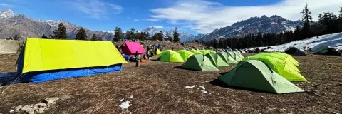
The trek page translates the name as "Serpent's Peak". The Tehri district administration's Nagtibba page explains the two halves: "Nag" refers to Nag Devta, and "Tibba" is a local word for a hill or peak. The same page says villagers come to pray to Nag Devta for the protection of their animals, and that the views take in the Bandarpoonch range. The trek's one camp sits in the forest near the Nag Devta temple.
On height, the district page gives 3,048 m. Trekkaro's trek page, route map and itinerary all use 3,022 m (9,915 ft), and this article follows the trek page.
Where are the base village, camp and summit?
| Place | Altitude | Where it sits on the route |
|---|---|---|
| Pantwari | About 1,400 m (4,590 ft) | Road head and base village, 88 km from Dehradun; the trek starts and ends here |
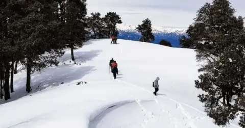
| Nag Devta camp | About 2,300 m (7,550 ft) | In the forest near the Nag Devta temple, 5 km and 3–4 hours above Pantwari |
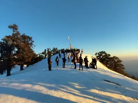
| Nag Tibba summit | 3,022 m (9,915 ft) | Above the camp; reached early on Day 2, then down to Pantwari, about 11 km and 6–8 hours that day |
From Pantwari to the summit you climb about 1,622 m, and the whole trek is about 16 km on foot. The Route Map & Altitude Profile on our Nag Tibba trek page shows Pantwari, the camp and the summit on a satellite and topographic map. Pantwari is a village of stone and slate-roofed houses spread across terraced fields. Luggage you don't need on the trail can stay in Trekkaro's store at the base camp, free of charge and at your own risk; valuables such as cash and documents stay with you.
Is Pantwari the only base village for Nag Tibba?
No. The Tehri district page describes another approach, from Thatyur, through Dewalsari, where there is a forest rest house; it puts Nagtibba 14 km from Dewalsari. Trekkaro's batches use Pantwari, and the 2-day plan, the camp and the pickup time on our trek page are all built around that start. If you are comparing operators, check which village each one starts from, because the drive, the distance on foot and the camp all change with it.
Which road leads to Pantwari on the map?
On the map, Pantwari sits north-west of Dehradun, 88 km and about 4 hours by road. The route climbs to Mussoorie, passes Kempty Falls and drops into the Aglar river valley to the village. Trains, buses and flights to Dehradun, the 6:30 AM shared cab and the return plan are all covered in our Nag Tibba complete guide.
What should you know before you travel to Pantwari?
Pantwari has only small bank branches and there is no ATM on the trail, so carry the cash you need from Dehradun or Mussoorie, in small notes. Jio and Airtel work at Pantwari and patchily at camp, with little or no signal near the summit, so make your important calls before you leave Pantwari.
The trek is graded Easy, and children aged 9 and above who walk regularly can join with a parent or guardian. Every trekker brings a medical certificate signed by a doctor; the form is in My Bookings. Travel insurance is mandatory and is not part of the trek fee, so arrange your own before you travel.
The fee is ₹3,825 + 5% GST (₹4,016) per person, and the trek page shows EMI from ₹197 a month; online booking closes at 5 PM (India time) the day before the batch starts. The Nag Tibba cost breakdown lists what the fee covers, including pure vegetarian meals and Free Trekking Gear.
See Nag Tibba dates and book | Nag Tibba itinerary and snow guide | Nag Tibba trek cost
Frequently asked questions
Which district is Nag Tibba in?
Nag Tibba is in Tehri Garhwal district, Uttarakhand, in the Jaunpur area beyond Mussoorie. It is the highest point of the Nag Tibba range in the Garhwal foothills.
How far is Nag Tibba from Dehradun?
Pantwari, the base village, is 88 km from Dehradun, about 4 hours by road through Mussoorie and Kempty Falls. From Pantwari the trail to the summit and back is about 16 km over two days.
Which village is the base for the Nag Tibba trek?
Trekkaro's Nag Tibba trek starts and ends at Pantwari, at about 1,400 m. The Tehri district page also describes an approach from Thatyur through Dewalsari.
What does the name Nag Tibba mean?
Nag refers to Nag Devta and Tibba is a local word for a hill or peak; the trek page translates the name as Serpent's Peak. The trek's camp sits in the forest near the Nag Devta temple.
Is there an ATM or mobile signal at Pantwari?
Pantwari has only small bank branches and no ATM on the trail, so carry cash from Dehradun or Mussoorie. Jio and Airtel work at Pantwari and patchily at camp, with little or no signal near the summit.