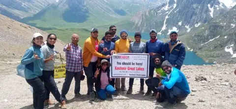
This guide is about the Kashmir Great Lakes Trek — dates, price, day-by-day itinerary and booking are on the trek page.
Quick answer: The Kashmir Great Lakes (KGL) trek is 67 km on foot over six walking days, from Shitkadi near Sonamarg to Naranag. The highest point is Gadsar Pass at 4,206 m (13,800 ft), and the longest day is Day 4: 14 km over that pass. Add about 85 km by road on Day 1 and 55 km on Day 7.
This guide is for trekkers working out how far they will walk on KGL and how high they will climb. Every distance, height and time below comes from our Kashmir Great Lakes itinerary. Heights in feet and metres are as written on the trek page and its route map.
KGL trek distance, day by day
| Day | Stretch | Distance | Walking time | Height (ft) |
|---|---|---|---|---|
| 1 | Srinagar to Shitkadi by road | About 85 km drive | About 3 hrs (drive) | 5,200 to 8,530 |
| 2 | Shitkadi to Nichnai | 10 km | 4 to 5 hrs | 8,530 to 11,500 |
| 3 | Nichnai to Vishansar Lake over Nichnai Pass | 12 km | 6 to 7 hrs | 11,500 to 13,100 (pass), then 13,386 |
| 4 | Vishansar to Gadsar Lake over Gadsar Pass | 14 km | 7 to 8 hrs | 13,386 to 13,800 (pass), then down to 11,800 |
| 5 | Gadsar to Satsar | 10 km | 5 to 6 hrs | 11,800 to 12,400 |
| 6 | Satsar to Gangabal Lake over Zaj Pass | 10 km | 5 to 6 hrs | 12,400 to 11,486 |
| 7 | Gangabal to Naranag, then the drive to Srinagar | 11 km walk, about 55 km drive | 5 to 6 hrs walk, about 2 hrs drive | 11,486 to 7,200 |
| 8 | Buffer day, used only if weather or trail conditions delay the group | – | – | – |
That is 10 + 12 + 14 + 10 + 10 + 11 = 67 km on foot. Days 3 and 4 are the hard pair: 26 km over two passes in two days. Day 4 starts by 5:30 AM so the group clears Gadsar Pass before afternoon cloud and wind build on the ridge.
How high is the Kashmir Great Lakes trek?
The trek starts at about 8,530 ft and goes above 13,000 ft four times: at Nichnai Pass, at the Vishansar Lake camp, at Gadsar Pass and at Zaj Pass.
| Point | Height (ft) | Height (m) | Where on the route |
|---|---|---|---|
| Naranag (trek end) | 7,200 | About 2,190 | Day 7 |
| Shitkadi (trek start) | 8,530 | About 2,600 | Day 1 camp |
| Gangabal Lake | 11,486 | 3,501 | Day 6 camp |
| Nichnai | 11,500 | About 3,510 | Day 2 camp |
| Gadsar Lake | 11,800 | About 3,600 | Day 4 camp |
| Satsar | 12,400 | About 3,780 | Day 5 camp |
| Nichnai Pass | 13,100 | About 3,990 | Day 3 |
| Vishansar Lake | 13,386 | About 4,080 | Day 3 camp |
| Gadsar Pass (highest point) | 13,800 | 4,206 | Day 4 |
Our route map puts Zaj Pass, the third pass on Day 6, at about 4,100 m. Harmukh Peak, which rises above the Gangabal camp, is 5,142 m; you see it, you do not climb it.
How much do you climb and descend each day?
- Day 2: about 2,970 ft up, through mixed forest and alpine scrub into open meadow.
- Day 3: about 1,600 ft up to Nichnai Pass over rock and snow patches, then on to the lake at 13,386 ft.
- Day 4: about 400 ft up to Gadsar Pass, then about 2,000 ft down over scree, boulders and occasional snow to the valley floor.
- Day 5: about 600 ft up across an open tundra valley with gentle ups and downs.
- Day 6: up to Zaj Pass and down into the Gangabal basin, ending about 900 ft below Satsar.
- Day 7: about 4,300 ft down to Naranag, through changing forest. Trekking poles help here, and you bring your own on this trek.
The lakes on the KGL route, in order
- Vishansar and Krishansar, Day 3: twin lakes separated by a narrow ridge, both in view from Nichnai Pass. You camp at Vishansar.
- Gadsar, Day 4: the lakeside camp at the foot of the descent from Gadsar Pass.
- Satsar, Day 5: not one lake but a chain of seven smaller lakes joined by channels.
- Gangabal and Nundkol, Day 6: two lakes beneath Harmukh, about 10 minutes apart across a short moraine ridge. You camp at Gangabal.
Is the KGL distance hard to walk?
Our trek page grades Kashmir Great Lakes Moderate–Difficult. The distance is not extreme, 10 to 14 km a day, but three of those days cross passes above 13,000 ft: Nichnai Pass, Gadsar Pass and, on Day 6, Zaj Pass. The page recommends one earlier Himalayan trek at a similar altitude, or strong fitness and 8 to 10 weeks of preparation, and the minimum age is 14 (under 18 with a parent or guardian). It is not suited to a first Himalayan trek.
Before the trek, read the Ladakh Tourism advisory for high-altitude travellers: it lists early signs of altitude sickness, such as a persistent headache and mild nausea, and says to stop ascending immediately if they appear. Tell your trek leader at once.
Trekkaro tip: train for Day 4, not for the 67 km total. A 14 km day that starts at 5:30 AM, climbs to 13,800 ft and then drops about 2,000 ft is the test of the trek.
How far is KGL from Srinagar and Delhi?
- Srinagar to Shitkadi: about 85 km, about 3 hours. Pickup is at the Tourist Reception Centre (TRC), Srinagar, at 12:00 PM on Day 1.
- Naranag to Srinagar: about 55 km, about 2 hours, reaching Srinagar by evening on Day 7.
- Delhi to Srinagar: direct flights of about 1 hour 20 minutes; by road about 876 km on NH44, a 2-day journey via Jammu; by rail to Katra, then the Vande Bharat to Srinagar in about 3 hours.
Transport is not included in the trek fee: we help the group book shared cabs, paid directly to the driver and split among trekkers, at ₹8,500 per 5–6 seat vehicle for the round trip. Meals on the drives are not included.
What to know before you walk
- Season: early July to mid-September. In early July there is snow on both passes; we lend microspikes and gaiters free, and you bring your own shoes, jacket and poles.
- Fee: ₹19,500 per person + 5% GST = ₹20,475. The trek page shows EMI from ₹1,003 a month. Backpack offloading is ₹3,000 + GST, up to 9 kg.
- Sonamarg has the last ATM; Shitkadi is the last stable signal, on postpaid SIMs only.
- A doctor-signed medical fitness certificate, an original government photo ID with a photocopy, and travel insurance covering high-altitude trekking and helicopter evacuation are all mandatory.
See Kashmir Great Lakes dates and book | KGL best time and opening date | Kashmir Great Lakes cost | Kashmir Great Lakes complete guide
Frequently asked questions
How many km is the KGL trek?
67 km on foot over six walking days, from Shitkadi to Naranag. The road drives from and back to Srinagar add about 85 km and 55 km.
What is the highest point of the Kashmir Great Lakes trek?
Gadsar Pass, at 4,206 m (13,800 ft), crossed on Day 4. Nichnai Pass, on Day 3, is about 13,100 ft.
How many lakes do you see on the KGL trek?
The trek page names Vishansar, Krishansar, Gadsar, the Satsar chain of seven lakes, Gangabal and Nundkol.
Which is the longest day on the Kashmir Great Lakes trek?
Day 4, Vishansar to Gadsar Lake: about 14 km in 7 to 8 hours over Gadsar Pass, starting by 5:30 AM.
What is the altitude of Gangabal Lake?
Gangabal Lake is at 3,501 m (11,486 ft), the camp for the last night of the trek, below Harmukh Peak at 5,142 m.