This guide is about the Buran Ghati Trek — dates, price, day-by-day itinerary and booking are on the trek page.
Quick answer: The 7-day Buran Ghati trek covers about 40.5 km on foot, from Janglik (2,804 m), 147 km by road from Shimla, to Barua (2,300 m) in Kinnaur. The pass is at 4,572 m (15,000 ft). You cross it on Day 6 from Dhunda (4,025 m), an 8 km day of 9 to 11 hours.
How long is the Buran Ghati trek, day by day?
The trek runs from Shimla to Shimla in 7 days. It is a crossing: you walk up the Pabbar valley in Shimla district and come down into Kinnaur, on the Sutlej side.
| Day | Route | On foot | Time on foot | Height |
|---|---|---|---|---|
| 1 | Drive Shimla to Janglik via Rohru | None | About 8 hrs by road (147 km) | 2,276 m to 2,804 m |
| 2 | Janglik to Dayara | 7.5 km | 5 to 6 hrs | 2,804 m to 3,366 m |
| 3 | Dayara to Litham | 5 km | 3 to 4 hrs | 3,366 m to 3,500 m |
| 4 | Litham to the Chandranahan lakes and back | 8 km | 4 to 7 hrs | 3,500 m to 4,000 m and back |
| 5 | Litham to Dhunda | 5 km | 3 to 5 hrs | 3,500 m to 4,025 m |
| 6 | Dhunda over Buran Ghati to Munirang | 8 km | 9 to 11 hrs | 4,025 m to 4,572 m, then down to 3,300 m |
| 7 | Munirang to Barua, drive to Shimla (about 210 km) | 7 km | 3 to 4 hrs | 3,300 m to 2,300 m |
| Total on foot | About 40.5 km | 27 to 37 hrs | Highest point 4,572 m | |
No day is longer than 8 km. What sets the pace is height and ground: the trek climbs 1,768 m from Janglik to the pass, and the 8 km over the top take hours longer than any other day.
How high is Buran Ghati pass?
Buran Ghati is at 4,572 m (15,000 ft), the highest point of the trek. You sleep at Janglik and then at three camps before it (Dayara, Litham for two nights, Dhunda), and the last, Dhunda, is only 547 m below the pass.
| Place | Height | What it is on the trek |
|---|---|---|
| Janglik | 2,804 m | Village and start of the walk; homestay on Day 1 |
| Dayara | 3,366 m | Meadow camp, Day 2 |
| Litham | 3,500 m | Riverside camp below waterfalls, Days 3 and 4 |
| Chandranahan lakes | 4,000 m (13,123 ft) | Day walk from Litham, Day 4 |
| Dhunda | 4,025 m | Exposed high camp below the pass wall, Day 5 |
| Buran Ghati | 4,572 m (15,000 ft) | The pass, Day 6 |
| Munirang | 3,300 m | River camp on the Kinnaur side, Day 6 |
| Barua | 2,300 m | Village above the Sutlej near Sholtu; end of the walk |
You will see a second figure. The Himachal Pradesh trekking portal entry for Buran Ghatti lists the trek altitude as 15400, without a unit, grades the trek hard, and gives the route as Janglik, Dayara, Litham Thatch, Chandernahan lake, Dunda Thatch, the pass, Manirang and Burra village. Trekkaro uses 4,572 m (15,000 ft), the figure on its trek page; its Manirang and Burra are Munirang and Barua.
How far are Janglik and Barua from Shimla?
Janglik is about 147 km from Shimla, about 8 hours through Rohru and the apple orchards of the Pabbar valley. The group meets at Shimla Old Bus Stand on Day 1. Barua, where the walk ends, is about 210 km from Shimla on the Kinnaur side, and the drive back on Day 7 reaches Shimla late at night, so book onward travel for the next day.
To reach Shimla, Chandigarh airport is about 120 km and 4 hours away and HRTC buses from Chandigarh take 4 to 5 hours.
The cabs between Shimla, Janglik and Barua are not in the trek fee. Trekkaro helps the group book shared cabs, paid directly to the driver and split among the trekkers in it, and your trek coordinator confirms the fare. Because the trek ends in another valley, there is no luggage store at the start: leave extra bags with your hotel or a friend in Shimla before the pickup. The last ATM is at Rohru, about 40 km before Janglik. Janglik has the last reliable mobile signal and the only charging point.
Why does the 8 km pass day take 9 to 11 hours?
Because the last stretch to the pass is a steep wall of snow and rock. You leave Dhunda well before dawn, while the snow on the pass wall is still firm, and climb 547 m to the top. On the steepest section the trek team cuts steps and fixes rope, and the ropes and harness gear are carried by the team.
The far side is a descent of 1,272 m to Munirang. In May and June it starts with a fixed-rope section and then long, supervised snow slides. In September and October the snow is mostly gone, and the same ground is rock and scree. Day 7 is a steep 7 km forest descent to Barua.
The trek page grades Buran Ghati moderate to difficult and says the grade comes from the pass. It recommends at least one multi-day Himalayan trek before this one. Plan eight weeks of preparation, building up to jogging 5 km in 35 minutes. The minimum age is 14, trekkers under 18 come with a parent or guardian, and trekkers over 60 are advised to bring an ECG or TMT report.
Why is there a day to the Chandranahan lakes?
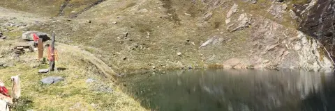
Day 4 is the acclimatisation day. You walk about 4 km each way (half the 8 km round trip) over moraine with only a day pack to the Chandranahan lakes at 4,000 m, treated locally as the source of the Pabbar river, and return to sleep at Litham, 500 m lower. It means you reach Dhunda at 4,025 m with a day at height already behind you.
Day 2 holds the largest height gain before the pass: 562 m in 7.5 km through fields and oak and maple forest from Janglik to Dayara. SpO2 and pulse are checked twice a day at every campsite. Tell your trek leader about a headache, nausea or dizziness at once; our guide to altitude sickness on Himalayan treks explains the warning signs.
How do the months change the route?
Trekkaro runs Buran Ghati from mid-May to June and from September to mid-October. It does not run in July and August, the monsoon months, and from November to April snow closes both the pass and the road to Janglik. See the trek page for live batch dates.
| Months | Day temperature | Night temperature | On the pass |
|---|---|---|---|
| Mid-May to June | 13°C to 17°C | 0°C to 5°C | Snow, fixed ropes and supervised snow slides |
| September to mid-October | 12°C to 16°C | -5°C to 2°C | Drier and colder; rock and scree, with fresh snow possible from the second week of October |
What should you check before you book the Buran Ghati trek?
Ask any company these questions; the last column gives Trekkaro’s answers.
| What to check | Why it matters | With Trekkaro |
|---|---|---|
| Is there an acclimatisation day before the pass? | Without one, your body has little time to adjust to 4,572 m. | Yes. Day 4 is a walk to the Chandranahan lakes (4,000 m) and back to Litham. |
| Who fixes the rope on the pass wall, and who runs the snow slides? | The steepest section of snow and rock is where a slip is most likely. | The trek team cuts steps, fixes rope and supervises the slides; ropes and harness gear are carried by the team. |
| Is gear for the snow included? | The pass and the descent are on snow in May and June. | Free Trekking Gear: Decathlon trekking shoes, a -10°C jacket, trekking poles, gaiters and microspikes, with a ₹3,000 refundable deposit and a ₹200 washing charge; the deposit comes back within 7 working days. |
| What help travels with the group? | Beyond Janglik there is no reliable signal. | SpO2 and pulse checks twice a day at every campsite; one oxygen cylinder and one stretcher travel with every batch. One trek leader or guide for every 8 trekkers, trained in wilderness first aid. |
| What are the cancellation terms? | Without them, a change of plan can cost you the whole fee. | 70% back at 30 or more days, 50% at 15 to 29 days, no cash refund at 8 to 14 days and nothing at 7 days or less. Up to 8 days before, you can take a 100% TrekCash voucher (valid 1 year), one free reschedule or a transfer instead. |
What does the Buran Ghati trek cost?
The Buran Ghati trek fee is ₹26,000 per person plus 5% GST (₹27,300 with GST). EMI starts at ₹1,337 a month. It covers the homestay at Janglik and tents shared by three (men and women in separate tents), vegetarian meals from dinner on Day 1 to lunch on Day 7, permits (Trekkaro arranges them and the fees are included), safety equipment, the trek leader and support team, and the Free Trekking Gear. Backpack offloading and a single tent are optional extras. Transport between Shimla, Janglik and Barua is not included.
Every trekker brings a medical certificate signed by a doctor (the form is in My Bookings), and travel insurance that covers high-altitude evacuation is mandatory and not included. Online booking closes at 5 PM (India time) the day before the batch starts. Live batch dates and fees are on the Buran Ghati trek page.
See Buran Ghati Trek dates and book | Altitude sickness on Himalayan treks | How to use trekking poles
Frequently asked questions
How many km is the Buran Ghati trek?
The Buran Ghati trek is about 40.5 km on foot over 7 days, from Janglik to Barua. Add about 147 km of road from Shimla at the start and about 210 km back at the end.
What is the height of Buran Ghati pass?
Buran Ghati is at 4,572 m (15,000 ft). The last camp before it, Dhunda, is at 4,025 m, and the camp after it, Munirang, is at 3,300 m.
Where does the Buran Ghati trek start and end?
It starts at Janglik, a village of old timber and slate houses in the Pabbar valley of Shimla district, and ends at Barua in Kinnaur, above the Sutlej near Sholtu. Both ends are reached by road from Shimla.
Why is the pass day so long for 8 km?
The climb to the pass is a steep wall of snow and rock, with steps cut and rope fixed on the steepest section, followed by a descent of about 1,270 m. The day takes 9 to 11 hours and starts well before dawn.
What should I look for when choosing a company for the Buran Ghati trek?
Check that there is an acclimatisation day before the pass, that the team fixes rope on the wall and that the snow slides are supervised. Then compare the gear, the health checks, the 1:8 ratio and the cancellation terms.
Cover photo via Wikimedia Commons (cropped): Snow peaks above the slopes: photo by Bharatkaistha, CC BY-SA 4.0.