Rupin Pass Trek
Inclusion:
Meals on the Trek
All Permits
Expert Trek Leader & Guide
Rupin Pass Trek — Guide, Dates & Cost
Rupin Pass Trek is a 7-day moderate–difficult trek in Shimla, Himachal Pradesh, reaching 4,679 m (15,350 ft). It covers about 40.5 km on foot and starts at Jiskun and ends at Sangla. Best time: May to June and September to October. Trekkaro price: ₹15,750 per person + 5% GST, with free microspikes & gaiters (no deposit, no charge); bring your own trekking shoes, jacket and poles. Next batch: 8 May 2027 (10 upcoming batches).
Updated
District: Shimla
Duration: 7 Days
Difficulty Level: Moderate–Difficult
Highest Altitude: 4,679 m / 15,350 ft
Trekking Distance: 40.5 km
Temperature: Summer (May-Jun): Day 13°C to 18°C, Night 0°C to 7°C | Autumn (15 Sep-Oct): Day 3°C to 9°C, Night -3°C to -1°C
Rupin Pass will not stay the same trek for more than a day. It begins in villages that hang off the mountainside, slips into forests beside a rushing river, and opens into a glacial bowl where a waterfall drops nearly 1,500 feet in tiers. Then it sends you up beside that same waterfall and into snow. On the last high day you climb a narrow gully, step onto the pass at 4,679 metres, and look out at the Kinner Kailash range above a valley you have never seen.
The Rupin Pass trek strings together an unusual run of sights in about 40.5 km. Jakha, the “Hanging Village”, clings to a steep slope above the valley, surrounded by coniferous forest and apple orchards. Saruwas Thatch is a meadow camp beneath towering cliffs at the edge of the Rupin River. Dhanderas Thatch is a broad glacial valley where waterfalls pour down the walls and the Rupin Waterfall plunges nearly 1,500 ft in several tiers. Above it lie the snowfields of Rata Pheri, the narrow Rupin Gully and the pass itself, with views of the Kinner Kailash range and Charang Ghati, before the trail drops to Ronti Gad and on towards Sangla.
The Rupin Pass trek is a 7-day crossover trek in Himachal Pradesh, graded Moderate – Difficult. It starts at Jiskun (2,099 m / 6,889 ft) in Shimla district, after a drive from Shimla, and ends at Sangla, so you begin in one valley and finish in another. The route climbs from village homestays at Jiskun and Jakha (2,650 m) to camps at Saruwas Thatch (3,450 m), Dhanderas Thatch (3,550 m) and the Upper Waterfall Camp (4,100 m), crosses Rupin Pass at 4,679 m (15,350 ft), the highest point of the trek, and descends to Ronti Gad (4,000 m). It is celebrated for the way it combines villages, forests, meadows, waterfalls and snow in a single crossing. In our experience, it deserves its place among the finest treks in India, because no two days on it look alike.
The Rupin Waterfall and the Snow Gully – What Makes the Rupin Pass Trek Unmissable
The heart of this trek is a waterfall you live beside. The walk from Saruwas Thatch to Dhanderas Thatch is short, two to three hours through pine, rhododendron and silver birch along the gushing river. Then the trees fall back, the valley opens, and the Rupin Waterfall comes into sight ahead, plunging nearly 1,500 feet in several tiers, throwing up mist and filling the valley with a roaring echo. Dhanderas Thatch itself is a wide glacial meadow ringed by towering cliffs, with more waterfalls streaming down its walls, and in summer, especially in June, it is carpeted with flowers. You pitch camp with the falls in full view and fall asleep to their sound.
The next morning you go up beside it. You start early, because afternoons up here can bring strong winds and cloud. The trail climbs steeply along the river, over glacial streams and boulder sections, and in the early season across icy snow bridges. The roar of the falls grows louder as you climb. The distance is only 3.5 km, but it gains about 550 metres in 3–4 hours on sharp ascents and narrow trail. By early afternoon you reach the Upper Waterfall Camp at 4,100 metres, set right above the cascade. The water you have been listening to all day now falls away beneath your tent, and ahead lie the snowfields and peaks of the upper valley.
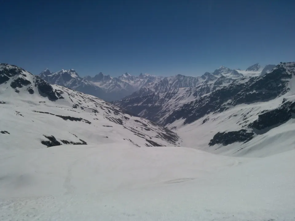
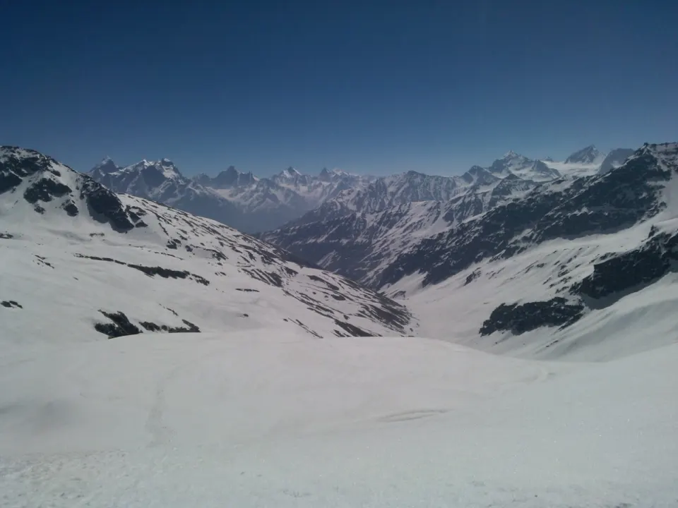
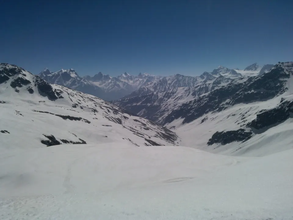
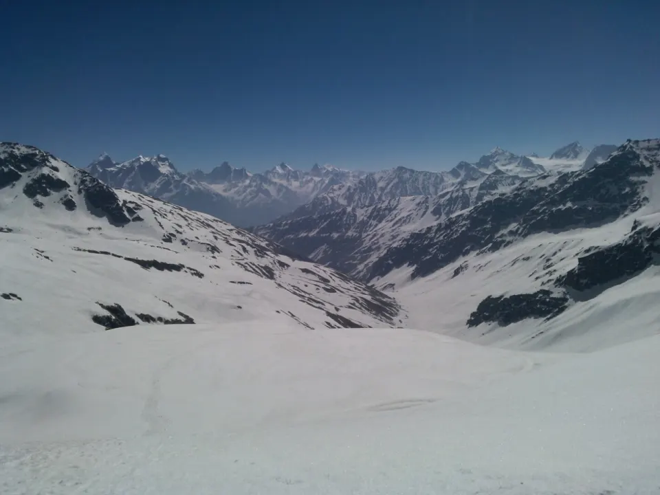
Summit day begins before sunrise, for better snow conditions. You walk out across the wide snowfields of Rata Pheri, a white world after days of forest and meadow. Then the valley narrows into the Rupin Gully, a steep, focused climb where all that matters is the next step. And then you are on the pass at 4,679 metres, and the view opens all at once to the Kinner Kailash range and Charang Ghati. The descent to Ronti Gad is steep and long, and the whole day runs 9–10 hours. The next day carries you down towards Sangla through country you have not seen before. We find that this sense of crossing into a new valley, rather than turning around and walking back, is what gives Rupin its character.
The Rupin Valley Itself
The landscape starts changing before you take your first step on the trail. The drive in runs through apple orchards, terraced fields and pine forest and climbs over Chainsheel Pass at about 11,000 ft, where the road cuts through dense forest and then opens onto rolling meadows with distant snow peaks, before dropping through isolated hamlets to Jiskun. From there the first walk climbs through pine and deodar forest and terraced fields of barley and potatoes, past traditional wooden houses and over small streams and wooden bridges, to Jakha, the highest settlement in the area and the last major village on the trek.
Above Jakha the trail belongs to the river. You walk under rhododendron, maple and deodar, cross the Rupin on rustic wooden bridges and pass small clearings dotted with wildflowers, with the sound of the water rarely out of earshot. The forest then gives way to open alpine meadows with views of snow-dusted peaks and waterfalls in the distance, and Saruwas Thatch, under its cliffs beside the river, gives you a night beneath starry skies. Higher still, meadow becomes glacial valley, glacial valley becomes snowfield, and snowfield becomes gully. Village, forest, meadow, waterfall, snow: the order never repeats, and that, more than any single view, is what defines the Rupin valley.
Who Is This Trek For?
The Rupin Pass trek is graded Moderate – Difficult. Most walking days are short, 3.5–7 km and 2–6 hours, but several are steep, and the climb beside the waterfall gains about 550 metres in just 3.5 km. The hard day is the pass crossing: about 10 km in 9–10 hours over snowfields and a steep gully, followed by a long, steep descent, with no water source after the Upper Waterfall Camp. The trek involves river crossings, snow patches and several nights of camping at altitude. We recommend it for trekkers who have done at least one high-altitude trek above 10,000 ft. Beginners with excellent fitness may attempt it, but endurance and stamina are essential. Plan on six to eight weeks of steady preparation before departure. Season: May to June and 15 September to October.
Key Highlights of the Rupin Pass Trek
- Jakha, the Hanging Village – at 2,650 m (8,694 ft), set on a steep mountainside, the highest and last major settlement on the route.
- The Rupin Waterfall – a cascade of nearly 1,500 ft in several tiers, which you camp below one night and above the next.
- Dhanderas Thatch – a broad glacial valley at 3,550 m (11,647 ft) full of waterfalls, carpeted with wildflowers in summer, especially in June.
- Upper Waterfall Camp – a campsite at 4,100 m (13,451 ft) perched right above the falls, with snowfields ahead.
- The snowfields of Rata Pheri – wide open snow below the pass, a complete change from the forests below.
- Rupin Gully and the pass – a narrow, steep final climb to 4,679 m (15,350 ft), with views of the Kinner Kailash range and Charang Ghati.
- Forests along the Rupin River – pine, deodar, maple, silver birch and rhododendron, crossed by rustic wooden bridges.
- A true crossover – from Jiskun over the pass to Ronti Gad and Sangla, with fresh country right to the end.
Best Time to Do the Rupin Pass Trek
The Rupin Pass trek runs in two seasons, May to June and 15 September to October, and the trek changes noticeably between them. Early summer is the time of snow bridges and then fresh green meadows; post-monsoon is the time of clear skies, crisp views and colder nights.
May – Snow Bridges Season
In early May the trail is still sprinkled with snow. You walk over snow bridges and snow-covered stretches of trail on the way up the valley, and you see the Himalayas around you in their most pristine, icy form. It is the most adventurous version of Rupin, with the feel of an early-season crossing, and for trekkers who want snow to be part of the story, this is the window to choose.
- Temperatures: Day: 13°C to 18°C | Night at camp: 0°C to 7°C (May–June range)
- Trail conditions: Snow-covered sections on the upper trail; snow bridges over streams.
- Best for: Snow bridges, snow walking and a full early-season pass crossing.
June – Meadows in Bloom
As summer moves on, the lower valley turns green. Lush meadows, blooming flowers and clear skies take over, and Dhanderas Thatch is at its best: the broad glacial valley below the Rupin Waterfall becomes a meadow carpeted with flowers, with the falls pouring down behind it. Snow still lies higher up on the way to the pass, so June gives you both sides of Rupin, flowers at the waterfall camp and snow at the top.
- Temperatures: Day: 13°C to 18°C | Night at camp: 0°C to 7°C (May–June range)
- Trail conditions: Green meadows and wildflowers lower down; snow patches remain on the upper trail.
- Best for: Wildflowers at Dhanderas Thatch, green meadows and the waterfall in full summer setting.
15 September to October – Post-Monsoon Clarity
After the monsoon the skies over the Rupin valley turn crystal clear, the valleys are fresh and green, and the meadows are full of colour. Views of the snow-clad peaks are at their sharpest, and the mountain air is crisp. The weather stays pleasant for long trekking days, though nights at the high camps drop below freezing. This is the season when the view from the top of the pass, across to the Kinner Kailash range and Charang Ghati, is at its clearest.
- Temperatures: Day: 3°C to 9°C | Night at camp: -3°C to -1°C
- Trail conditions: Clear skies, fresh green valleys, colourful meadows and crisp mountain views.
- Best for: Sharp views of the snow peaks, the clearest views from the pass and pleasant long walking days.
Trekkaro Recommendation
For the full snow experience, with snow bridges and a snowy upper valley, book an early-season batch in May. For wildflowers at Dhanderas Thatch alongside the waterfall, with snow still waiting at the top, choose June. For the clearest mountain views from the pass and pleasant, crisp trekking days, a batch from 15 September to October is our pick, provided you are ready for colder nights at camp.
📅 Best months for the Rupin Pass Trek: May to June and September to October. Still choosing dates? Compare all treks in May, treks in June, treks in September and treks in October.
🏃 Am I ready for the Rupin Pass Trek? Take the free 2-minute fitness test and get your readiness score and a personal training plan.
Take the test →Trek Itinerary
Pickup: Shimla Old Bus Stand at 06:30 AM. Transport is not included in the trek fee: we help the group book shared cabs from Shimla to Jiskun (the starting point) and from Sangla back to Shimla (the ending point) at ₹3,500 per person for both ways, paid directly to the driver.
Transport is not included in the trek fee: we help the group book shared cabs from Shimla to Jiskun (the starting point) and from Sangla back to Shimla (the ending point) at ₹3,500 per person for both ways, paid directly to the driver.
Tip: Since the return journey is overnight, carry light snacks, water, and a neck pillow for extra comfort.
Day 1: Drive from Shimla to Jiskun
Route Details:
Pickup: Shimla Old Bus Stand, 6:30 AM | Drive: Shimla → Jiskun (~198 km, ~10 hrs) | Altitude: 2,276 m → 2,099 m (6,889 ft) | Stay: Homestay in Jiskun (triple / quad sharing)
The Rupin Pass Trek begins with a long drive from Shimla to Jiskun, the village where the walking starts. It is about 198 km and roughly 10 hours on the road. The route winds through apple orchards, terraced fields and thick forest, and the landscape keeps changing as you move deeper into the hills.
Rohru is the last dependable ATM on the way, and after Rohru facilities are sparse, so carry enough cash and any last essentials from Shimla. Beyond Rohru the road climbs over Chainsheel Pass, at about 11,000 ft, on winding dirt roads that cut through dense forest. Near the top the trees give way to wide, rolling meadows with distant snow peaks on the horizon. The road then drops gradually through isolated hamlets and quiet valleys towards Jiskun.
You arrive at Jiskun (2,099 m / 6,889 ft) by evening, a small village on the mountainside. You settle into a homestay, with local hospitality and a hearty dinner before the trek begins. Make your last calls here: Jiskun has a weak signal, with BSNL and Vodafone working only sporadically, and beyond it there is no network for the rest of the trek. Sleep early; tomorrow you start walking.
What to Expect:
- Long drive from Shimla (~198 km, ~10 hrs) through apple orchards and pine forest
- Last dependable ATM at Rohru; carry cash and essentials from Shimla
- Cross Chainsheel Pass (~11,000 ft) with views of rolling meadows and snow peaks
- Weak, patchy mobile signal at Jiskun (BSNL, Vodafone); none beyond
- Dinner and a night in a village homestay
- Overnight: Jiskun homestay (2,099 m / 6,889 ft)
Day 2: Jiskun to Jakha
Route Details:
Altitude: 2,099 m → 2,650 m (8,694 ft) | Distance: 4 km | Duration: ~4 hrs | Terrain: village trail and terraced fields, pine and deodar forest, small stream crossings | Stay: Homestay in Jakha
Day 2 is your first day on foot, and it is a good warm-up for what follows. It is short, 4 km in about 4 hours, but it climbs about 551 m, so the trail is steeper than the distance suggests. You leave Jiskun on a path that winds through forests of pine and deodar, and the air carries their fresh scent. The gradient mixes gradual climbs with occasional steep pitches. On the steep pitches, shorten your step and keep moving slowly rather than stopping and starting; it costs less energy and keeps your breathing even.
This is a day of village life as much as mountain scenery. The trail passes terraced farmland where locals grow barley and potatoes, and traditional wooden houses stand along the slopes. It is worth slowing down to take it in, because after tomorrow the villages are behind you. As you climb, the valley opens up below. Small streams and rustic wooden bridges break up the walk; cross them one at a time and watch your footing where the planks are wet.
By afternoon you reach Jakha, at 2,650 m (8,694 ft), known as the Hanging Village for the way it sits on the steep mountain slope. It is the highest and the last major settlement on the trek, surrounded by coniferous forest and apple orchards. Jakha is also the last point where you may find basic supplies, so stock up on packaged snacks or anything else you need. Before dark, take a few minutes at the edge of the village to look back down the valley you climbed.
Tonight is another homestay night. Rest your legs, spend some time with the villagers and get your kit sorted for the trail ahead. From tomorrow you sleep in tents, and the days get longer and higher. Check your boots, socks and rain cover tonight, because tomorrow’s climb gains about 800 m.
What to Expect:
- Short but steep first trek day: 4 km, ~4 hrs, ~551 m gain
- Pine and deodar forest, terraced fields of barley and potatoes
- Traditional wooden houses and village life along the trail
- Small streams and wooden bridges to cross
- Last chance for basic supplies at Jakha
- Overnight: Jakha homestay (2,650 m / 8,694 ft)
Day 3: Jakha to Saruwas Thatch
Route Details:
Altitude: 2,650 m → 3,450 m (11,319 ft) | Distance: 7 km | Duration: 5–6 hrs | Terrain: forest of rhododendron, maple and deodar, wooden bridges, then alpine meadow | Stay: Tents at Saruwas Thatch
Day 3 is the first big climbing day, gaining about 800 m over 7 km. You leave the hanging village of Jakha behind, and the trail climbs gradually through dense forest of rhododendron, maple and deodar. The canopy gives plenty of shade, which helps on a long uphill. The ascents are broken by level stretches, so there are natural places to pause, catch your breath and look around. Use them; a steady pace with short stops gets you to camp in better shape than pushing hard and then resting long.
The Rupin River is your companion all day. You hear it long before you see it, and the trail winds across rustic wooden bridges over the river and through small clearings dotted with wildflowers. Water is easy today: you pass fresh streams along the way, so carry a refillable bottle and top up as you go rather than hauling a heavy load from Jakha. The shaded forest can feel cool early on, so start in a light layer and take it off as you warm up.
Higher up, the forest opens into vast alpine meadows. Snow-dusted peaks come into view and waterfalls cascade down the slopes in the distance, the first grand views of the trek. This is the point where the walk changes from a village trail into a high-mountain journey, and the scale of the valley ahead becomes clear.
By afternoon you reach Saruwas Thatch, at 3,450 m (11,319 ft), your first campsite. It is a broad meadow ringed by towering cliffs, with the gushing Rupin River running along its edge, and it is one of the most beautiful campsites on the trek. On a clear night the stars are worth staying up for, but not for too long. You have climbed a lot today, and a warm layer, a hot dinner and a full night’s sleep will serve you well.
What to Expect:
- 7 km, 5–6 hrs, ~800 m gain through rhododendron, maple and deodar forest
- Wooden bridges over the Rupin River and clearings with wildflowers
- Fresh streams on the way – carry a refillable bottle
- First grand views of snow-dusted peaks and distant waterfalls
- First tent night of the trek, beside the Rupin River
- Overnight: Saruwas Thatch meadow camp (3,450 m / 11,319 ft)
Day 4: Saruwas Thatch to Dhanderas Thatch (Lower Waterfall)
Route Details:
Altitude: 3,450 m → 3,550 m (11,647 ft) | Distance: 4 km | Duration: 2–3 hrs | Terrain: gentle forest trail of pine, silver birch and rhododendron, stream crossings, open glacial valley | Stay: Tents at Dhanderas Thatch
Day 4 is the easiest day of the trek: 4 km in 2–3 hours with only about 100 m of gain. It is short, but it is far from dull. The walk begins gently through alpine forest where pine and silver birch stand tall and the scent of rhododendron hangs in the air. Enjoy the slow pace. In our experience, a light day like this is exactly what your body needs before the two steep days that follow.
The trail runs alongside the gushing Rupin River and crosses several wooden bridges and lively streams. Look out for wildflowers and birdlife along the banks. Then the trees thin, the valley opens, and the Rupin Waterfall comes into view. It plunges nearly 1,500 ft in several tiers, throwing up mist and filling the valley with a roaring echo. It is the first close look at the waterfall, and it changes the feel of the whole trek. Keep a light rain shell handy; the spray from the falls carries on the wind.
The final stretch brings you into Dhanderas Thatch, at 3,550 m (11,647 ft), a broad glacial valley surrounded by towering cliffs and dotted with waterfalls. In summer, and especially in June, the meadow is carpeted with wildflowers. It is one of the most scenic campsites on the trek, with the Rupin Waterfall filling the backdrop and plenty of open ground to spread out across the meadow.
Because the walk is short, you arrive with most of the afternoon free. Wander the meadow, photograph the falls and rest your legs. Spend a little time studying the waterfall closely, too: tomorrow’s trail climbs right beside it to the camp above, and it helps to see the line before you walk it. Eat well tonight and keep your water bottles full for the morning.
What to Expect:
- Short, easy day: 4 km, 2–3 hrs, ~100 m gain
- Pine, silver birch and rhododendron forest beside the Rupin River
- Wooden bridges and lively streams; wildflowers and birdlife
- First close view of the Rupin Waterfall, dropping nearly 1,500 ft in tiers
- Wildflower meadows at Dhanderas Thatch, especially in June
- Overnight: Dhanderas Thatch camp at the Lower Waterfall (3,550 m / 11,647 ft)
Day 5: Dhanderas Thatch to Upper Waterfall Camp
Route Details:
Altitude: 3,550 m → 4,100 m (13,451 ft) | Distance: 3.5 km | Duration: 3–4 hrs | Terrain: steep climb beside the waterfall over boulders, glacial streams and seasonal snow bridges | Stay: Tents at Upper Waterfall Camp
Day 5 is short but steep, and it is one of the most adventurous days of the trek. You gain about 550 m in just 3.5 km, climbing beside the Rupin Waterfall to a camp above it. We recommend an early start: afternoons here can bring strong winds and cloud cover, and you want to be at camp before the weather turns.
The trail begins with a steep climb along the gushing Rupin River. You cross glacial streams and boulder sections, and depending on the season, icy snow bridges. Carry trekking poles; they make a real difference on this steep, uneven ground. On snow bridges, follow the guide’s instructions exactly, cross one at a time and do not stop to rest in the middle. Snow is firmer in the cold of the morning, which is one more reason the early start matters.
As you climb, the roar of the waterfall grows louder and the views become more dramatic. The cascade falls in several tiers between sheer cliffs, and the trail keeps you close to it. The ascents are sharp and the path is narrow in places, so take your time and keep a steady rhythm. You can feel the landscape change underfoot as the trek moves from green meadow to alpine snowfield.
By early afternoon you reach the Upper Waterfall Camp, at 4,100 m (13,451 ft), perched right above the falls, with tents pitched on open ground at the top of the cascade. From here the valley opens up to wide snowfields and towering Himalayan peaks. It is one of the most dramatic campsites on the trek, with the waterfall roaring below and snow stretching ahead. This is your highest camp so far. Rest well, drink plenty this evening and get your gear ready before dark; tomorrow is the longest and hardest day of the trek, and it starts before sunrise.
What to Expect:
- Short, steep climb: 3.5 km, 3–4 hrs, ~550 m gain
- Trail beside the Rupin Waterfall, crossing glacial streams, boulders and seasonal snow bridges
- Trekking poles strongly recommended for the steep, uneven ground
- Early start to beat afternoon wind and cloud
- Transition from green meadows to alpine snowfields
- Overnight: Upper Waterfall Camp (4,100 m / 13,451 ft)
Day 6: Summit Day - Upper Waterfall Camp to Ronti Gad via Rupin Pass
Route Details:
Altitude: 4,100 m → 4,679 m (15,350 ft) at Rupin Pass → 4,000 m (13,123 ft) | Distance: 10 km | Duration: 9–10 hrs | Terrain: snowfields, the steep Rupin Gully, then snow slopes, scree and rocky patches on the descent | Stay: Tents at Ronti Gad
Day 6 is the pass crossing, the most awaited and most strenuous day of the Rupin Pass Trek. It is 10 km and 9–10 hours, with about 550 m of climbing to Rupin Pass and about 650 m of descent to Ronti Gad. Start before sunrise, when the snow is in better condition. There are no water sources after the Upper Waterfall Camp, so carry enough water and energy snacks for the whole day.
The trail begins with a steep ascent from camp onto snowfields and icy terrain. You cross the wide snowfields of Rata Pheri, an open white world unlike anything lower on the trek. You wear microspikes and gaiters on the snow, and the team fixes ropes where the slope needs them. Walk in the steps of the person ahead, keep your pace even and save your energy for the final push.
The crux is the Rupin Gully, a narrow, steep section on the final climb to the pass that tests both endurance and balance. Take it slowly, one step at a time, kicking firm steps into the snow and keeping your weight over your feet. Then you are on top of Rupin Pass, at 4,679 m (15,350 ft). The view opens in every direction: towering peaks, glaciers and valleys, with the Kinner Kailash range and Charang Ghati in sight.
After some time at the top, the trail drops sharply down the other side. The descent is just as demanding, involving sliding down snow slopes or picking your way carefully over scree and rocky patches. Keep your poles out and your knees bent. By evening you reach Ronti Gad, at 4,000 m (13,123 ft), a quiet alpine meadow with views of the Kinner Kailash range. You will be tired, and you will have earned every minute of the rest.
What to Expect:
- Pre-dawn start; 10 km, 9–10 hrs – the longest and hardest day
- ~550 m climb over the snowfields of Rata Pheri and up the steep Rupin Gully
- Rupin Pass (4,679 m / 15,350 ft) with views of the Kinner Kailash range and Charang Ghati
- Microspikes and gaiters on the snowfields; ropes fixed by the team
- No water after Upper Waterfall Camp – carry enough for the day
- Overnight: Ronti Gad meadow camp (4,000 m / 13,123 ft)
Day 7: Ronti Gad to Sangla and Drive to Shimla
Route Details:
Altitude: 4,000 m → 2,680 m (8,790 ft) | Distance: 12 km | Duration: 6–7 hrs | Terrain: alpine meadow, then a steep descent through oak and rhododendron forest | Drive: Sangla → Shimla (~215 km, 9–10 hrs) | Stay: Not included
The last day starts with a long descent of about 1,320 m over 12 km. From Ronti Gad the trail drops gradually through rolling alpine meadows, then steeply into forests of oak and rhododendron. The steep section is hard on the knees, so shorten your stride and lean on your poles. On the way, the Baspa Valley and the Kinner Kailash range spread out ahead, with traditional Himachali villages on the slopes below.
The descent ends at Sangla, at 2,680 m (8,790 ft) in Kinnaur, where the trek officially concludes. Sangla is known for its apple orchards, wooden houses and temples, and its mountain backdrop. Trekkaro’s services end here.
The shared cab to Shimla (not included in the trek fee, paid directly to the driver) leaves Sangla at about 3:00 PM. The 215 km drive runs along the Sutlej River through deep mountain valleys and takes 9–10 hours, so you reach Shimla around 2:00 AM the next day. Pre-book a hotel in Shimla that allows late-night check-in, or plan to rest at the bus stand or taxi stop until morning. Dinner today is not included.
What to Expect:
- 12 km, 6–7 hrs, ~1,320 m descent from Ronti Gad
- Alpine meadows, then a steep drop through oak and rhododendron forest
- Views of the Baspa Valley and the Kinner Kailash range
- Arrival at Sangla in Kinnaur, known for apple orchards and wooden temples
- Cab to Shimla at about 3:00 PM (215 km, 9–10 hrs), arriving around 2:00 AM; dinner and stay not included
- Trek ends at Sangla (2,680 m / 8,790 ft)
How To Reach
Nearest airport: Chandigarh Airport, about 115–120 km and 4–5 hours by road from Shimla, with daily flights from major cities. The drive to Jiskun takes about 10 hours, so reach Shimla the day before.
From Shimla to Jiskun: about 198 km, a 10-hour drive. Transport is not included in the trek fee: we help the group book shared cabs from Shimla to Jiskun and back from Sangla to Shimla at ₹3,500 per person for both ways, paid directly to the driver. The pickup is at Shimla Old Bus Stand at 06:30 AM on Day 1.
Return: on the last day you trek about 12 km (6–7 hours) from Ronti Gad down to Sangla, then drive about 215 km (9–10 hours) to Shimla. The drive is overnight, so carry light snacks, water and a neck pillow, and book onward travel from Shimla for later the next day.
Nearest railway station: Kalka, about 90 km from Shimla, with direct trains from Delhi and other cities such as Kolkata. From Kalka, take the Kalka–Shimla toy train or a taxi; check current timings and reach Shimla the day before the drive to Jiskun.
- Kalka–Shimla toy train – a scenic UNESCO World Heritage route, slower than the road
- Taxi or shared cab from Kalka – the faster way up to Shimla
- Chandigarh – also well served by trains from Delhi; Shimla is 4–5 hours by road from there
From Shimla to Jiskun: about 198 km, a 10-hour drive. Transport is not included in the trek fee: we help the group book shared cabs from Shimla to Jiskun and back from Sangla to Shimla at ₹3,500 per person for both ways, paid directly to the driver. The pickup is at Shimla Old Bus Stand at 06:30 AM on Day 1.
Return: on the last day you trek about 12 km (6–7 hours) from Ronti Gad down to Sangla, then drive about 215 km (9–10 hours) to Shimla. The drive is overnight, so carry light snacks, water and a neck pillow, and book onward travel from Shimla for later the next day.
Bus route: HRTC and Volvo buses run from Delhi ISBT Kashmere Gate to Shimla (about 360 km, 8–9 hours) and from Chandigarh (about 120 km, 4–5 hours). Take an overnight bus from Delhi or travel a day early, so you are rested before the long drive to Jiskun.
From Shimla to Jiskun: about 198 km, a 10-hour drive. Transport is not included in the trek fee: we help the group book shared cabs from Shimla to Jiskun and back from Sangla to Shimla at ₹3,500 per person for both ways, paid directly to the driver. The pickup is at Shimla Old Bus Stand at 06:30 AM on Day 1.
Return: on the last day you trek about 12 km (6–7 hours) from Ronti Gad down to Sangla, then drive about 215 km (9–10 hours) to Shimla. The drive is overnight, so carry light snacks, water and a neck pillow, and book onward travel from Shimla for later the next day.
Things To Carry
Rupin Pass has river crossings, snow-covered trails and snow bridges in May–June and a steep climb to 4,679 m, so bring sturdy gear of your own.
- Backpack – 50–60 L with a rain cover and padded hip belt
- Day pack – 20–30 L; needed if you offload your main backpack (₹3,800 + 5% GST for the full trek, max 9 kg, no suitcases, trolleys or duffel bags)
- Trekking shoes – bring your own: broken-in, with ankle support and waterproof, for snow, slush and stream crossings
- Trekking poles – bring your own; a pair gives balance on snow, river crossings and steep descents
- Microspikes and gaiters – provided free (no deposit, no charge); the team also carries ice axes and ropes
- Headlamp – with spare batteries, for early starts and evenings at camp
- Water bottles – 2 bottles of 1 L each; make one insulated for the snow sections
- Lunch box – reusable, for packed lunches on the trail
Nights are 0–7°C in May–June and can drop to -2°C in September–October, so pack 4 warm layers including a proper jacket.
- Padded or down jacket – bring your own, warm enough for sub-zero nights at the high camps
- Thermal innerwear – 1 set, top and bottom, essential for cold nights
- Fleece or woollen layers – 2, to wear under the jacket in the evenings and on pass day
- Rain jacket or poncho – essential for unexpected showers
- Trek pants – 2 pairs, quick-dry so they dry after stream crossings; no jeans
- T-shirts – 3 quick-dry collared T-shirts
- Socks – 3–4 pairs of cotton or sports socks for walking, plus 2 pairs of woollen socks for the night
- Caps – a sun cap (wide-brimmed or neck-covering) and a woollen cap
- Balaclava or buff – for cold wind on the pass
- Gloves – a fleece or woollen pair, plus waterproof gloves for snow
Sun on the snowfields below the pass is fierce, especially in May–June, so protect your eyes and skin every day.
- Sunglasses – UV-protected, to prevent snow blindness
- Sunscreen – SPF 50+, reapplied through the day
- Lip balm – SPF 30, to prevent chapped lips
- Quick-dry towel – small and light
- Toiletries – toothbrush, toothpaste and biodegradable soap; no wet wipes, as they are not biodegradable
- Plastic or ziploc bags – to separate wet or dirty clothes and to carry back your waste
- Personal medical kit – your regular and prescribed medicines plus basic first aid; consult your doctor before the trek
Jiskun has only a weak signal and there is no network beyond it, so sort out cash and calls before the trek starts.
- Snacks – energy bars, dry fruits and chocolate for the trail and the overnight drive back
- ORS or electrolyte sachets – a few, to stay hydrated at altitude
- Power bank – fully charged; BSNL and Vodafone work only sporadically at Jiskun
- Neck pillow – for the overnight drive from Sangla to Shimla
- Cash – withdraw enough at Rohru, the last dependable ATM on the way to Jiskun, for the transport (₹3,500 per person, paid to the driver), offloading if needed and small expenses
- Government photo ID – original and a photocopy (passport, Aadhaar, driving licence or voter ID)
- Medical certificate – signed by a registered doctor
- Travel insurance – a copy of your policy; it is mandatory and must cover high-altitude trekking and emergency evacuation
Frequently Asked Questions
Rupin Pass Trek is a 7-day moderate–difficult trek in Shimla, Himachal Pradesh, reaching 4,679 m (15,350 ft). It covers about 40.5 km on foot and starts at Jiskun and ends at Sangla. Best time: May to June and September to October. Trekkaro price: ₹15,750 per person + 5% GST, with free microspikes & gaiters (no deposit, no charge); bring your own trekking shoes, jacket and poles. Next batch: 8 May 2027 (10 upcoming batches).
The Rupin Pass trek is in Himachal Pradesh, starting from Jiskun village in Shimla district and ending at Sangla in Kinnaur. Jiskun (2,099 m) is about 198 km and 10 hours by road from Shimla, via Rohru and the Chainsheel Pass.
The trail follows the Rupin River past Jakha village and the Rupin Waterfall, crosses Rupin Pass (4,679 m) and descends to Sangla in the Baspa Valley.
The Rupin Pass trek takes 7 days from Shimla, with 6 trekking days covering about 40.5 km. The return drive from Sangla is overnight and reaches Shimla around 2:00 AM.
- Day 1: drive from Shimla to Jiskun (about 198 km, 10 hours)
- Days 2–7: trekking, 3.5–12 km a day
- Pass day: Day 6, about 10 km and 9–10 hours over Rupin Pass
- Day 7: 12 km trek to Sangla, then a 215 km, 9–10 hour drive to Shimla
The highest point of the Rupin Pass trek is Rupin Pass at 4,679 m (15,350 ft). The trek starts at Jiskun (2,099 m / 6,889 ft), and the highest camp is Upper Waterfall Camp at 4,100 m (13,451 ft).
- Jakha: 2,650 m / 8,694 ft
- Saruwas Thatch: 3,450 m / 11,319 ft
- Dhanderas Thatch (Lower Waterfall): 3,550 m / 11,647 ft
- Ronti Gad: 4,000 m / 13,123 ft
- Sangla (end point): 2,680 m / 8,790 ft
The Rupin Pass trek is graded Moderate–Difficult, with long walking hours, steep ascents, river crossings, snow patches and high-altitude camping. Pass day is the longest and hardest, at 9–10 hours.
- Day 5: a short, steep climb of about 550 m beside the Rupin Waterfall over boulders and snow bridges
- Day 6: snowfields and the steep Rupin Gully up to 4,679 m, then snow, scree and rock on the descent
- Day 7: a steep descent of about 1,320 m to Sangla
The Rupin Pass trek is not ideal for beginners; at least one earlier high-altitude trek above 10,000 ft is recommended. Beginners with excellent physical fitness may attempt it, but endurance and stamina are crucial.
Pass day alone is 9–10 hours on snow and steep ground at up to 4,679 m.
For the Rupin Pass trek you should be able to jog 5 km in 30–35 minutes comfortably. Strong leg muscles, cardiovascular endurance and stamina are essential for the 9–10 hour pass day.
- Running: build up to the 5 km target with regular runs
- Stairs: stair climbing builds strength for the steep climbs
- Workouts: regular leg-strength training for the long descents
The best time for the Rupin Pass trek is May to June and 15 September to October. The two seasons give very different experiences of the same route.
- May–June: snow-covered trails and snow bridges, with days of 13–18°C
- June: wildflower meadows at Dhanderas Thatch
- 15 September–October: clear skies, colourful meadows and crisp mountain views, with colder nights
Snow on the Rupin Pass trek is heaviest in May–June, when the upper trail is snow-covered and you cross snow bridges and snowfields below the pass. September–October is the clearer season, though snowfields and snow patches can remain near the pass.
Microspikes and gaiters are provided free, and the team carries ice axes and ropes for the snow sections.
On the Rupin Pass trek, May–June days are 13–18°C and nights 0–7°C, while September–October nights can drop to about -2°C. Expect cold wind on the pass.
- Layers: 4 warm layers, including thermals and 2 fleece or woollen layers
- Jacket: bring your own padded or down jacket for sub-zero nights at the high camps
- Pass day: a balaclava or buff and waterproof gloves
From Rupin Pass (4,679 m) you see the Kinner Kailash range and Charang Ghati, and the descent to Sangla gives views of the Baspa Valley and Kinner Kailash. The other highlight is the Rupin Waterfall, which drops nearly 1,500 ft in tiers.
- Chainsheel Pass drive: meadows and snow peaks on Day 1
- Saruwas Thatch: first grand views of snow-dusted peaks and distant waterfalls
- Dhanderas Thatch: the first close view of the Rupin Waterfall
The Rupin Pass trek changes terrain almost every day, from village trails and forest to meadows, a glacial valley, snowfields and a steep gully. Stream and river crossings on wooden bridges are frequent.
- Lower trail: terraced fields and pine, deodar, maple and rhododendron forest
- Middle section: meadows and an open glacial valley along the Rupin River
- Waterfall climb: boulders, glacial streams and seasonal snow bridges
- Pass and descent: snowfields, the steep Rupin Gully, scree and rocky patches
The Rupin Pass trek reaches 4,679 m and camps at 4,000–4,100 m, so trekkers must be prepared for high altitude and acclimatisation. The climb is spread out, with short days of 2–4 hours on Days 4 and 5 before the pass.
- Biggest gains: about 800 m on Day 3 and about 550 m each on Days 5 and 6
- Safety kit: first-aid kit, medical support and oxygen cylinders at every camp
- Evacuation: stretchers at each campsite
To reach the Rupin Pass trek, travel to Shimla and arrive the day before; the pickup is at Shimla Old Bus Stand at 6:30 AM on Day 1, and the drive to Jiskun is about 198 km and takes around 10 hours.
- By air: Chandigarh Airport, about 115–120 km and 4–5 hours by road from Shimla
- By train: Kalka, about 90 km from Shimla, then the Kalka–Shimla toy train or a taxi
- By bus: HRTC buses from Delhi ISBT Kashmere Gate to Shimla (about 360 km, 8–9 hours) or from Chandigarh (4–5 hours)
- Return: the drive from Sangla reaches Shimla around 2:00 AM, so book onward travel for later the next day
No, transport is not included in the Rupin Pass trek fee. We help the group book shared cabs from Shimla to Jiskun and back from Sangla to Shimla at ₹3,500 per person for both ways, paid directly to the driver.
- Onward: from Shimla Old Bus Stand at 6:30 AM on Day 1 to Jiskun, about 198 km and 10 hours
- Return: the cab leaves Sangla at about 3:00 PM on Day 7 and reaches Shimla around 2:00 AM
- Overnight drive: dinner and stay are not included that night
On the Rupin Pass trek you stay two nights in village homestays at Jiskun and Jakha and four nights in 3-person tents at the high camps. Homestays are on a triple or quad sharing basis, and tents and sleeping bags are included.
- Day 1: homestay at Jiskun (2,099 m)
- Day 2: homestay at Jakha (2,650 m)
- Days 3–5: tents at Saruwas Thatch, Dhanderas Thatch and Upper Waterfall Camp
- Day 6: tents at Ronti Gad meadow camp (4,000 m)
- Day 7: overnight drive to Shimla, with no stay included
The Rupin Pass trek is led by experienced trek leaders supported by local certified mountain guides and support staff, combining safety with local knowledge. All technical equipment needed on the route is included.
- Technical gear: ice axes, microspikes, gaiters and ropes
- Safety: first-aid kit, medical support and oxygen cylinders at every camp
Yes, the Rupin Pass trek is safe with Trekkaro’s trained trek leaders, local guides and support staff, and medical kits and oxygen cylinders are always available. Trekkers must follow instructions and stay aware of altitude-related risks.
- Snow sections: free microspikes and gaiters, with ropes fixed by the team
- Evacuation: stretchers are kept at each campsite
- Insurance: mandatory, covering high-altitude trekking and emergency evacuation
All meals on the Rupin Pass trek are included from Day 1 dinner to Day 6 dinner: simple, freshly prepared vegetarian food. Tea, coffee, soups and snacks are served regularly.
- On the trail: packed lunches, so bring a reusable lunch box
- Not included: meals in transit and dinner on Day 7
- Snacks: carry energy bars, dry fruits and chocolate for the trail and the overnight drive
On the lower Rupin Pass trail there are fresh streams to refill a bottle, but there is no water after Upper Waterfall Camp, so carry enough for the whole of pass day. Take two 1-litre bottles, one of them insulated for the snow sections.
Add ORS or electrolyte sachets to stay hydrated at altitude.
Yes. On the Rupin Pass trek you bring your own trekking shoes, jacket and poles; microspikes and gaiters are provided free, with no deposit and no charge.
Yes, backpack offloading on the Rupin Pass trek costs ₹3,800 + 5% GST for the full trek. Book it in advance, as last-minute requests made at Jiskun may cost more.
- Weight limit: 9 kg
- Bag type: no suitcases, trolleys or duffel bags
- Day pack: carry a 20–30 L day pack for water, snacks and layers
Medical support on the Rupin Pass trek is available at every camp, with a first-aid kit and oxygen cylinders, and stretchers are kept at each campsite for emergency evacuation. Trained trek leaders and local guides manage safety on the trail.
- Medical certificate: signed by a registered doctor, required before the trek
- Insurance: mandatory and not included
- Your kit: carry your regular and prescribed medicines plus basic first aid
For the Rupin Pass trek you need an original government photo ID with a photocopy, a medical certificate signed by a registered doctor and a copy of your travel insurance policy.
- ID: passport, Aadhaar, driving licence or voter ID
- Insurance: mandatory and not included; it must cover high-altitude trekking and emergency evacuation
Yes, the Rupin Pass trek needs permits, and all necessary trekking permits and forest camping fees are included in the trek fee. Carry your original government photo ID and a photocopy.
Keep your documents dry in a ziploc or plastic bag, as the trail has many stream crossings.
On the Rupin Pass trek, Rohru is the last dependable ATM, and Jiskun is the last place with even a weak mobile signal; beyond Jiskun there is no reliable network for the rest of the trek.
- Signal at Jiskun: BSNL and Vodafone work only sporadically
- Cash: withdraw enough at Rohru for the ₹3,500 transport fare, offloading if needed and small expenses
- Supplies: Jakha is the last chance for basic supplies
The Rupin Waterfall drops nearly 1,500 ft in tiers and is the main sight of the Rupin Pass trek. You get the first close view on Day 4 at Dhanderas Thatch (Lower Waterfall camp), and on Day 5 you climb beside it to Upper Waterfall Camp at 4,100 m.
The climb beside the falls crosses glacial streams, boulders and seasonal snow bridges, so trekking poles are strongly recommended.
Pass day on the Rupin Pass trek (Day 6) starts before dawn and covers about 10 km in 9–10 hours, the longest and hardest day of the trek. You climb about 550 m over the Rata Pheri snowfields and up the steep Rupin Gully to the pass at 4,679 m, then descend to Ronti Gad (4,000 m).
- Views: the Kinner Kailash range and Charang Ghati from the pass
- Snow gear: free microspikes and gaiters, with ropes fixed by the team
- Water: none after Upper Waterfall Camp, so carry enough for the day
The Rupin Pass trek ends at Sangla on Day 7 after a 12 km, 6–7 hour descent, and the cab to Shimla leaves at about 3:00 PM, arriving around 2:00 AM. Book onward travel from Shimla for later the next day.
- Not included: dinner and stay on the night of Day 7
- Carry: light snacks, water and a neck pillow for the overnight drive
For the Rupin Pass trek, pack a 50–60 L backpack with your own trekking shoes, poles and a warm padded or down jacket, plus 4 warm layers in all; microspikes and gaiters are provided free.
- Clothing: thermals, 2 fleece or woollen layers, 2 quick-dry trek pants, 3 quick-dry T-shirts and a rain jacket
- Cold gear: woollen cap, balaclava or buff, fleece gloves and waterproof gloves
- Accessories: UV sunglasses, SPF 50+ sunscreen and lip balm for the snowfields
- Essentials: headlamp, two 1 L bottles, lunch box, power bank, neck pillow and cash
The minimum age for the Rupin Pass trek is 14 years, because pass day alone is 9–10 hours and climbs to 4,679 m. Trekkers under 18 must come with a parent or guardian. At least one earlier high-altitude trek is recommended.
There is no upper age limit. Trekkers above 60 are welcome if they are fit and in good cardiovascular health; along with the medical certificate signed by a doctor that every trekker brings, we recommend an ECG or TMT report.
Terms & Conditions
1. Accommodation
- Day 1 and Day 2: homestays in Jiskun and Jakha, on a triple/quad sharing basis
- Day 3 to Day 6: camping in 3-person tents at Saruwas Thatch, Dhanderas Thatch, Upper Waterfall Camp and Ronti Gad
2. Meals
- All meals from Day 1 dinner to Day 6 dinner
- Freshly prepared, simple vegetarian food
- Tea, coffee, soups and snacks during the trek
3. Permits & Camping Fees
- All necessary trekking permits and forest camping fees
4. Camping & Safety Equipment
- Tents and sleeping bags
- Large mess tents with tables
- Free microspikes and gaiters (no deposit, no charge), plus the ice axes and ropes the team uses on snow
- First-aid kit, medical support and oxygen cylinders at every camp
- Stretchers at each campsite for emergency evacuation
5. Trek Team
- Experienced trek leaders, supported by local certified mountain guides
1. Transport
- Transport (Shimla to Jiskun, and Sangla back to Shimla) is not included in the trek fee: we help the group book shared cabs at ₹3,500 per person for both ways, paid directly to the driver.
2. Food During Transit
- Meals on the drive from Shimla to Jiskun and from Sangla back to Shimla
3. Backpack Offloading (optional)
- ₹3,800 + 5% GST for the entire trek
- Maximum weight: 9 kg; no suitcases, trolleys or duffel bags
- Charges may be higher for last-minute requests made at Jiskun
4. Personal Equipment
- Trekking shoes, jacket and trekking poles: bring your own (microspikes and gaiters are provided free)
5. Trek Insurance
- Travel insurance is mandatory and not included. It must cover high-altitude trekking and emergency evacuation.
6. Anything Not Mentioned Under Inclusions
- If an item is not listed under inclusions, it is not part of the package; ask in advance if you are unsure
We know that cancelling a trek can be genuinely disappointing. Plans change, life intervenes, and sometimes the mountains have to wait. That is why Trekkaro has designed one of the most trekker-friendly cancellation policies in the industry — to reduce the financial impact on you and give you real options when things do not go as planned.
Important: Bookings made on trekkaro.com are cancelled online from My Bookings. Bookings made offline with our team must be cancelled in writing by e-mail by the person who originally booked the trek. Requests over the phone, via WhatsApp, or through third parties are not accepted.
How to Cancel Your Trek
Booked online on trekkaro.com:
- Log in and open My Bookings.
- Choose Cancel Booking on the trek you want to cancel.
- Pick a refund (as per the charges below) or Get TrekCash Voucher instead — the voucher is issued instantly and appears under My TrekCash Vouchers.
Booked offline with our team:
- Compose an e-mail from the registered e-mail ID used at the time of booking.
- Attach a copy of your tax invoice to the e-mail.
- Send both to info@trekkaro.com.
- Your cancellation is effective from the date Trekkaro receives and acknowledges your e-mail.
How to Reschedule Your Trek (Free)
- Once per booking, to another batch of the same trek, free of charge. A request we decline doesn’t count.
- Up to 8 days before departure, also in the 8–14-day window when there is no cash refund. The new batch must start at least 7 days after the day you ask.
- Subject to seat availability for every trekker on the booking.
- Not available for bookings paid fully or partly with a TrekCash Voucher.
- No fee or price difference; add-ons and the number of trekkers stay as booked.
Booked online: My Bookings → Reschedule free → pick a batch. Our team confirms by e-mail and your booking moves once approved. Booked offline: e-mail info@trekkaro.com.
How to Transfer Your Booking
You can give your booking to another trekker up to 8 days before departure. E-mail info@trekkaro.com from your registered e-mail ID with your booking ID and the new trekker’s name, age, phone number and ID proof. The new trekker must meet the fitness, age and document rules of the trek. We confirm the transfer by e-mail.
Cancellation Charges
| When you cancel | Cash refund | Other options |
|---|---|---|
| 30 days or more before departure | 70% refund (30% cancellation charge) | Or instead: a 100% TrekCash Voucher (valid 1 year), a free reschedule or a transfer |
| 15 to 29 days before departure | 50% refund (50% cancellation charge) | Or instead: a 100% TrekCash Voucher (valid 1 year), a free reschedule or a transfer |
| 8 to 14 days before departure | No cash refund of the trek fee | You can take a 100% TrekCash Voucher (valid 1 year), a free reschedule (once per booking) or a transfer to another trekker |
| 7 days or less before departure, or no-show | No refund of the trek fee | None: no voucher, reschedule or transfer |
A 100% voucher instead of a refund. From the day you book until 8 days before departure, you can take a TrekCash Voucher worth 100% of the amount paid, valid for 1 year on any Trekkaro trek. This works in every slab above, including 8–14 days, when there is no cash refund. Online bookings take the voucher from My Bookings → Cancel Booking (issued instantly). Offline bookings ask for it by e-mail to info@trekkaro.com.
If you paid the FTG security deposit and the washing charge, both are refunded in full when you cancel before the trek starts, in every slab.
Cancellation of Voucher-Based Bookings
- The standard cancellation policy applies to voucher-based bookings in the same way it applies to direct bookings.
- Any remaining balance after the applicable cancellation charge has been deducted will be credited back to your Trekkaro account as a new voucher.
- If your voucher has already expired at the time of cancellation, no refund, credit, or extension will be issued under any circumstance.
- If a voucher is set to expire on a Sunday or public holiday, it must be redeemed before the expiry date.
Additional Terms
- Free Rescheduling: Switching to a different batch of the same trek is free of charge once per booking, up to 8 days before departure, subject to seat availability. Not available for bookings paid with a TrekCash Voucher. See “How to Reschedule Your Trek” above.
- Trek Transfers: You can transfer your booking to another person up to 8 days before departure, by e-mail. The new trekker must meet the fitness, age and document rules of that trek. See “How to Transfer Your Booking” above.
- No Refund Post-Commencement: Once the trek has commenced from Day 1 of your confirmed itinerary, no refunds or TrekCash Vouchers will be issued for any reason, including early exit, illness, or dissatisfaction with services.
- Policy Changes: Trekkaro reserves the right to amend or withdraw this cancellation policy at any time without prior notice. The version in effect at the time of your booking confirmation governs your booking.
Early Exit or Removal from Trek
A trekker may be required to leave the trek before completion for health concerns (AMS, hypertension, cardiac symptoms, or fitness that poses a safety risk), rule violations (alcohol or non-prescribed drugs on trail, smoking in prohibited zones, reckless behaviour, or misconduct), or by their own decision. In all cases of early exit or removal, no refund, partial refund, or TrekCash Voucher will be provided, and any additional transport or exit expenses are the trekker's responsibility. The trek leader's decision on health and safety grounds is final.
If Trekkaro Cancels Your Trek
In rare circumstances beyond our control — natural disasters (extreme snowfall, avalanche, floods, landslides, earthquakes) or unforeseen civil events (government curfews, lockdowns, political unrest) — Trekkaro will issue a TrekCash Voucher for the full trek fee paid, valid for 12 months on any trek listed on Trekkaro.com. If the new trek costs more, the difference is payable by the trekker. The voucher is sent to your registered e-mail within 10 working days and may be transferred to another person who meets Trekkaro's eligibility requirements.
Refund Processing
Refunds are processed within 10 working days of cancellation approval and credited to the original payment method only (credit card, debit card, net banking, UPI, or wallet). Your bank may take another 3–5 business days. Office hours: Monday to Saturday, 10:00 AM to 7:00 PM IST.
The full policy is part of our Terms & Conditions (Section 09).
Oxygen, first aid, daily SpO₂ checks, trained leaders — tap to read
1. Trained Trek Leaders
- Trek leaders hold NIM (Nehru Institute of Mountaineering) certification or an equivalent qualification
- Their training covers casualty assessment, high-altitude medical response, rope work and evacuation
2. Daily Health Checks
- Blood oxygen (SpO2) and pulse are checked for every trekker every day
- A falling SpO2 reading is acted on early, before it turns into Acute Mountain Sickness (AMS)
- If you are not fit to continue, the trek leader will ask you to rest or descend; the trek leader’s decision on health and safety is final
3. Emergency Equipment
- Portable oxygen cylinders carried with the group
- First-aid and medical kit with the trek team
- Stretchers at every campsite for emergency evacuation
- Radio communication across the trek team, as mobile signal is not reliable on the trail
4. Proper Trekking Gear
- Free microspikes and gaiters on this trek (no deposit, no charge). Bring your own broken-in trekking shoes with good grip, a warm jacket and trekking poles (see Things To Carry)
5. Tents and Sleeping Bags
- Sleeping bags rated to -20°C, and tents shared by three trekkers, with men and women in separate tents
6. Snow and Steep Sections
- On snow, ice or exposed ground, the trek team fixes ropes and cuts steps where needed and helps you across
7. Risks on the Rupin Pass Trek
- Highest point: 4,679 m (15,350 ft)
- A steep climb beside the Rupin Waterfall over boulders and snow bridges on Day 5
- Pass day: snowfields and the steep Rupin Gully up to 4,679 m
- A steep descent of about 1,320 m to Sangla on Day 7
8. Your Part
- Build your fitness before the trek with running, cycling or swimming
- Tell the trek leader about any medical condition and the medicines you carry before Day 1
- Report a headache, nausea, dizziness or breathlessness to the trek leader at once
- Carry travel insurance that covers high-altitude trekking and emergency evacuation
What a day on the trek feels like — tap to read
1. What You Can Expect From Us
- Safety first on the Rupin Pass trek: daily SpO2 and pulse checks, oxygen cylinders and a stretcher with the group
- Personal attention: batches of up to 20 trekkers, so the trek leader knows each trekker’s health and pace
- NIM-certified trek leaders (Nehru Institute of Mountaineering, or an equivalent qualification), with local guides who know the Rupin Pass route, its weather and its campsites
- An itinerary planned for altitude, with daily distance and height gain set so your body can adjust
- Clear pricing: everything included and excluded is listed under Terms & Conditions, with the price of each optional add-on
2. What We Expect From You
- A willing attitude: cold nights, steep climbs and sudden weather changes are part of the mountains
- Physical preparation: you do not need to be an athlete, but train before the trek so the longest day feels comfortable
- Trust in your trek leader: follow their calls on route, pace, start times and turning back, as they are made for the group’s safety
Last ATM and phone network on the route — tap to read
1. Last ATM
- Rohru is the last dependable ATM on the way to Jiskun
- There is no ATM on the trail
- Carry small notes: cards are not accepted on the trail
2. Mobile Network
- Jiskun is the last place with even a weak signal; BSNL and Vodafone work there sporadically
- There is no reliable network beyond Jiskun
- Make your important calls and tell your family about the limited connectivity before you leave the base
Route Map & Altitude Profile
Follow the Rupin Pass Trek route on the map: from Jiskun (2,099 m) to Rupin Pass (4,679 m), about 2,580 m of climbing. Press Walk the trail and follow the hiker camp to camp, or tap a day to jump to its camp.
Satellite imagery with a topographic map option. The trail is drawn from mapped footpaths and the Trekkaro route (367 points); it is for orientation, not a navigation map. Your trek leader walks the trail with you.
Camps and altitudes on the Rupin Pass Trek
- Day 1 Jiskun · 2,099 m / 6,886 ft Base — Road head village
- Day 2 Jakha · 2,650 m / 8,694 ft Camp — Last village
- Day 3 Saruwas Thatch · 3,450 m / 11,319 ft Camp — Meadow camp
- Day 4 Dhanderas Thatch · 3,550 m / 11,647 ft Camp — Lower waterfall camp
- Day 5 Upper Waterfall Camp · 4,100 m / 13,451 ft Camp — High camp
- Day 6 Rupin Pass · 4,679 m / 15,351 ft Pass — Summit day; the gully
- Day 6 Ronti Gad · 4,000 m / 13,123 ft Camp — Camp after the pass
- Day 7 Sangla (trek end) · 2,680 m / 8,793 ft Base — Road head in Kinnaur
Related Treks You May Like
What Trekkers Say About Trekkaro
Reviews left on trekkaro.com by trekkers across our treks.
"Winter Kuari Pass trek with the team of Trekkaro. Food was amazing for breakfast, lunch and diner. Views on top and during the track are amazing. Trek in total was completely amazing. Big thanks to all of hard work from trek leader, superhuman cooks, the mule team, our driver."
"I have trek with Trekkaro for kuari pass and it was an amazing experience ,food was excellent and experience trek trainer."
"Trekkaro was simply amazing from the guidance to food to stay everything was very good!!! Local guides and trek leaders where always motivating, fun and made sure entire group had always been together and interacted with each other!!!"
"Had an amazing experience! Thanks for making this an amazing experience - Trekkaro Team"
"Trekkaro has a amazing team capable of leading anyone over a trek. Had an amazing experience!"
"Very amazing experience with Kedartal trek. Awesome views, Trek leaders and coordinators were very helpful."
Why Trekkaro?
Leaders in providing Free Trekking Gear for 8+ years — redefining the way everyone must trek.

Up to 8 days before departure, reschedule to another batch for free or take a TrekCash Voucher worth 100% of your amount — valid for 1 year on any future trek.

Rated 4.9/5 on Facebook & 4.7/5 on Google by trekkers who trekked with us.

We keep you safe from the moment you book to the moment you head home — certified leaders, first aid & emergency support.

Well-planned itineraries balanced with the freedom to make the experience your own — no matter the trek difficulty.

Every decision we make is guided by our commitment to making trekking a force for good — for people and the planet.
Welcome to Trekkaro
Login or create an account to manage your bookings and profile
Login Create AccountTalk to an Expert
Enter your number — we'll call you back shortly.
*Free to use on the trek, returned after · refundable deposit
AI can make mistakes · don’t share personal details · Talk to a person