Kedartal Trek
Inclusion:
Accommodation
Meals
All Permits
Expert Trek Leader & Guide
Kedartal Trek — Guide, Dates & Cost
Kedartal Trek is a 6-day moderate–difficult trek in Uttarkashi, Uttarakhand, reaching 4,912 m (16,116 ft). It covers about 38 km on foot and starts and ends at Gangotri. Best time: May to June and September to October. Trekkaro price: ₹15,750 per person + 5% GST, with Free Trekking Gear (Decathlon shoes, -10°C jacket, poles, gaiters and microspikes; ₹3,000 refundable deposit + ₹200 washing). Next batch: 17 Oct 2026 (22 upcoming batches).
Updated
District: Uttarkashi
Duration: 6 Days
Difficulty Level: Moderate–Difficult
Highest Altitude: 4,912 m / 16,116 ft
Trekking Distance: 38 km
Temperature: The Kedartal Trek offers varying temperatures across seasons. In summer (May–June), days range from 12°C to 17°C with nights dropping to -2°C to 7°C, while autumn (Sept–Oct) brings cooler days (3°C to 9°C) and freezing nights (-4°C to -1°C).
Above Gangotri, the Kedar Ganga thunders down a steep gorge. Follow it upstream for three days, through birch forest, over the tree line and across fields of loose boulder, and you reach the place where it begins: a still glacial lake at 4,912 m, held in a ring of rock and snow beneath Thalay Sagar. In our view, few walks in the Garhwal Himalayas lead so directly from a temple town to the feet of mountains this big. And in our experience, the moment that lake comes into view repays every hard step it took to get there.
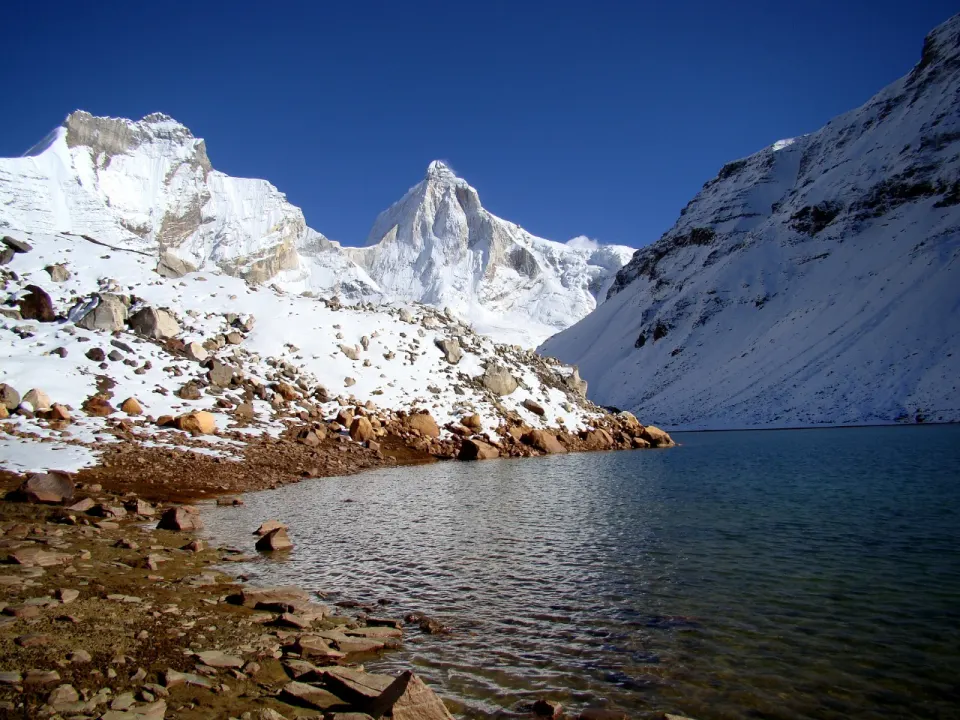
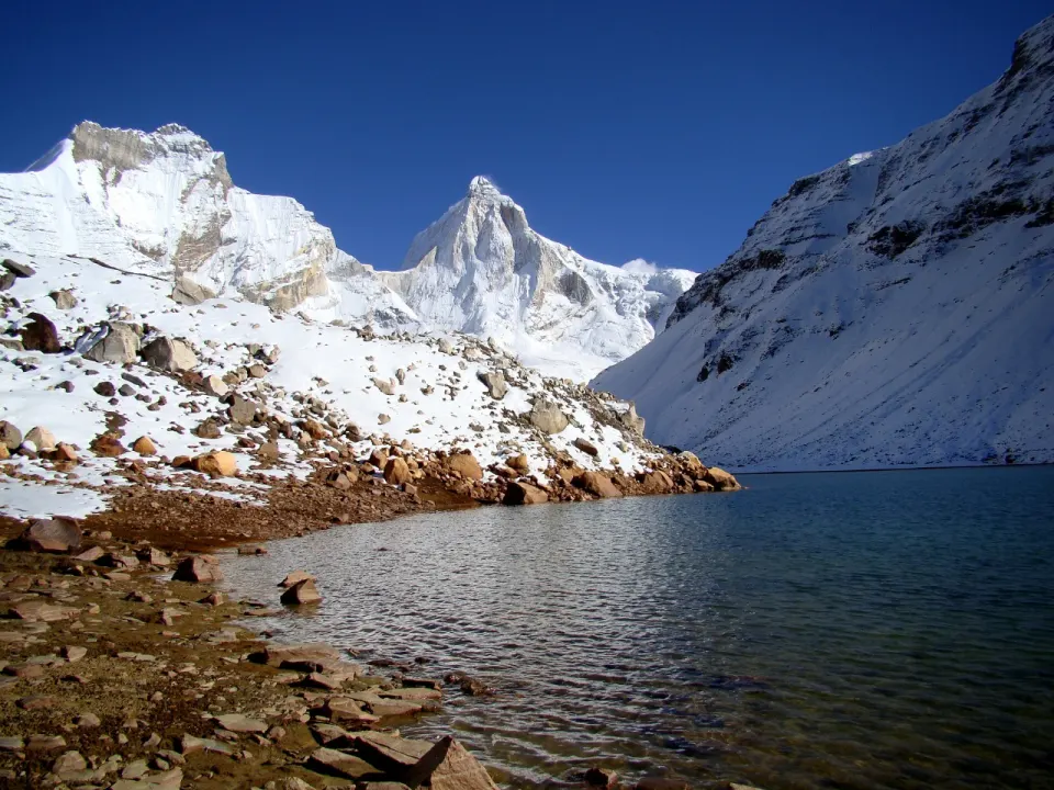
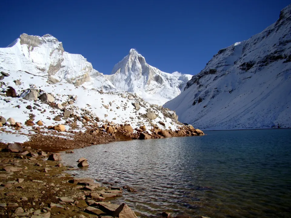
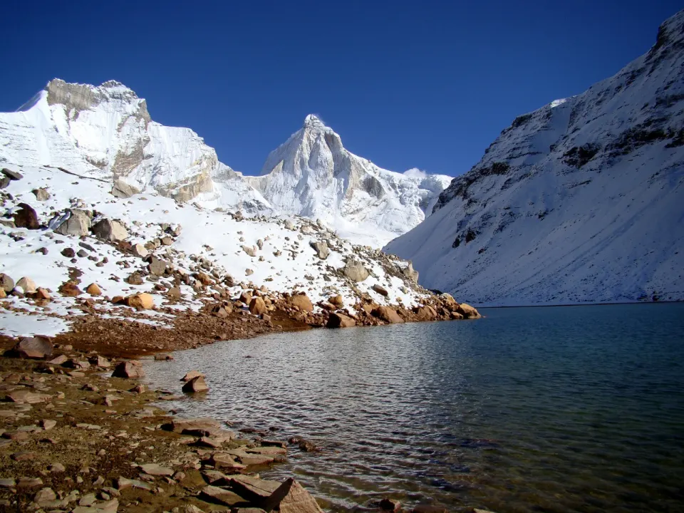
The Kedartal trek takes you to Kedartal, also known as Shiva’s Lake, a turquoise glacial lake at 4,912 m (16,116 ft). Three snow-clad peaks stand around it: Thalay Sagar (6,904 m), Bhrigupanth (6,772 m) and Meru (6,672 m). Fed by the melting snow of these mountains, Kedartal is the origin of the sacred Kedar Ganga River. The trail to it climbs beside that river through pine, deodar and Bhojpatra forest to the camp at Bhoj Kharak, crosses the tree line into the alpine meadows of Kedar Kharak, where Bhrigupanth makes its first grand appearance, and then rises over scree and boulders to the lake itself. At either end lies Gangotri, one of the Char Dham shrines, with its temple, its evening Ganga Aarti and the natural Shivling in the river. Over six days, Trekkaro’s itinerary takes you from that sacred town to the foot of Thalay Sagar and back again.
The Kedartal trek lies in the Uttarkashi district of Uttarakhand. It is a 6-day, Moderate to Difficult trek of about 38 km, out and back from Gangotri (3,065 m), the base and a revered pilgrimage town. There is no pass to cross; the summit of this trek is the lake. The route climbs from 3,065 m to 4,912 m in three days of walking, with camps at Bhoj Kharak (3,780 m) and Kedar Kharak (4,267 m), an ascent spread out so the body can adjust before the lake. We consider Kedartal one of the most striking glacial lakes in the Garhwal Himalayas. In our experience, it is also one of the most rewarding ways to get close to 5,000 m in under a week, provided you come prepared for what it asks in return.
Shiva’s Lake at 4,912 m – What Makes the Kedartal Trek Unmissable
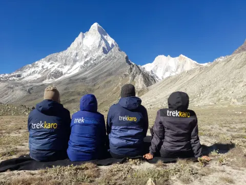
What sets Kedartal apart is how close it brings you to very big mountains in very few days. Bhrigupanth (6,772 m) appears first, from the open meadows above the tree line on the way to Kedar Kharak. On the final climb, Thalay Sagar (6,904 m) and Meru (6,672 m) join it, and the three peaks close in until they stand directly around you. The lake at their feet is fed by their snow, and from it flows the Kedar Ganga, the same river you have followed all the way from Gangotri. On a clear day, the water is turquoise and perfectly still, and every one of those peaks appears in it a second time.
You leave Kedar Kharak before sunrise, because this is the most challenging day of the trek and the daylight matters. The meadow falls behind and the trail turns to rocky path, then scree, then loose boulders that shift under your boots and demand balance and patience with every step. Water is scarce on this section, so you carry what you need. The air thins. The mountains grow. Thalay Sagar fills more of the sky with each hour, and Bhrigupanth and Meru crowd in from the sides. After four to five hours of climbing, the ground levels out, and Kedartal is in front of you. You find a rock near the shore, take off your pack and eat your lunch beside the water. For a while, the only thing to do is look at the peaks, and then look at them again in the lake.
The lake also carries a meaning beyond the view. Kedartal is called Shiva’s Lake, and the trek begins and ends at Gangotri, where, according to legend, the River Ganga descended to Earth, sanctified by Lord Shiva. On the way back down, an early start brings you into Gangotri in time for the evening Ganga Aarti at the Gangotri temple. Nearby is Bhagirath Shila, where Raja Bhagirath is believed to have meditated for the salvation of his ancestors, and the natural Shivling submerged in the river, where mythology says the Goddess Ganga descended into Shiva’s locks. We find that this frame changes the trek. The lake at the top and the shrine at the bottom are joined by the same river, and walking from one to the other gives the hard climb a sense of pilgrimage as much as of adventure.
The Kedar Ganga Valley Itself
The trail leaves the temple town and climbs at once beside the roaring Kedar Ganga, on narrow paths that hug steep mountain slopes, with rocky sections and sharp ridges that keep you alert. Pine and deodar give way to the Bhojpatra, the birch whose bark is said to have been the ancient writing medium of sages, and through gaps in the trees the Bhagirathi peaks appear and disappear. Waterfalls run beside the path. As you gain height the forest thins and the air turns crisp, and by afternoon you reach Bhoj Kharak, a camp perched above the gorge among birch trees, looking out over the valley.
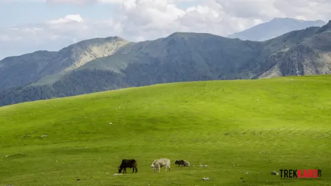
The next morning opens with a steep hour through the Bhoj forest, and then the trees end. Above the tree line the valley widens into lush alpine meadows with sweeping views, and this upper ground is home to high-altitude wildlife: the trail gives chances to spot blue sheep, goral, the Himalayan black bear and a variety of mountain birds. Kedar Kharak sits in a vast meadow beside a gushing, crystal-clear mountain stream. Beyond the camp, the green runs out, and the last stretch to the lake is a bare world of scree, boulders and snow-clad peaks. Forest, meadow and rock, one after another, in three days of walking: it is a compact lesson in how a Himalayan valley changes with height.
Who Is This Trek For?
The Kedartal trek is graded Moderate to Difficult, and it is not a first trek. It suits trekkers in good physical condition who have some prior experience of high-altitude trekking and are steady on rocky ground. Trekking days are long, 5 to 8 hours, with steep ascents and descents throughout. The first day on foot climbs about 715 m over 8 km in 5 to 6 hours on narrow, continuous trail; the next gains about 487 m at altitude in 6 to 7 hours. The hard day is the lake day: 7 to 8 hours and about 8 km, climbing roughly 645 m to 4,912 m over scree and loose boulders with scarce water, then descending the same height back to Kedar Kharak. The walk out to Gangotri is about 15 km and 7 to 8 hours, almost all downhill, which is easier on the lungs but hard on the knees. We recommend cardio training and hill walking for at least 6 to 8 weeks before departure. There is no upper age limit: trekkers above 60 are welcome if they are fit and bring a doctor’s medical certificate, and anyone with a health condition should consult a doctor before booking. Season: May to June, and September to October.
Key Highlights of the Kedartal Trek
- Kedartal (Shiva’s Lake) at 4,912 m / 16,116 ft – a turquoise glacial lake and the origin of the Kedar Ganga
- Thalay Sagar, Bhrigupanth and Meru up close – peaks of 6,904 m, 6,772 m and 6,672 m standing directly around the final climb
- Peaks reflected in the lake – on a clear day the still water holds the snow-clad mountains that ring it
- The first view of Bhrigupanth – a grandstand view from the meadows above the tree line on the way to Kedar Kharak
- Bhojpatra forest along the Kedar Ganga – birch trees whose bark is said to have been the ancient writing medium of sages
- Kedar Kharak meadow camp at 4,267 m – a vast meadow beside a gushing, crystal-clear mountain stream
- High-altitude wildlife – chances to spot blue sheep, goral, the Himalayan black bear and mountain birds
- Gangotri at both ends – a Char Dham shrine, with the evening Ganga Aarti, Bhagirath Shila and the natural Shivling in the river
Best Time to Do the Kedartal Trek
The Kedartal trek runs in two windows: May to June, and September to October. Summer brings warmer days and snow on the trail, especially early in the season; autumn brings settled, pleasant weather, colder air and the clearest views of the peaks around Kedartal.
May to June – Summer Season (Snow on the Trail)
The summer window opens with the trail still carrying snow, especially in May, and the climb through the upper valley takes on a wintry edge. Snow on the path makes the going slower and asks for more care, which adds to the challenge of an already demanding route, but it also gives the high ground a cleaner, whiter look beneath Thalay Sagar and Bhrigupanth. Days are the warmer of the two seasons, while nights at the high camps still drop to around freezing.
- Temperatures: Day: 12°C to 17°C | Night: -2°C to 7°C
- Trail conditions: Snow-laden trails, especially in May; snow can slow progress on the upper sections.
- Best for: Snow on the high trail, warmer trekking days and a wintry approach to the lake.
September to October – Autumn Season (Clearest Views)
Autumn is when the mountains around Kedartal show themselves most clearly. The weather turns pleasant and settled, the air sharpens, and the views of Thalay Sagar, Meru and Bhrigupanth come into hard focus from the meadows and the final climb. The trade-off is cold: days are cooler, and nights at Bhoj Kharak and Kedar Kharak are freezing, so this season suits trekkers who are comfortable with a real high-altitude chill.
- Temperatures: Day: 3°C to 9°C | Night: -4°C to -1°C
- Trail conditions: Pleasant weather, clearer views of the peaks, freezing nights at camp.
- Best for: The clearest views of Thalay Sagar, Meru and Bhrigupanth, and photography at the lake.
Trekkaro Recommendation
For the clearest views of the peaks around the lake, book a September or October batch; it is our first choice for photographers and for anyone who wants Thalay Sagar at its sharpest, as long as you are ready for freezing nights. For warmer days on the trail and the added challenge of snow on the trail, choose May or June.
📅 Best months for the Kedartal Trek: May to June and September to October. Still choosing dates? Compare all treks in May, treks in June, treks in September and treks in October.
🏃 Am I ready for the Kedartal Trek? Take the free 2-minute fitness test and get your readiness score and a personal training plan.
Take the test →Trek Itinerary
Transport is not included in the trek fee: we help the group book shared cabs (about ₹8,000 one way per 5–6 seat vehicle), paid directly to the driver and split among trekkers. The cab leaves Dehradun Railway Station at 06:30 AM for Gangotri.
Transport is not included in the trek fee: we help the group book shared cabs (about ₹8,000 one way per 5–6 seat vehicle), paid directly to the driver and split among trekkers. The cab leaves Gangotri at 06:30 AM for Dehradun Railway Station, with an expected arrival by 07:00 PM.
Day 1: Drive from Dehradun to Gangotri
Route Details:
Pickup: Dehradun Railway Station, 6:30 AM | Drive: Dehradun → Gangotri (~241 km, 10–11 hrs) | Altitude: 655 m → 3,065 m (10,050 ft) | Stay: Guesthouse / homestay (triple or quad sharing)
Day 1 is a long road day, and it sets you up for everything that follows. The cab leaves Dehradun Railway Station at 6:30 AM, so you reach Gangotri by evening with time to spare for the temple and a slow walk around town. The road climbs through Mussoorie and then works up the valley via Uttarkashi, Gorsali, Bhatwari, Harshil and Dharali. For long stretches the Bhagirathi River runs beside you, and the slopes fill with pine and deodar forest as you gain height. Transport is not included in the trek fee: we help the group book shared cabs, paid directly to the driver and split among trekkers.
Two practical points matter today. Bhatwari has the last reliable ATM before Gangotri, so withdraw the cash you need there. Gangotri is the last place with a stable mobile signal, and only BSNL, Jio and Airtel work consistently, so make your important calls before the trail starts tomorrow.
Gangotri sits at 3,065 m (10,050 ft) and is one of the four shrines of the Chota Char Dham. Legend holds that this is where the Ganga descended to Earth, sanctified by Lord Shiva. After you check in to your guesthouse, there is time to visit the Gangotri temple, explore the small market, meet the sadhus or take a quiet walk in the forest around town. After dinner, the team meets for introductions and the trek briefing. Sleep early; tonight your body begins adjusting to the altitude.
What to Expect:
- Scenic drive via Mussoorie, Uttarkashi, Bhatwari, Harshil and Dharali (~241 km, 10–11 hrs)
- Early start from Dehradun, around 6:30 AM, to reach Gangotri by evening
- Last ATM at Bhatwari; last stable mobile network (BSNL, Jio, Airtel) at Gangotri
- Evening visit to the Gangotri temple, one of the Char Dham shrines
- Team introduction and trek briefing after dinner
- Overnight: Gangotri guesthouse / homestay (3,065 m / 10,050 ft)
Day 2: Gangotri to Bhoj Kharak
Route Details:
Altitude: 3,065 m → 3,780 m (12,402 ft) | Distance: 8 km | Duration: 5–6 hrs | Terrain: steep riverside trail, pine and deodar forest, then bhojpatra (birch) forest | Stay: Tents at Bhoj Kharak
Day 2 is the first walking day, and it does not ease you in. The trail leaves Gangotri and turns up the valley of the Kedar Ganga, the river that flows down from Kedartal itself. Within minutes the temple town is behind you and the roar of the river takes over. The path climbs steadily through pine and deodar forest, gaining about 715 m over 8 km. That is a lot of height for a first day, so expect to feel it in your lungs before you feel it in your legs.
The gradient is moderate but continuous. The trail is narrow in places, cut into steep mountain slopes, with rocky stretches and a few sharp ridges where you need to watch every step. Walk these sections slowly, keep to the inside of the path and let faster walkers pass at the wider points. In our experience, the trekkers who do best today are the ones who start slower than they want to. There are waterfalls along the route; use them as natural rest stops, and carry enough water from Gangotri so you never have to ration it.
Higher up, the conifers give way to bhojpatra, the Himalayan birch. Its papery bark is said to have been the writing material of ancient sages, and the forest has a quieter, paler feel than the pines below. Through gaps in the trees the Bhagirathi peaks begin to appear. As you climb on, the forest thins, the ground turns more rugged and the air gets sharper and cooler.
By afternoon you reach Bhoj Kharak at 3,780 m (12,402 ft). The campsite is perched above the gorge, ringed by birch trees and looking down the valley you have just climbed. Tents go up, evening snacks and hot drinks follow, and the rest of the day is yours to rest. Keep drinking water through the evening; this is a big first jump in altitude, and your body needs the night to catch up.
What to Expect:
- First trekking day: 8 km, 5–6 hrs, ~715 m altitude gain from Gangotri
- Trail along the Kedar Ganga through pine, deodar and bhojpatra (birch) forest
- Narrow, rocky sections on steep slopes – slow down and watch your footing
- Waterfalls on the way make good rest stops; carry enough water from Gangotri
- First glimpses of the Bhagirathi peaks as the forest thins
- Overnight: Bhoj Kharak camp above the gorge (3,780 m / 12,402 ft)
Day 3: Bhoj Kharak to Kedar Kharak
Route Details:
Altitude: 3,780 m → 4,267 m (14,000 ft) | Distance: 7 km | Duration: 6–7 hrs | Terrain: steep birch forest, then open alpine meadow above the tree line | Stay: Tents at Kedar Kharak
Day 3 starts hard and then settles. The first hour out of Bhoj Kharak is a steep climb through dense birch forest, and it comes before your legs have properly warmed up. Take it in short steps, breathe steadily and do not try to match anyone else’s pace. Once that first hour is behind you, the gradient eases and the day turns into a steady, moderate ascent. Overall it is gentler than yesterday’s climb, but the altitude makes it strenuous all the same.
The distance is short at 7 km, and that is exactly why it can catch you out. You gain about 487 m and the walk takes 6–7 hours, because at this height every uphill stretch costs more than it looks. Keep a slow, even rhythm, sip water regularly and carry enough for the full day. Stopping for a few breaths works better than stopping rarely for long breaks.
The big change today is the tree line. Somewhere above Bhoj Kharak the birches thin out and you step onto open alpine meadow. The valley widens, the views sweep out on all sides, and Bhrigupanth (6,772 m) comes into full view for the first time. This open ground is also good wildlife country. The area is home to blue sheep, goral and the Himalayan black bear, along with a variety of mountain birds, so keep your camera within reach and your voice low.
Kedar Kharak, at 4,267 m (14,000 ft), is a wide meadow beside a fast, crystal-clear mountain stream. The sound of the water carries across the camp, and the open ground gives you room to walk around gently after you arrive, which helps your body adjust. Nights on this trek can drop below freezing, so put your warm layers on before the sun goes. Tomorrow is the climb to Kedartal, and the best preparation is a full dinner, plenty of fluids and an early night.
What to Expect:
- Steep first hour through dense birch forest, then a steadier, moderate climb
- 7 km, 6–7 hrs, ~487 m gain – short distance, but the altitude makes it strenuous
- Cross the tree line into open alpine meadows with wide valley views
- First full view of Bhrigupanth Peak (6,772 m)
- Chance to spot blue sheep, goral and mountain birds
- Overnight: Kedar Kharak camp beside a mountain stream (4,267 m / 14,000 ft)
Day 4: Kedar Kharak to Kedartal and back to Kedar Kharak
Route Details:
Altitude: 4,267 m → 4,912 m (16,116 ft) → 4,267 m | Distance: 8 km (up and back) | Duration: 7–8 hrs | Terrain: steep rocky trail, scree and loose boulders | Stay: Tents at Kedar Kharak
Day 4 is the hardest and the most rewarding day of the Kedartal Trek. You climb about 645 m to the lake and come back down the same way to Kedar Kharak. We recommend starting before sunrise so you can use every hour of daylight. The trail is steep and strenuous from early on, over rocky paths, scree and loose boulders. It asks for stamina, balance and patience far more than speed.
The loose ground is the part to respect. Test each step on scree before you put your full weight on it, use your hands where the boulders get big, and use trekking poles on both the climb and the descent. Natural water sources are scarce on this section, so fill every bottle at camp before you leave. The climb to the lake takes 4–5 hours, and it pays to keep something in reserve for the walk back.
With every hour the setting grows more dramatic. The peaks close in around you: Thalay Sagar (6,904 m), Bhrigupanth (6,772 m) and Meru (6,672 m), with other high summits filling the skyline. Then the ground levels and Kedartal appears, a glacial lake at 4,912 m (16,116 ft), also known as Shiva’s Lake. It is fed by snowmelt from the peaks around it and is the source of the Kedar Ganga, the river you followed up from Gangotri. On a still day its turquoise water holds a clear reflection of the snow peaks above.
Take your time at the shore. Sit, take photographs, or simply stay quiet for a while; you have earned it. Lunch is at the lake, and then you begin the descent to Kedar Kharak, which takes about 3 hours. Going down on scree is where tired legs slip, so shorten your stride and keep your poles planted. Back at camp, the stream and the open meadow feel very welcome after a long day at altitude.
What to Expect:
- Pre-dawn start for the toughest day of the trek (7–8 hrs)
- Steep ~645 m climb over rocky paths, scree and loose boulders; trekking poles strongly recommended
- Close views of Thalay Sagar (6,904 m), Bhrigupanth (6,772 m) and Meru (6,672 m)
- Kedartal (Shiva’s Lake), source of the Kedar Ganga and the highest point of the trek
- Very few water sources – fill all bottles at Kedar Kharak; lunch at the lake
- Overnight: Kedar Kharak camp (4,267 m / 14,000 ft)
Day 5: Kedar Kharak to Gangotri
Route Details:
Altitude: 4,267 m → 3,065 m (10,050 ft) | Distance: 15 km | Duration: 7–8 hrs | Terrain: long descent via Bhoj Kharak, birch forest and the Kedar Ganga trail | Stay: Guesthouse / homestay in Gangotri
Day 5 is the last day on the trail and the longest in distance. You retrace the route down through Bhoj Kharak and along the Kedar Ganga, all the way from 4,267 m to Gangotri. The trail is mostly downhill. That makes it easier on the lungs but much harder on the knees, so trekking poles are highly recommended, along with knee support if you use one.
Descending well is a skill. Shorten your stride, keep your knees soft and avoid running the steep sections, however tempting it is with Gangotri getting closer. The narrow, rocky stretches you climbed on Day 2 need the same care on the way down. There are a few natural water sources along the route where you can refill your bottles, so you do not need to carry a heavy load of water today. Short, regular breaks help too; a few minutes off your feet every hour gives your knees and thighs a chance to recover before the next long downhill.
The walk back through the birch forest and past the waterfalls of the Kedar Ganga looks quite different in this direction, with the valley opening below you instead of above. We recommend an early start so you reach Gangotri in time for the evening Ganga Aarti at the Gangotri temple. The original temple was built by a Nepalese general, and today it draws thousands of pilgrims every year.
Close to the temple is Bhagirath Shila, the rock where Raja Bhagirath is believed to have meditated for the salvation of his ancestors. Nearby, the natural Shivling lies submerged in the river, where mythology says the Ganga descended into Shiva’s locks. Spend the evening walking through town past its dharamshalas and ashrams, or sit by the Bhagirathi and let the trek settle in. Tonight you sleep under a roof again.
What to Expect:
- Longest day by distance: 15 km, 7–8 hrs, mostly downhill
- Retrace the route via Bhoj Kharak, birch forest and waterfalls along the Kedar Ganga
- Hard on the knees – trekking poles and knee support recommended
- A few natural water sources on the way for refills
- Evening Ganga Aarti at the Gangotri temple; Bhagirath Shila and the submerged Shivling nearby
- Overnight: Gangotri guesthouse / homestay (3,065 m / 10,050 ft)
Day 6: Drive from Gangotri to Dehradun
Route Details:
Drive: Gangotri → Dehradun (~241 km, 10–11 hrs) | Altitude: 3,065 m → 655 m (2,150 ft) | End: Dehradun by evening
The last day is a long drive back to the plains. We recommend leaving Gangotri around 6:30 AM so you reach Dehradun by evening without delays. The road follows the Bhagirathi River downstream, and the first stretch takes you past Dharali and Harshil, known for their apple orchards and calm, open valley floors.
Further down you pass through villages, forests and valleys to Uttarkashi, a hub for mountaineering and river rafting. From there the road climbs over to Mussoorie before it drops into the Doon Valley. Watch the Garhwal Himalaya fall away behind you; it is a good moment to look back on how far you climbed in four days on foot. Meals on the road are not included, so plan for food stops along the way.
The shared cab reaches Dehradun Railway Station by about 07:00 PM. If you are travelling onward the same night, leave yourself a comfortable margin, as the drive alone takes 10–11 hours.
What to Expect:
- Early start from Gangotri, around 6:30 AM
- Drive along the Bhagirathi past the apple orchards of Dharali and Harshil
- Through Uttarkashi and Mussoorie, then down into the Doon Valley
- ~241 km, 10–11 hrs on mountain roads; meals in transit are on your own
- Drop at Dehradun Railway Station (655 m / 2,150 ft) by about 07:00 PM
How To Reach
Nearest airport: Jolly Grant Airport (DED), about 25 km / 45–60 min from Dehradun city, with direct flights from Delhi and other metros. The drive to Gangotri takes most of a day, so fly in the day before.
From Dehradun to Gangotri: 241 km, 10–11 hrs by road. Transport is not included in the trek fee: we help the group book shared cabs from Dehradun to Gangotri and back (about ₹8,000 one way per 5–6 seat vehicle), paid directly to the driver and split among trekkers. The pickup is at Dehradun Railway Station at 06:30 AM on Day 1.
Return: On the last day the shared cab (not included in the trek fee, paid directly to the driver) leaves Gangotri at 06:30 AM and is expected at Dehradun Railway Station by 07:00 PM. Book your flight home for the next day.
Nearest railway station: Dehradun (DDN), with direct trains from Delhi. Book well in advance for the May–June and September–October peak season.
- Nanda Devi Express – overnight from New Delhi, arriving early in the morning.
- Dehradun Shatabdi, Jan Shatabdi and Vande Bharat – day trains; take them the day before the trek.
Check current timings before you book.
From Dehradun to Gangotri: 241 km, 10–11 hrs by road. Transport is not included in the trek fee: we help the group book shared cabs from Dehradun to Gangotri and back (about ₹8,000 one way per 5–6 seat vehicle), paid directly to the driver and split among trekkers. The pickup is at Dehradun Railway Station at 06:30 AM on Day 1.
Return: On the last day the shared cab (not included in the trek fee, paid directly to the driver) leaves Gangotri at 06:30 AM and is expected at Dehradun Railway Station by 07:00 PM. Book a late-night train or travel the next day.
By bus: Delhi ISBT Kashmere Gate to Dehradun ISBT takes about 6–7 hrs, with Uttarakhand Roadways Volvo and ordinary buses running through the night. Choose government buses from inside the ISBT and avoid private buses that leave from outside the ISBT premises. From Dehradun ISBT, an auto, shared three-wheeler or app cab takes you to Dehradun Railway Station for the 06:30 AM pickup.
From Dehradun to Gangotri: 241 km, 10–11 hrs by road. Transport is not included in the trek fee: we help the group book shared cabs from Dehradun to Gangotri and back (about ₹8,000 one way per 5–6 seat vehicle), paid directly to the driver and split among trekkers. The pickup is at Dehradun Railway Station at 06:30 AM on Day 1.
Return: On the last day the shared cab (not included in the trek fee, paid directly to the driver) leaves Gangotri at 06:30 AM and is expected at Dehradun Railway Station by 07:00 PM. Book a late-night bus or travel the next day.
Things To Carry
Kedartal climbs to 4,912 m on steep, rocky trail, with snow possible on the higher sections, so good grip and poles matter.
- Trekking shoes – Provided free with Trekkaro’s Free Trekking Gear (one refundable deposit of ₹3,000 + ₹200 washing charge covers the whole kit); your own broken-in, waterproof pair with ankle support is welcome too.
- Trekking poles – Provided free with Trekkaro’s Free Trekking Gear; needed for the steep ascents and descents.
- Microspikes and gaiters – Provided free with Trekkaro’s Free Trekking Gear; the team also carries ice axes and ropes.
- Backpack (50–60 L) – with a rain cover.
- Day pack (20–30 L) – required if you offload your main backpack.
- Two water bottles (1 L each) – or a 1 L hydration bladder plus a bottle; an insulated one helps on cold mornings.
- Headlamp – with spare batteries.
- Lunch box – reusable, for packed lunches on the trail.
Nights at the high camps are very cold even in May–June and September–October, so plan on 4 warm layers (thermals, 2 fleece or woollen layers and a padded jacket) plus rain protection.
- -10°C padded jacket – Provided free with Trekkaro’s Free Trekking Gear; your main warm layer at camp.
- Thermal inners (top and bottom) – essential for the cold nights.
- Fleece jackets or woollen sweaters x2 – light layers you can add or remove as you climb.
- Rain jacket or poncho – for unexpected showers.
- Trek pants x2 – one to wear, one spare; no jeans.
- Quick-dry collared T-shirts x3 – full sleeves protect from sun.
- Socks – 3–4 pairs: cotton or sports socks for walking and woollen socks for the night.
At close to 5,000 m the sun, glare and cold are all strong, so pack these for the upper camps.
- Sun cap – wide brim or neck flap.
- Woollen cap – covering the ears.
- Balaclava or buff – for cold, windy mornings near the lake.
- Gloves – a fleece or woollen pair plus a waterproof pair for snow.
- UV sunglasses – to prevent snow blindness.
- Sunscreen SPF 50+ and lip balm – for strong high-altitude sun.
- Quick-dry towel and toiletries – toothbrush, toothpaste, biodegradable soap; no wet wipes, as they are not biodegradable.
- Plastic or ziploc bags – to keep wet or dirty clothes apart from dry ones and to carry back your waste.
Mobile signal ends at Gangotri and there is no charging on the trail, so set yourself up before you leave the base.
- Personal medical kit – your regular and prescribed medicines plus a basic kit (blister plasters, pain relief, ORS); consult your doctor before the trek.
- Snacks and ORS – dry fruit, energy bars and electrolyte sachets for the long climbs.
- Power bank – to keep your phone and headlamp going for the whole trek.
- Cash – the last ATM is at Bhatwari, and Uttarkashi ATMs can run out of cash, so withdraw what you need in Dehradun, including your share of the cab fare.
- Camp slippers or sandals – light, for camp.
- Extra luggage – can be left free of charge at the base camp; do not keep valuables in it.
- Government photo ID – original and a photocopy (passport, Aadhaar card, driving licence or voter ID).
- Medical certificate – signed by a registered doctor.
- Travel insurance – mandatory; the policy must cover high-altitude trekking and emergency evacuation.
Frequently Asked Questions
Kedartal Trek is a 6-day moderate–difficult trek in Uttarkashi, Uttarakhand, reaching 4,912 m (16,116 ft). It covers about 38 km on foot and starts and ends at Gangotri. Best time: May to June and September to October. Trekkaro price: ₹15,750 per person + 5% GST, with Free Trekking Gear (Decathlon shoes, -10°C jacket, poles, gaiters and microspikes; ₹3,000 refundable deposit + ₹200 washing). Next batch: 17 Oct 2026 (22 upcoming batches).
The Kedartal trek is in Uttarkashi district, Uttarakhand, above the temple town of Gangotri. It starts from Gangotri (3,065 m / 10,050 ft), one of the Char Dham shrines, about 241 km (10–11 hours) by road from Dehradun.
From Gangotri the trail follows the Kedar Ganga through pine, deodar and birch forest to Bhoj Kharak and Kedar Kharak, then climbs to Kedartal lake at 4,912 m (16,116 ft).
The Kedartal trek takes 6 days from Dehradun to Dehradun, with 4 trekking days covering about 38 km.
- Day 1 and Day 6: drive between Dehradun and Gangotri (241 km, 10–11 hours)
- Days 2–5: trekking, 7–15 km a day
- Hardest day: Day 4, Kedar Kharak to Kedartal and back, 8 km in 7–8 hours
- Longest day: Day 5, a 15 km descent to Gangotri in 7–8 hours
The highest point of the Kedartal trek is Kedartal lake at 4,912 m (16,116 ft). The trek starts at Gangotri (3,065 m / 10,050 ft), so you gain about 1,850 m in three trekking days.
- Gangotri: 3,065 m (10,050 ft)
- Bhoj Kharak camp: 3,780 m (12,402 ft)
- Kedar Kharak camp: 4,267 m (14,000 ft)
- Kedartal: 4,912 m (16,116 ft)
The Kedartal trek is graded Moderate–Difficult, with steep ascents and descents, rocky terrain and high altitude. It is recommended for fit trekkers with some prior high-altitude trekking experience.
- Day 2: narrow, rocky sections on steep slopes above the Kedar Ganga
- Day 4: a steep climb of about 645 m over scree and loose boulders to the lake
- Day 5: a 15 km descent that is hard on the knees
No, the Kedartal trek is not a beginner trek. It is graded Moderate–Difficult and is recommended for trekkers in good physical condition who have some prior high-altitude experience.
First-time trekkers should gain experience on an easier high-altitude trek first, as proper preparation and acclimatisation are essential on Kedartal.
For the Kedartal trek you need good fitness: you should be comfortable walking 5–8 hours a day and handling steep ascents and descents at altitude.
- Train before the trek: regular cardio exercise and hiking on hills
- Summit day: 7–8 hours with a steep 645 m climb above 4,267 m
- Descent: 15 km downhill on Day 5, so build leg strength for the knees
The best time for the Kedartal trek is May–June and September–October, the two seasons in which Trekkaro runs it.
- May–June: summer, with days of 12–17°C and nights of -2°C to 7°C
- September–October: autumn, with cooler days of 3–9°C and freezing nights of -4°C to -1°C
Snow is possible on the higher sections of the Kedartal trek, which climbs to 4,912 m, so microspikes and gaiters are provided free.
- Team gear: ice axes and ropes are carried as part of the included technical equipment
- Eyes: UV sunglasses prevent snow blindness from the glare
- Hands: carry a waterproof pair of gloves for snow
Nights on the Kedartal trek drop to -2°C to 7°C in May–June and to -4°C to -1°C in September–October. Days are 12–17°C in summer and 3–9°C in autumn.
- Layers: plan on 4 warm layers – thermals, 2 fleece or woollen layers and a padded jacket
- Jacket: a -10°C padded jacket comes free with Trekkaro’s Free Trekking Gear
- Cold mornings: a balaclava or buff, a woollen cap and gloves for the climb to the lake
On the Kedartal trek you get close views of Thalay Sagar (6,904 m), Bhrigupanth (6,772 m) and Meru (6,672 m) from the lake, with the Bhagirathi peaks appearing earlier on the trail.
- Day 2: first glimpses of the Bhagirathi peaks as the forest thins
- Day 3: first full view of Bhrigupanth from the meadows near Kedar Kharak
- Day 4: Kedartal lake with Thalay Sagar, Bhrigupanth and Meru close by
- Wildlife: a chance to spot blue sheep, goral and mountain birds
The Kedartal trek moves from forest trail to rocky alpine ground: steep riverside paths through pine, deodar and birch forest, open meadows above the tree line, and scree and loose boulders below the lake.
- Gangotri to Bhoj Kharak: steep riverside trail with narrow, rocky sections
- Bhoj Kharak to Kedar Kharak: steep birch forest, then open alpine meadow
- Kedar Kharak to Kedartal: steep rocky trail, scree and loose boulders
Yes, the Kedartal trek reaches 4,912 m and you sleep two nights at Kedar Kharak (4,267 m), so altitude sickness is a real risk and proper acclimatisation is essential.
- Altitude gain: about 715 m on Day 2 and 487 m on Day 3
- Summit day: you climb to the lake and return to sleep at Kedar Kharak
- At every camp: first-aid kit, medical support, oxygen cylinders and a stretcher for evacuation
Yes. There is no upper age limit on the Kedartal trek: trekkers above 60 are welcome if they are fit and bring a medical certificate signed by a doctor, as it is a Moderate–Difficult trek to 4,912 m.
- Medical certificate: carry one signed by a registered doctor
- Experience: prior high-altitude trekking is recommended
- Pace: take breaks as needed on the long climbs and descents
The Kedartal trek starts from Gangotri, 241 km (10–11 hours) by road from Dehradun. Reach Dehradun the day before, as the cab to Gangotri leaves Dehradun Railway Station at 6:30 AM on Day 1.
- By air: Jolly Grant Airport (DED), about 25 km and 45–60 minutes from Dehradun city
- By train: Dehradun (DDN), with the overnight Nanda Devi Express and day trains such as the Shatabdi, Jan Shatabdi and Vande Bharat from Delhi
- By bus: government buses from Delhi ISBT Kashmere Gate to Dehradun ISBT (6–7 hours)
- Return: the cab leaves Gangotri at 6:30 AM and reaches Dehradun Railway Station by about 7:00 PM
No, transport is not included in the Kedartal trek fee. We help the group book shared cabs between Dehradun and Gangotri (about ₹8,000 one way per 5–6 seat vehicle), paid directly to the driver and split among trekkers.
- Pickup: Dehradun Railway Station at 6:30 AM on Day 1
- Payment: paid directly to the driver and split among the trekkers
- Route: via Mussoorie, Uttarkashi, Bhatwari, Harshil and Dharali
- Meals in transit: not included, so budget for food on both drive days
On the Kedartal trek you stay 2 nights in a guesthouse or homestay at Gangotri and 3 nights in tents on the trail.
- Gangotri (Day 1 and Day 5): guesthouse or homestay, triple or quad sharing
- Bhoj Kharak (Day 2): 3-person tents with a mess tent and tables
- Kedar Kharak (Days 3–4): camp beside a mountain stream
- Single tent: ₹2,000 + 5% GST per tent for the whole trek, for 1 or 2 people
Each Kedartal trek batch has a maximum of 20 trekkers, led by experienced trek leaders supported by local certified mountain guides.
All technical equipment for the trek is included, from tents and sleeping bags to ice axes, microspikes, gaiters and ropes.
Yes, women can join the Kedartal trek on their own: you trek in a batch of up to 20 led by experienced trek leaders and local certified mountain guides.
- Tents: shared 3-person tents, or a single tent for ₹2,000 + 5% GST for the whole trek
- Stay at Gangotri: guesthouse or homestay on a triple or quad sharing basis
- Connectivity: inform your family before you leave Gangotri, as there is no reliable mobile signal after it
All meals on the Kedartal trek are included from Day 1 dinner to Day 5 dinner: freshly prepared, simple vegetarian food.
- Through the day: tea, coffee, soups and snacks are served regularly
- On the trail: packed lunches, so carry a reusable lunch box
- Not included: meals during the drive between Dehradun and Gangotri
Water sources on the Kedartal trek are limited, so carry two 1 L bottles and fill them at camp before each day’s walk.
- Day 2: carry enough water from Gangotri; waterfalls on the way make good rest stops
- Day 4: very few water sources, so fill every bottle at Kedar Kharak
- Day 5: a few natural water sources on the way down for refills
- Bottles: an insulated bottle helps on cold mornings
Yes, the Kedartal trek includes Trekkaro’s Free Trekking Gear: trekking shoes, a -10°C padded jacket and trekking poles, plus microspikes and gaiters, at no rental fee.
- Deposit: one refundable deposit of ₹3,000 + ₹200 washing charge covers the whole kit
- Value: shoes worth ₹6,999 and a jacket worth ₹3,299
- Own shoes: your own broken-in, waterproof pair with ankle support is welcome too
Yes, backpack offloading on the Kedartal trek costs ₹3,600 + 5% GST for the full trek, for a bag of up to 9 kg.
- Not allowed: suitcases, trolleys or duffel bags
- Late requests: charges may be higher if you ask for offloading at Gangotri
- Day pack: a 20–30 L day pack is required if you offload
No, a doctor is not part of the Kedartal trek package. Safety is handled by experienced trek leaders and local certified mountain guides, with emergency support at every camp.
- At every camp: first-aid kit, medical support and oxygen cylinders
- Evacuation: stretchers at each campsite; your travel insurance must cover emergency evacuation
- Your part: carry a personal medical kit and consult your doctor before the trek
For the Kedartal trek you need a government photo ID, a medical certificate signed by a registered doctor and travel insurance.
- Photo ID: original and a photocopy (passport, Aadhaar card, driving licence or voter ID)
- Medical certificate: signed by a registered doctor
- Travel insurance: mandatory and not included; it must cover high-altitude trekking and emergency evacuation
Yes, but all necessary trekking permits and forest camping fees are included in the Kedartal trek fee, so you do not need to arrange them.
Just carry your original government photo ID and a photocopy on the trek.
No, there is no ATM or reliable mobile network on the Kedartal trail. Gangotri is the last place with a stable signal (BSNL, Jio and Airtel), and Bhatwari has the last reliable ATM.
- Network: once you leave Gangotri, there is no reliable mobile signal
- Charging: there is no charging on the trail, so carry a power bank
- Cash: Uttarkashi ATMs can run out, so withdraw what you need in Dehradun, including your share of the cab fare
Yes, you can leave luggage you do not need on the Kedartal trek at the base camp in Gangotri free of charge and collect it when you return.
Do not keep any valuables in the luggage you leave behind.
Kedartal, known as Shiva’s Lake, sits at 4,912 m (16,116 ft) and is the source of the Kedar Ganga. It is the highest point of the Kedartal trek, with close views of Thalay Sagar, Bhrigupanth and Meru.
- Gangotri temple: an evening visit to this Char Dham shrine on Day 1
- Ganga Aarti: evening aarti at the Gangotri temple when you return on Day 5
- Nearby: Bhagirath Shila and the submerged Shivling at Gangotri
Booking for a Kedartal trek batch closes at 5 PM (India time) on the day before the trek starts. Popular batches in May–June and September–October fill early, so book as soon as your dates are fixed.
Trains to Dehradun should also be booked early for the peak season.
The minimum age for the Kedartal trek is 16 years, because it is a Moderate–Difficult trek to 4,912 m. Trekkers under 18 must come with a parent or guardian. Prior high-altitude experience is recommended.
There is no upper age limit. Trekkers above 60 are welcome if they are fit and in good cardiovascular health; along with the medical certificate signed by a doctor that every trekker brings, we recommend an ECG or TMT report.
Terms & Conditions
1. Free Trekking Gear (FTG)
- Decathlon trekking shoes
- Decathlon jacket rated to -10°C
- Trekking poles, gaiters and microspikes
- No rental fee: ₹3,000 refundable deposit + ₹200 washing charge
2. Accommodation
- Day 1 and Day 5: guesthouse or homestay in Gangotri, on a triple/quad sharing basis
- Day 2 to Day 4: camping in 3-person tents at Bhoj Kharak and Kedar Kharak
3. Meals
- All meals from Day 1 dinner to Day 5 dinner
- Simple, freshly prepared vegetarian food
- Tea, coffee, soups and snacks served regularly during the trek
4. Permits & Camping Fees
- All necessary trekking permits and forest camping fees
5. Camping & Safety Equipment
- Tents and sleeping bags
- Large mess tents and tables at the campsites
- All technical equipment needed on the trek, including ice axes, microspikes, gaiters and ropes
- First-aid kit, medical support and oxygen cylinders at every camp
- Stretchers at each campsite for emergency evacuation
6. Trek Team
- Experienced trek leaders, supported by certified local mountain guides
1. Transport
- Not included: Dehradun to Gangotri and back. Trekkaro helps the group book a shared cab, approximately ₹8,000 one way per 5–6 seat vehicle, paid directly to the driver and split among the trekkers in it.
- Travel to and from Dehradun, arranged by you
2. Food During Transit
- Meals on the drive between Dehradun and Gangotri
3. Backpack Offloading (optional)
- ₹3,600 + 5% GST for the entire trek
- Maximum weight: 9 kg; no suitcases, trolleys or duffel bags
- Charges may be higher for last-minute requests made at Gangotri
4. Single Tent Occupancy (optional)
- ₹2,000 + 5% GST per tent for the entire trek
5. Personal Equipment
- Your backpack, clothing and other personal gear (trekking shoes, jacket, poles, gaiters and microspikes come with Free Trekking Gear)
6. Trek Insurance
- Travel insurance is mandatory and not included. It must cover high-altitude trekking and emergency evacuation.
7. Anything Not Mentioned Under Inclusions
- Anything not listed under inclusions is not part of the package; ask in advance if you have any questions
We know that cancelling a trek can be genuinely disappointing. Plans change, life intervenes, and sometimes the mountains have to wait. That is why Trekkaro has designed one of the most trekker-friendly cancellation policies in the industry — to reduce the financial impact on you and give you real options when things do not go as planned.
Important: Bookings made on trekkaro.com are cancelled online from My Bookings. Bookings made offline with our team must be cancelled in writing by e-mail by the person who originally booked the trek. Requests over the phone, via WhatsApp, or through third parties are not accepted.
How to Cancel Your Trek
Booked online on trekkaro.com:
- Log in and open My Bookings.
- Choose Cancel Booking on the trek you want to cancel.
- Pick a refund (as per the charges below) or Get TrekCash Voucher instead — the voucher is issued instantly and appears under My TrekCash Vouchers.
Booked offline with our team:
- Compose an e-mail from the registered e-mail ID used at the time of booking.
- Attach a copy of your tax invoice to the e-mail.
- Send both to info@trekkaro.com.
- Your cancellation is effective from the date Trekkaro receives and acknowledges your e-mail.
How to Reschedule Your Trek (Free)
- Once per booking, to another batch of the same trek, free of charge. A request we decline doesn’t count.
- Up to 8 days before departure, also in the 8–14-day window when there is no cash refund. The new batch must start at least 7 days after the day you ask.
- Subject to seat availability for every trekker on the booking.
- Not available for bookings paid fully or partly with a TrekCash Voucher.
- No fee or price difference; add-ons and the number of trekkers stay as booked.
Booked online: My Bookings → Reschedule free → pick a batch. Our team confirms by e-mail and your booking moves once approved. Booked offline: e-mail info@trekkaro.com.
How to Transfer Your Booking
You can give your booking to another trekker up to 8 days before departure. E-mail info@trekkaro.com from your registered e-mail ID with your booking ID and the new trekker’s name, age, phone number and ID proof. The new trekker must meet the fitness, age and document rules of the trek. We confirm the transfer by e-mail.
Cancellation Charges
| When you cancel | Cash refund | Other options |
|---|---|---|
| 30 days or more before departure | 70% refund (30% cancellation charge) | Or instead: a 100% TrekCash Voucher (valid 1 year), a free reschedule or a transfer |
| 15 to 29 days before departure | 50% refund (50% cancellation charge) | Or instead: a 100% TrekCash Voucher (valid 1 year), a free reschedule or a transfer |
| 8 to 14 days before departure | No cash refund of the trek fee | You can take a 100% TrekCash Voucher (valid 1 year), a free reschedule (once per booking) or a transfer to another trekker |
| 7 days or less before departure, or no-show | No refund of the trek fee | None: no voucher, reschedule or transfer |
A 100% voucher instead of a refund. From the day you book until 8 days before departure, you can take a TrekCash Voucher worth 100% of the amount paid, valid for 1 year on any Trekkaro trek. This works in every slab above, including 8–14 days, when there is no cash refund. Online bookings take the voucher from My Bookings → Cancel Booking (issued instantly). Offline bookings ask for it by e-mail to info@trekkaro.com.
If you paid the FTG security deposit and the washing charge, both are refunded in full when you cancel before the trek starts, in every slab.
Cancellation of Voucher-Based Bookings
- The standard cancellation policy applies to voucher-based bookings in the same way it applies to direct bookings.
- Any remaining balance after the applicable cancellation charge has been deducted will be credited back to your Trekkaro account as a new voucher.
- If your voucher has already expired at the time of cancellation, no refund, credit, or extension will be issued under any circumstance.
- If a voucher is set to expire on a Sunday or public holiday, it must be redeemed before the expiry date.
Additional Terms
- Free Rescheduling: Switching to a different batch of the same trek is free of charge once per booking, up to 8 days before departure, subject to seat availability. Not available for bookings paid with a TrekCash Voucher. See “How to Reschedule Your Trek” above.
- Trek Transfers: You can transfer your booking to another person up to 8 days before departure, by e-mail. The new trekker must meet the fitness, age and document rules of that trek. See “How to Transfer Your Booking” above.
- No Refund Post-Commencement: Once the trek has commenced from Day 1 of your confirmed itinerary, no refunds or TrekCash Vouchers will be issued for any reason, including early exit, illness, or dissatisfaction with services.
- Policy Changes: Trekkaro reserves the right to amend or withdraw this cancellation policy at any time without prior notice. The version in effect at the time of your booking confirmation governs your booking.
Early Exit or Removal from Trek
A trekker may be required to leave the trek before completion for health concerns (AMS, hypertension, cardiac symptoms, or fitness that poses a safety risk), rule violations (alcohol or non-prescribed drugs on trail, smoking in prohibited zones, reckless behaviour, or misconduct), or by their own decision. In all cases of early exit or removal, no refund, partial refund, or TrekCash Voucher will be provided, and any additional transport or exit expenses are the trekker's responsibility. The trek leader's decision on health and safety grounds is final.
If Trekkaro Cancels Your Trek
In rare circumstances beyond our control — natural disasters (extreme snowfall, avalanche, floods, landslides, earthquakes) or unforeseen civil events (government curfews, lockdowns, political unrest) — Trekkaro will issue a TrekCash Voucher for the full trek fee paid, valid for 12 months on any trek listed on Trekkaro.com. If the new trek costs more, the difference is payable by the trekker. The voucher is sent to your registered e-mail within 10 working days and may be transferred to another person who meets Trekkaro's eligibility requirements.
Refund Processing
Refunds are processed within 10 working days of cancellation approval and credited to the original payment method only (credit card, debit card, net banking, UPI, or wallet). Your bank may take another 3–5 business days. Office hours: Monday to Saturday, 10:00 AM to 7:00 PM IST.
The full policy is part of our Terms & Conditions (Section 09).
Oxygen, first aid, daily SpO₂ checks, trained leaders — tap to read
1. Trained Trek Leaders
- Trek leaders hold NIM (Nehru Institute of Mountaineering) certification or an equivalent qualification
- Their training covers casualty assessment, high-altitude medical response, rope work and evacuation
2. Daily Health Checks
- Blood oxygen (SpO2) and pulse are checked for every trekker every day
- A falling SpO2 reading is acted on early, before it turns into Acute Mountain Sickness (AMS)
- If you are not fit to continue, the trek leader will ask you to rest or descend; the trek leader’s decision on health and safety is final
3. Emergency Equipment
- Portable oxygen cylinders carried with the group
- First-aid and medical kit with the trek team
- Stretchers at every campsite for emergency evacuation
- Radio communication across the trek team, as mobile signal is not reliable on the trail
4. Proper Trekking Gear
- Free Trekking Gear, with no rental fee: Decathlon trekking shoes with good grip, a jacket rated to -10°C, trekking poles, gaiters and microspikes
- No one walks in worn-out or wrong gear, the cause of many slips and cold injuries
5. Tents and Sleeping Bags
- Sleeping bags rated to -20°C, and tents shared by three trekkers, with men and women in separate tents
6. Snow and Steep Sections
- On snow, ice or exposed ground, the trek team fixes ropes and cuts steps where needed and helps you across
7. Risks on the Kedartal Trek
- Highest point: 4,912 m (16,116 ft)
- Narrow, rocky sections on steep slopes above the Kedar Ganga on Day 2
- A steep climb of about 645 m over scree and loose boulders to the lake on Day 4
- A 15 km descent on Day 5 that is hard on the knees
8. Your Part
- Build your fitness before the trek with running, cycling or swimming
- Tell the trek leader about any medical condition and the medicines you carry before Day 1
- Report a headache, nausea, dizziness or breathlessness to the trek leader at once
- Carry travel insurance that covers high-altitude trekking and emergency evacuation
What a day on the trek feels like — tap to read
1. What You Can Expect From Us
- Safety first on the Kedartal trek: daily SpO2 and pulse checks, oxygen cylinders and a stretcher with the group
- Personal attention: batches of up to 20 trekkers, so the trek leader knows each trekker’s health and pace
- NIM-certified trek leaders (Nehru Institute of Mountaineering, or an equivalent qualification), with local guides who know the Kedartal route, its weather and its campsites
- An itinerary planned for altitude, with daily distance and height gain set so your body can adjust
- Clear pricing: everything included and excluded is listed under Terms & Conditions, with the price of each optional add-on
2. What We Expect From You
- A willing attitude: cold nights, steep climbs and sudden weather changes are part of the mountains
- Physical preparation: you do not need to be an athlete, but train before the trek so the longest day feels comfortable
- Trust in your trek leader: follow their calls on route, pace, start times and turning back, as they are made for the group’s safety
Last ATM and phone network on the route — tap to read
1. Last ATM
- Bhatwari has the last reliable ATM before Gangotri
- There is no ATM on the trail
- Carry small notes: cards are not accepted on the trail
2. Mobile Network
- Gangotri is the last place with a stable signal; BSNL, Jio and Airtel work there
- There is no reliable signal after Gangotri
- Make your important calls and tell your family about the limited connectivity before you leave the base
Reviews
Route Map & Altitude Profile
Follow the Kedartal Trek route on the map: from Gangotri (3,065 m) to Kedartal (4,912 m), about 1,847 m of climbing. Press Walk the trail and follow the hiker camp to camp, or tap a day to jump to its camp.
Satellite imagery with a topographic map option. The trail is drawn from mapped footpaths and the Trekkaro route (343 points); it is for orientation, not a navigation map. Your trek leader walks the trail with you.
Camps and altitudes on the Kedartal Trek
- Day 1 Gangotri · 3,065 m / 10,056 ft Base — Temple town
- Day 2 Bhoj Kharak · 3,780 m / 12,402 ft Camp — Birch camp
- Day 3 Kedar Kharak · 4,267 m / 13,999 ft Camp — Meadow camp
- Day 4 Kedartal · 4,912 m / 16,115 ft Lake — Lake under Thalaysagar
- Day 4 Kedar Kharak (return) · 4,267 m / 13,999 ft Camp — Back to camp
- Day 5 Gangotri (trek end) · 3,065 m / 10,056 ft Base — Descent
Related Treks You May Like
Kedartal Trek Guides
What Trekkers Say About the Kedartal Trek
Reviews left on trekkaro.com by trekkers who did this trek with us.
"Very amazing experience with Kedartal trek. Awesome views, Trek leaders and coordinators were very helpful."
"I had a great experience with Trekkaro. Safety plus all needed facilities were taken care by them."
"Exceptional staff, the food was beyond expectation. Went for the Kedartal Trek, best experience so far."
"An eco friendly,pet friendly work place with some really humble employees..."
Why Trekkaro?
Leaders in providing Free Trekking Gear for 8+ years — redefining the way everyone must trek.

World's first free trekking gear company — Decathlon trekking shoes, -10°C jacket, trekking poles, gaiters & microspikes. ₹3,000 refundable deposit + ₹200 washing charge.

Up to 8 days before departure, reschedule to another batch for free or take a TrekCash Voucher worth 100% of your amount — valid for 1 year on any future trek.

Rated 4.9/5 on Facebook & 4.7/5 on Google by trekkers who trekked with us.

We keep you safe from the moment you book to the moment you head home — certified leaders, first aid & emergency support.

Well-planned itineraries balanced with the freedom to make the experience your own — no matter the trek difficulty.

Every decision we make is guided by our commitment to making trekking a force for good — for people and the planet.
Welcome to Trekkaro
Login or create an account to manage your bookings and profile
Login Create AccountTalk to an Expert
Enter your number — we'll call you back shortly.
*Free to use on the trek, returned after · refundable deposit
AI can make mistakes · don’t share personal details · Talk to a person