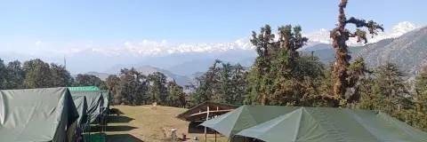
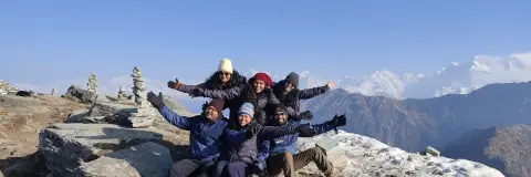
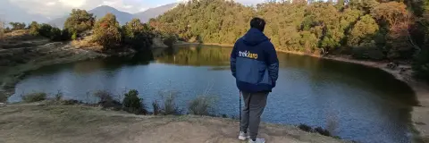
Quick answer: Chopta sits at 2,679 m (8,790 ft) in Rudraprayag district and is the road head for Tungnath temple, about 3 to 3.5 km up, and Chandrashila, about 1 km beyond it. On our 5-day trek you start at Sari, camp near Deoriatal and at Baniyakund, and reach Chopta by a short drive on summit day.
Where is Chopta and how high is it?
The Rudraprayag district administration places Chopta on the Gopeshwar to Ukhimath road, about 40 km from Gopeshwar, and calls it "one of the most picturesque places in the entire Garhwal region". The temple committee (BKTC) puts Chopta about 212 km from Rishikesh by the Kund–Gopeshwar road. Our trek page gives its height as 2,679 m (8,790 ft) and calls it "the Mini Switzerland of Uttarakhand".
The roads in from Rishikesh, Haridwar and Dehradun, and the choice between the Ukhimath and Gopeshwar sides, are covered in how to reach Tungnath and Chopta, so this guide sticks to the ground around Chopta itself.
What is where around Chopta?
Here is how the places around Chopta fit together: the road head and the two high points above it, two places off the trek, then the trek camp and start village.
| Place | Height | How it links to Chopta | Role on the trek |
|---|---|---|---|
| Chopta | 2,679 m (8,790 ft) | Road head | Start of the Day 4 walk |
| Tungnath temple | 3,680 m (12,073 ft) | About 3 to 3.5 km on foot (the temple committee gives 3 km) | Panch Kedar temple, passed on Day 4 |
| Chandrashila summit | 3,962 m (13,000 ft) | About 1 km above Tungnath, steep | Highest point of the trek |
| Gopeshwar | – | About 40 km by the Gopeshwar–Ukhimath road (Rudraprayag district administration) | Other end of the road; not on the trek |
| Makkumath | – | About 45 km from Ukhimath (temple committee) | Winter seat of Tungnath; not on the trek |
| Baniyakund | 2,610 m (8,562 ft) | A short drive from Chopta | Camp on Days 3 and 4; the trek ends here |
| Sari | 2,012 m (6,601 ft) | Road head 10 km from Ukhimath (Rudraprayag district administration) | Start village; night 1 |
Between Deoriatal and Baniyakund lies the Day 3 forest stretch, about 16 km through "rolling forest ridges with steep descents" and the Rohini Bugyal meadow, as the trek page puts it. You reach Baniyakund on foot and drive the short way to Chopta the next morning. Deoriatal, the Day 2 camp in between, has its own Deoriatal lake guide.
For the temple itself, its opening season and the Makkumath winter seat, see the Tungnath temple guide.
What does the walk above Chopta look like?
From Chopta the trail "climbs gradually through rhododendron and oak forest, then opens into wide alpine meadows with the Himalaya behind them", says the trek page, and "In spring the rhododendrons are in bloom; in winter the slopes are white with snow." You gain about 1,000 m to the temple and about 1,280 m to the summit; the whole Day 4, from Baniyakund and back, is 11 km and 8–9 hours.
Tungnath lies inside the Kedarnath Wildlife Sanctuary, which the Wildlife Institute of India places in Rudraprayag and Chamoli districts.
What is the weather around Chopta in each season?
Our trek runs from October to June. The trek page gives these ranges for the route; they are not readings for Chopta village alone. The Wildlife Institute of India notes that in this sanctuary "Heavy snowfall takes place during the winter months (December to February) in the alpine and temperate regions."
| Months | Day | Night | Trail |
|---|---|---|---|
| December–February | 8°C to 14°C | -10°C to -6°C | Snow season |
| March–April | 13°C to 17°C | Around 0°C | Snow on the higher sections; patches can stay on the summit into April |
| May–June | 18°C to 24°C | 3°C to 8°C | Pleasant weather and clear trails |
| October–November | 10°C to 15°C | Around 0°C | Pleasant weather and clear trails |
The trek page gives snow from December to April. In those months the Tungnath temple is closed for winter, so the walk above Chopta is a snow walk, not a darshan.
Where do you stay near Chopta on the trek?
You do not book a room at Chopta on our trek. Night 1 is in Sari; nights 2 to 4 are in tents shared by three, men and women separately, near Deoriatal and then at Baniyakund, the camp closest to Chopta. Meals run from Day 1 dinner to Day 4 dinner and are pure vegetarian. Drinking water at camp is boiled or treated with chlorine tablets.
Chopta itself is past the last reliable ATM (Rudraprayag) and the last stable mobile signal (Sari), so sort cash and calls before Day 2. Because the trek starts at Sari and ends at Baniyakund, there is no luggage store: whatever you bring travels with you. Optional backpack offloading costs ₹1,000 + 5% GST for the full trek.
What does the Chopta Chandrashila trek include and cost?
The fee is ₹8,250 + 5% GST, which is ₹8,662.50 per person, and the trek page shows EMI from ₹425 a month. It covers stays and meals as above, permits and forest camping fees, and Free Trekking Gear: Decathlon trekking shoes, a -10°C jacket, trekking poles, gaiters and microspikes, against a ₹3,000 refundable deposit and a ₹200 washing charge.
Transport is not included. We help the group book shared cabs, about ₹6,500 one way per 5–6 seat vehicle, paid directly to the driver and split among trekkers. The Day 1 cab leaves Tapovan in Rishikesh at 7:00 AM; the Day 5 cab leaves Baniyakund at 6:30 AM. The minimum age is 8, and every trekker brings a doctor-signed medical certificate (the form is in My Bookings). Travel insurance is your own: the trek page makes it mandatory and does not include it. Booking closes at 5 PM (India time) the day before the trek; see the trek page for live batch dates.
See Chopta Chandrashila trek dates and book | Tungnath temple guide | Sari village guide
Frequently asked questions
What is the height of Chopta?
Our trek page gives Chopta's height as 2,679 m (8,790 ft). From there the walk climbs about 1,000 m to Tungnath and about 1,280 m to Chandrashila summit.
Why is Chopta called the Mini Switzerland of Uttarakhand?
Our trek page says Chopta is known as the Mini Switzerland of Uttarakhand. The Rudraprayag district administration calls it one of the most picturesque places in the entire Garhwal region.
Do you stay at Chopta on the Chopta Chandrashila trek?
No. You stay in Sari on night 1, in tents near Deoriatal on night 2 and at Baniyakund on nights 3 and 4. On Day 4 you drive the short way from Baniyakund to Chopta to start the summit walk.
How far is Chopta from Gopeshwar?
The Rudraprayag district administration places Chopta on the Gopeshwar–Ukhimath road, about 40 km from Gopeshwar. Our trek reaches Chopta from Baniyakund instead, by a short drive on Day 4.
Which is the best season to visit Chopta?
Our trek runs from October to June. The trek page suggests December to April for snow, and May–June or October–November for pleasant weather and clear trails.