Dayara Bugyal Trek 2026: The Complete Guide to the Himalaya's Gentlest High-Altitude Meadow
Trek at a Glance
Three days of walking. One meadow. A landscape so soft and green and vast it seems impossible that something this gentle exists above 12,000 feet.
You begin in Raithal — a quiet Garhwal village clinging to a mountain slope, with the sound of the Bhagirathi River echoing up from the valley below and the first stands of oak forest rising above. You walk for a day through that forest. Then you climb above the treeline.
And when you reach Dayara Bugyal at 12,000 feet, the forest is gone. Not gradually thinned. Gone. In its place: a rolling, absurdly beautiful alpine meadow stretching for kilometres in every direction, so green it looks artificial, surrounded by snow-capped peaks that rise like theatre backdrops against a sky wide enough to swallow the horizon.
The Dayara Bugyal trek route: Raithal (7,500 ft), Gui (10,400 ft), Dayara Bugyal Top (12,000 ft), return via Gui to Raithal. Total walking distance: ~22 km over 3 trekking days.
The Dayara Bugyal trek is not long. Twenty-two kilometres of walking over three days. It is not the most physically demanding route in the Indian Himalayas — it may, in fact, be the least demanding trek that delivers views of this magnitude. But what it lacks in difficulty, it replaces with something rarer: beauty without violence. A high-altitude experience that is inviting rather than punishing. A meadow so expansive, so gentle in contour, so improbably perfect in its proportions that first-time trekkers stand at its centre and wonder if they've earned something this spectacular with so little suffering.
Most Himalayan treks make you pay for the views. Dayara Bugyal hands them to you with both hands and asks only that you walk slowly enough to notice.
This is the trek Trekkaro recommends more than any other as a first high-altitude trek. Not because it is the easiest — though it is among them. Because it teaches you, in the space of four days, what high-altitude meadows are, what the Garhwal Himalayas look like when they are not trying to intimidate you, and what it feels like to stand at 12,000 feet without gasping.
Trekkaro has operated the Dayara Bugyal circuit through every season since its inception. Here is everything you need to know before you book.
Why Is It Called Dayara Bugyal?
The name is Garhwali, and it is descriptive rather than poetic. "Dayara" refers to the lake — daya means a high-altitude lake in the local dialect — though the lake itself is small, seasonal, and often dry by late summer. "Bugyal" means meadow.
Dayara Bugyal: the meadow near the lake.
The meadow is the thing. Not the lake. The bugyal spreads across the ridgetop plateau between the Bhagirathi and Tons River valleys, a rolling expanse of alpine grassland at elevations between 10,500 and 12,000 feet. It is one of the largest and most accessible high-altitude meadows in Uttarakhand — a landscape that has been used for centuries by local shepherds who bring their flocks here in summer when the lower pastures are spent and the upper meadows are in full grass.
The Garhwali herding communities who graze their sheep and goats on Dayara from May through September are following a transhumance pattern older than any written record of the region. The stone shelters you see scattered across the meadow, the livestock trails cutting through the grass, the occasional shepherd's camp visible on the far ridges — these are not decorative features. This is a working landscape. The meadow exists in the form it does because it has been grazed, managed, and known intimately by people who depend on it.
When you walk across Dayara Bugyal, you are walking through someone's pasture. Treat it accordingly.
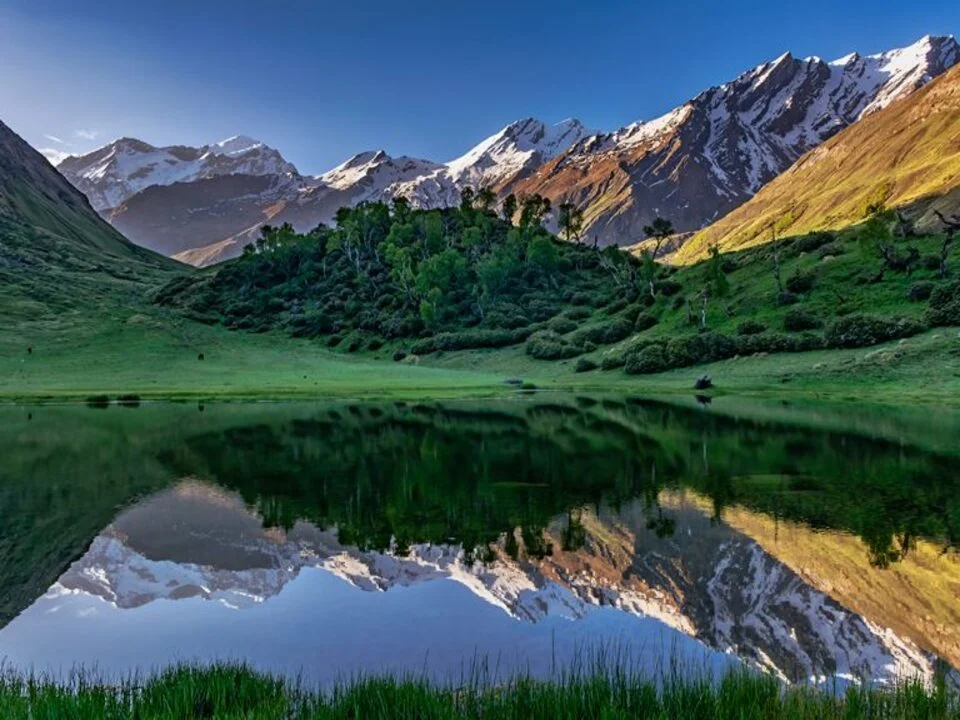
The meadow sits on the northern shoulder of the Garhwal Himalayas, in the Uttarkashi district, roughly 30 kilometres from the town of Uttarkashi as the crow flies — though considerably longer by road. The bugyal faces north and west, with views across the Bhagirathi Valley toward the high peaks of the Gangotri range: Bandarpoonch (20,731 ft), Srikanth (21,624 ft), Draupadi ka Danda (18,389 ft), Jaonli (20,190 ft), and in clear conditions, the distant white pyramid of Kala Nag rising above the eastern horizon like a distant lighthouse.
The altitude — 12,000 feet at the Dayara summit — is high enough to deliver genuine alpine conditions and spectacular mountain views. It is not so high that altitude sickness becomes the primary concern. For first-time high-altitude trekkers, this balance is the entire reason the trek exists.
What Makes the Dayara Bugyal Trek Special
There are higher meadows in Uttarakhand. There are longer circuits, more remote campsites, more technically challenging routes. Dayara Bugyal is none of those things. What it is, uniquely, is a trek that delivers Himalayan scale and beauty without Himalayan punishment.
The Meadow Is the Single Most Beautiful Feature
On the morning of Day 3, you climb the final slope from Gui camp to Dayara Top — a gentle, rolling ascent through grassland so thick and green it looks like someone has been watering it — and when you crest the ridge and the full meadow opens in front of you, the first response is usually silence.
Not because there is nothing to say. Because the scale of it — the sheer improbable width of green rolling away in every direction, framed by snow peaks on three sides — takes a moment to parse.
The meadow at Dayara is not a small clearing. It is not a pocket of grass tucked between ridges. It is a plateau-meadow, kilometres wide, gently undulating, with no trees, no rock outcrops, nothing but grass and sky and the distant white serrations of the Garhwal peaks rising above the far edge like a wall at the end of the world.
The colour is the other thing. In June and early July, after the snowmelt, the grass is an almost violent shade of green — the kind of green that looks digitally enhanced in photographs but is simply what happens when you combine altitude, monsoon moisture, and soil enriched by centuries of grazing. By late September, the green has shifted to gold and amber, and the meadow in autumn light has a warmth to it that the summer version does not.
Both are beautiful. Both are worth seeing.
The Accessibility Is Honest
This is a Dayara Bugyal trek from Raithal — a small Garhwal village accessible by road from Uttarkashi in approximately 3 hours. The drive from Dehradun to Raithal is long — 7 to 8 hours — but the roads are paved for most of the route, and Raithal itself sits at a modest 7,500 feet, which means acclimatisation begins gently.
The trek's maximum altitude is 12,000 feet. This is high enough to feel different from sea level — the air is thinner, the breathing is harder, the nights are cold — but not so high that acute mountain sickness becomes a statistically likely problem for healthy, well-prepared trekkers. Most people at 12,000 feet feel breathless and tired. Very few feel dangerously ill.
The duration — four days, Dehradun to Dehradun — is short enough to fit into a long weekend with a day on either side. The walking distances are modest: 6–8 kilometres per day, with the longest day (Day 3, the summit day) involving only 14 kilometres total, much of it on gentle terrain.
None of this makes Dayara easy. All of it makes it possible for people who cannot commit to a week-long high-altitude expedition but want something more than a day hike.
The Views Are Disproportionate to the Effort
The Dayara summit — Dayara Top, locally — sits at 12,000 feet on the ridgeline above the meadow, with 360-degree views across the Garhwal and Tons valleys.
To the north and west: the Gangotri range, with Bandarpoonch's twin summits dominating the skyline. To the east: the Kedarnath and Jogin massifs, distant but unmistakable. To the south: the forested ridges dropping toward the Bhagirathi Valley and the town of Uttarkashi, invisible in the haze below.
These are not partial views. These are not glimpses between ridges. This is the full Garhwal panorama, the kind of 360-degree mountain visibility that usually requires crossing a high pass or summiting a technical peak.
At Dayara, you get it by walking up a meadow.
The contrast between effort and reward is so skewed in the trekker's favour that experienced Himalayan trekkers, arriving at Dayara Top after years of harder routes, often express something close to disbelief. This is what I get for three days of moderate walking?
Yes. That is what you get.
The Wildflowers Are Among the Finest in Uttarakhand
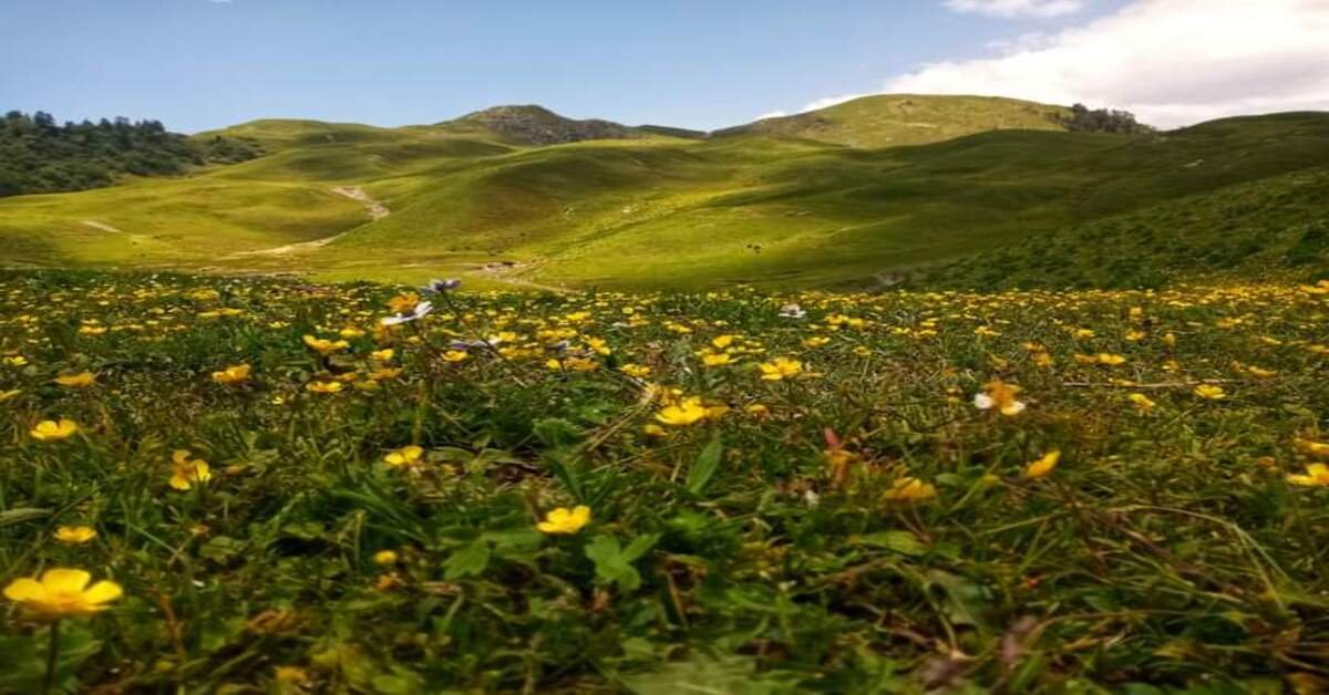
The Dayara meadow in late June and July is a botanical event. The post-monsoon bloom carpets the bugyal in waves of colour: Himalayan blue poppies, primulas, potentillas, gentians, asters, marsh marigolds, and dozens of species that have no common English names but blanket the meadow in purples, yellows, whites, and blues.
The flower density in early July — particularly in the meadow sections between Gui and Dayara Top — is extraordinary. You are not walking through a meadow with some flowers. You are walking through flowers with some grass.
Photographers: bring a macro lens. The meadow will keep you busy for hours.
The Trek Has Narrative Simplicity
You begin in a village. You climb through forest. You emerge into a meadow. You walk across the meadow to its highest point. You return.
The progression is linear, comprehensible, and satisfying in the way that simple stories are satisfying. There are no complicated variations, no multiple route options, no decisions to make about which valley to take. The trail goes to one place. That place is worth reaching. You reach it and come back.
For first-time trekkers, this clarity is a gift. The trek does not ask you to navigate complexity. It asks you to walk, and look, and notice what 12,000 feet of alpine meadow feels like under your boots.
The Best Time for the Dayara Bugyal Trek
The Dayara Bugyal trekking window runs from late May through October. Unlike high-pass routes, which operate in narrow seasonal bands, Dayara offers a genuinely long season — but each month within it has a distinct character.
Dayara Bugyal Trek in May and Early June — The Snow Transition
The meadow begins to emerge from snow in late May, though snow patches persist on the upper meadow and the Dayara summit through early June. May and early June crossings involve walking through sections of melting snow, particularly on the final approach to Dayara Top.
The wildflower season is just beginning. The forests between Raithal and Gui are dense and green, dripping with moisture from snowmelt and early pre-monsoon showers.
May is the month for trekkers who want the meadow in transition — half snow, half grass, with the mountains still carrying their full winter load of white. It is also the quietest month in terms of trekker traffic.
Trekkaro recommends May for trekkers with some prior trekking experience. First-timers are better served by July or September.
Dayara Bugyal Trek in July and August — The Green Explosion
July is when Dayara is at its most vivid. The monsoon reaches the Garhwal region in early July, and the meadow responds with an intensity of green that has to be seen to be believed. The wildflowers are at peak bloom in mid to late July — the meadow is not just green but multicoloured, a carpet of alpine flowers stretching from Gui to Dayara Top.
July has the highest rainfall of the season. Expect rain on at least half the days. Morning starts are typically clear, with cloud build-up through late morning and afternoon showers. The meadow in rain has its own beauty — mist rolling across the grass, the peaks appearing and disappearing behind cloud, the sound of rain on a tent at 10,000 feet — but you will get wet.
August is slightly drier than July but still monsoon-affected. The flowers are in their second bloom, and the grass is still thick and green. The meadow in August, on a clear morning after overnight rain, is as beautiful as any landscape in India.
Image: Wildflower meadows in full bloom at Dayara Bugyal in late July. The post-monsoon explosion of colour — blue poppies, potentillas, gentians — is among the finest alpine flower displays in Uttarakhand.
Dayara Bugyal Trek in September — The Optimal Window
September is what Trekkaro recommends to anyone with flexibility in their schedule. The monsoon has retreated, the skies are the clearest of the season, and the visibility from Dayara Top extends to horizons that July and August clouds typically obscure.
The meadow is beginning its transition from green to gold. The grass takes on a warmer, amber tone in the September light, and the contrast between the golden meadow and the white peaks is extraordinary.
Trekking crowds thin after early September. The meadow is quieter. The campsites are less crowded. Gui camp in mid-September, with clear skies and the Bandarpoonch massif sharp against the northern horizon, is one of the most beautiful places to spend a night in the Indian Himalayas.
The nights are colder — temperatures at Gui drop to freezing by late September. Carry warmer layers than you would in July.
Dayara Bugyal Trek in October — The Autumn Crossing
October is the final month of the season. The meadow has shifted fully from green to gold and brown, the grass dry and rustling underfoot. The wildflowers are gone, but the clarity of the air and the sharpness of the mountain views are unmatched.
The crowds are gone. The shepherds have taken their flocks down to lower pastures. The meadow in October has a quality of silence and emptiness that the summer months do not offer.
October is cold. Night temperatures at Gui can drop well below freezing. Expect frost on the tent by morning. The days are shorter — sunset comes by 5:30 PM, and the temperature drops rapidly once the sun is behind the western ridge.
October is for trekkers who want the meadow to themselves and are prepared for genuine cold-weather camping at altitude.
Dayara Bugyal Weather by Month
Weather conditions on the Dayara Bugyal trek vary significantly across the May–October season. Temperatures below are approximate and refer to campsite altitudes (Gui at 10,400 ft and Dayara summit at 12,000 ft).
MonthDaytime Temp (Meadow)Night Temp (Gui, 10,400 ft)RainfallMeadow ConditionTrail CrowdsMay–Early June10–16°C0 to 4°CLowSnow patches; flowers emergingVery LowJuly12–18°C4 to 8°CHeavy (monsoon)Peak green; wildflowers at maximumModerateAugust11–17°C3 to 7°CModerate–HeavyGreen; second flower bloomModerateSeptember9–15°C0 to 5°CLow (monsoon retreat)Green to gold transition; clear skiesLow–ModerateOctober6–12°C–3 to 2°CVery LowGolden-brown; dry grass; frost at nightVery Low
Note: The Dayara meadow sits in a zone that receives monsoon moisture but is sheltered enough that rain, even in July and August, tends to fall in afternoon bursts rather than continuous downpours. Mornings are typically clear. Plan summit attempts and photography for early morning.
Dayara Bugyal Trek Itinerary — 4 Days
Day 1 — Drive from Dehradun to Raithal
Drive: ~7–8 hours | Altitude at Raithal: 7,500 ft
The day is a drive, and the drive is beautiful.
You leave Dehradun in the early morning and follow the Mussoorie–Uttarkashi road through the lower Garhwal hills — a winding, climbing route that follows the Yamuna River valley through Mussoorie, then crosses into the Bhagirathi drainage and descends toward Uttarkashi.
The road is paved for most of the route, though narrow and winding in sections. Expect mountain traffic: trucks hauling supplies to the hill towns, local buses, the occasional herd of goats crossing at an intersection with no concern for the concept of right-of-way.
The landscape shifts as you climb. The lower valleys are terraced and cultivated — rice paddies, wheat fields, apple orchards clinging to slopes that seem too steep to farm but are farmed nonetheless. The villages are frequent and small, each one announcing itself with a cluster of slate-roofed houses and a tea stall at the roadside.
By the time you reach Uttarkashi — roughly 5 hours from Dehradun — the mountains are serious. The Bhagirathi River runs fast and grey alongside the road, fed by glaciers upstream. The peaks visible to the north are not foothills. They are the real thing.
From Uttarkashi, the road climbs toward Raithal — a smaller, rougher road that leaves the main valley and switchbacks up through oak and pine forest toward the ridge where Raithal sits. The final hour of the drive is slow, winding, and spectacular. The valley opens below you. The peaks rise above you. The air cools with every hundred metres of elevation.
Raithal is a small Garhwal village at 7,500 feet — a cluster of stone houses clinging to a mountain slope, with terraced fields dropping below and the first stands of alpine forest rising above. The village has a handful of guesthouses, a small temple, and the kind of quiet that comes from being far enough from any major road that the only sounds are wind, water, and the occasional goat bell.
The Trekkaro team meets you at Raithal. Gear check happens before dinner — your guide will inspect your boots, your rain gear, your layers, and will provide anything you're missing from the Trekkaro equipment stock. Pay attention to the briefing. The route is straightforward, but there are specific things to know about water sources, campsite etiquette, and the summit-day schedule.
Dinner is at the guesthouse in Raithal — dal, rice, sabzi, chapati, the kind of simple, hot food that tastes unreasonably good after 8 hours in a vehicle. Sleep early. Tomorrow, you walk.
What to know: Raithal is already at 7,500 feet — higher than any point in most of South India. If you have come from Delhi or Mumbai, your body has jumped from near sea level to significant altitude in a single day. Drink water constantly. Avoid alcohol tonight. Sleep as much as your body allows. The acclimatisation process begins the moment you arrive.
Day 2 — Raithal to Gui
Trek: ~6 km | Ascent: ~2,900 ft | Time: 4–5 hours | Altitude at camp: 10,400 ft
The day the forest teaches you patience.
You leave Raithal in the early morning and begin climbing through oak and rhododendron forest — dense, shaded, and steep enough that the trail switchbacks frequently to keep the gradient manageable.
The first hour is all forest. Thick canopy overhead, dappled sunlight filtering through the leaves, the sound of the wind in the branches and the occasional bird call. The trail is well-defined — centuries of shepherd traffic and decades of trekking traffic have worn a clear path through the undergrowth.
Wildflowers line the lower trail in July and August: Himalayan balsam, wood sorrel, wild strawberries growing in the clearings between the trees. The forest in monsoon is dripping — everything is wet, green, alive in a way that forests at lower altitudes are not.
The ascent is steady. Not punishingly steep, but unrelenting. There are no flat sections to rest your legs. The trail climbs, and you climb with it, and the only way forward is upward.
Image: The oak forest trail between Raithal and Gui. Day 2 climbs through dense canopy for 3 hours before breaking into open meadow. The forest section is steep, shaded, and extraordinarily beautiful in monsoon.
Halfway to Gui, the forest begins to thin. The oak gives way to birch and pine, and the canopy opens enough that you begin to see sky. The meadows appear — small at first, just clearings in the trees, but growing larger with every hundred feet of elevation until the forest breaks entirely and you are standing in open alpine grassland with the ridgeline visible above and the valley visible below.
The transition from forest to meadow is not gradual. One moment you are walking under branches, the next you are standing in waist-high grass with mountains visible in three directions and the sky suddenly enormous.
Gui camp sits at 10,400 feet in a wide, sloping meadow just below the treeline — a flat section of grass with a stream running nearby and the ridge rising steeply above. It is not a dramatic campsite in the sense of a lake or a pass. What it has is space. The meadow stretches in every direction. The mountains are visible but distant. The sound of the stream and the wind in the grass are the only sounds.
This is the first night above 10,000 feet. The altitude is beginning to be real. The air is thinner. Breathing while walking is noticeably harder than it was at Raithal. The cold arrives quickly after sunset — by 6 PM, you will want your down jacket. By 8 PM, you will want to be in your sleeping bag.
Dinner is served at the Trekkaro camp kitchen — hot, filling, and designed to refuel the day's climb. Eat fully. Your body is burning significantly more calories at this altitude than it does at sea level, and the deficit, if you don't address it tonight, will show up as fatigue tomorrow.
The stars at Gui are worth staying awake for. The meadow is dark enough and high enough that the Milky Way is visible as a band across the sky, and on clear nights in September and October, the clarity is extraordinary. Lie on your back outside the tent for ten minutes before you sleep. Let your eyes adjust. The sky at 10,000 feet is not the same sky you see from the city.
Trek Leader's Tip: "Gui is where people start to feel altitude. Not sick — just noticeably slower, more breathless, a little lightheaded if they stand up too quickly. This is normal. This is what 10,400 feet feels like. Drink water constantly — a litre before dinner, another litre before bed. Walk slowly tomorrow. The meadow will wait for you." — Vikram Singh Rawat, Trekkaro Lead Guide, Uttarakhand
Day 3 — Gui to Dayara Bugyal Top and Back
Trek: ~14 km (7 km ascent, 7 km return) | Ascent to summit: ~1,600 ft | Time: 7–8 hours round trip | Altitude at Dayara Top: 12,000 ft
This is the day.
You leave Gui camp in the early morning — the Trekkaro start time is 6:00 AM — and begin the ascent toward Dayara Top. The first hour climbs gently through the meadow above Gui, the grass thick and green (or golden, in autumn), the trail a faint line through the bugyal rather than a defined path.
The meadow is the thing. Not a pocket of grass. Not a clearing. A plateau-meadow that spreads across the ridgetop in rolling, gentle waves, kilometres wide, with no trees, no rock outcrops, nothing but grass and sky and the distant peaks rising like a wall at the edge of the world.
The scale of it takes time to comprehend. You walk, and the meadow continues. You walk further, and it continues still. The horizon seems always the same distance away, and the sense of space — the sheer openness of a landscape this high and this empty — is disorienting in the best possible way.
Image: The Dayara meadow on the approach to the summit. The rolling grassland stretches for kilometres in every direction, with the Gangotri peaks — Bandarpoonch, Srikanth, Draupadi ka Danda — visible on the northern horizon.
The Gangotri peaks are visible ahead: Bandarpoonch's twin summits dominating the skyline to the north, Srikanth and Draupadi ka Danda to the northwest, Kala Nag rising as a distant white pyramid in the far distance. These are not small mountains. These are 20,000-foot peaks, and from the meadow, they are completely, impossibly visible.
The final approach to Dayara Top climbs more steeply — the gradient increases as you near the ridgeline — but even here, the trail is on grass rather than rock. Your feet sink slightly with each step. The ground is soft. The altitude — above 11,500 feet now — makes every step cost more than it should, but the terrain itself is forgiving.
And then you are there.
Image: Standing at Dayara Top at 12,000 feet. 360-degree views: Gangotri range to the north, Kedarnath massif to the east, Tons Valley to the west, Bhagirathi Valley to the south. The most spectacular mountain panorama accessible via a three-day moderate trek in India.
Dayara Top at 12,000 feet is a broad, flat ridgeline with 360-degree views across the Garhwal Himalayas. Not partial views. Not glimpses between peaks. The full, unobstructed, overwhelming panorama of the central Garhwal ranges, from the Gangotri peaks in the north to the Kedarnath massif in the east to the forested ridges of the Bhagirathi Valley dropping away to the south.
Stand here. Turn in a full circle. Understand that you are seeing 50 kilometres of Himalayan geography in a single visual sweep, and that you have reached this point by walking up a meadow.
The wind at the summit is cold and constant. The ridgeline is exposed on all sides, and even on calm days, there is enough wind to make standing still uncomfortable after ten minutes. Wear every layer you brought. Eat something. Drink water. Take your photographs. And then sit on the grass and look.
The descent back to Gui follows the same route — 7 kilometres of gentle downhill through the meadow, the peaks behind you now, the forest and the camp visible below. The return walk is easier on the lungs, harder on the knees, and gives you time to notice things you missed on the way up: the specific flowers in the grass, the distant shepherd camps on the far ridges, the way the light changes on the meadow as the sun moves across the sky.
You arrive back at Gui camp by mid-afternoon. The rest of the day is yours. Sleep. Read. Sit outside and watch the light leave the valley. You have done the thing. The meadow is behind you. Tomorrow, you descend.
What to know: Day 3 is long but not difficult. The altitude at Dayara Top — 12,000 feet — is high enough that you will feel breathless, but the terrain is so gentle that even first-time trekkers reach the summit without significant distress. Start early. Weather at the summit is most stable in the morning. Afternoon clouds can obscure the peaks, and in monsoon season, afternoon rain is common. Cross to the summit before noon for the best visibility and the safest weather window.
Day 4 — Gui to Raithal and Drive to Dehradun
Trek: ~6 km | Descent: ~2,900 ft | Time: 3–4 hours | Drive: ~7–8 hours
The walk down is the walk you remember differently.
You leave Gui camp in the morning and descend through the meadow, back into the forest, retracing the route you climbed two days ago. The trail is the same. The gradient is the same. But the direction has changed, and descending is a different conversation with the mountain than ascending.
The knees take the load. The toes press into the front of the boots. The forest, which felt dense and enclosing on the way up, feels sheltering now — cool shade after two days in open meadow, the sound of birds, the smell of wet earth and pine resin.
The descent to Raithal takes 3 to 4 hours. It is easier on the lungs and harder on the legs, and by the time you reach the village, your calves will remind you that downhill walking is not the same as easy walking.
Lunch is at Raithal, and it is the kind of meal that tastes different because of what preceded it. The drive back to Dehradun begins after lunch — the same 7 to 8 hours through the Garhwal hills, but in reverse, and with the mountains shrinking behind you as you descend toward the plains.
By the time you reach Dehradun in the evening, the meadow — that impossible green expanse at 12,000 feet — will already feel like something you dreamed rather than walked through. The mountains above Raithal will be invisible in the distance. The trek is over. The circuit is complete.
What to know: The descent from Gui to Raithal is steep in sections. Trekking poles are useful for reducing impact on the knees. Take your time. The village will wait.
The drive from Raithal to Dehradun can take longer than 8 hours if there is traffic on the Uttarkashi–Mussoorie road, which is common on weekends and during festival periods. Trekkaro schedules a midday departure from Raithal to avoid the worst of the evening traffic into Dehradun. Carry snacks for the drive. Carry motion-sickness medication if you are susceptible — the road is winding in sections.
How Difficult Is the Dayara Bugyal Trek?
Image: A Trekkaro group ascending through the Dayara meadow above Gui. The trail is gentle, the terrain is forgiving, and the altitude — while real — is manageable for well-prepared first-time trekkers.
The Dayara Bugyal trek is easy to moderate. That classification is used precisely here, and it is worth understanding what it includes and what it does not.
The trek involves three days of walking, with daily distances of 6–7 kilometres (and 14 km on the summit day, though much of that is return distance on the same gentle terrain). The total altitude gain from Raithal to Dayara Top is approximately 4,500 feet, distributed over two days. The highest point — Dayara Top at 12,000 feet — is reached on a long day that requires 7–8 hours of walking, but almost all of it is on soft meadow with gentle gradients.
There is no technical climbing, no rope work, no exposed ridges, no river crossings, no section that requires anything other than the ability to walk steadily on gentle terrain at altitude.
What makes it moderate rather than trivial is the altitude. Dayara Top at 12,000 feet is high enough that the air is noticeably thinner, breathing requires more effort, and fatigue accumulates faster than it does at lower elevations. Headaches, mild breathlessness, and a general sense of moving through thicker air are common and expected. None of these are dangerous if managed properly. All of them are uncomfortable.
Who Is This Trek For?
The Dayara Bugyal trek is appropriate for first-time high-altitude trekkers who have prepared with basic cardiovascular fitness — regular walking or light jogging for 4–6 weeks before the trek. It is appropriate for families with older children (12+) who are comfortable with moderate physical activity. It is an excellent introduction to Himalayan trekking before attempting longer or higher routes.
It is not appropriate for those who have not walked more than 5 km in a single stretch in the months before the trek. It is not appropriate for those with unmanaged respiratory or cardiac conditions. The altitude is real, and while 12,000 feet is not extreme, it is high enough that pre-existing health issues can become complicated quickly.
The Honest Assessment
If you can walk 10 kilometres on hilly terrain with a light daypack without significant distress, the Dayara Bugyal trek is well within your capability. If the longest walk you have taken in the past two months is from your car to a shopping mall, it will be harder than you expect.
Dayara Bugyal Trek Cost — Fixed ?5,400 from Raithal to Raithal
?5,400 per person — Raithal to Raithal, all trekking services included.
Transportation is extra. The cost of the vehicle from Dehradun to Raithal and return is paid directly to the driver and is not included in the trek package. Approximate vehicle cost (shared among the group): ?8,000–?10,000 for a round-trip Dehradun–Raithal–Dehradun transfer in a shared SUV or Bolero.
What's Included in the ?5,400 Package:
- All meals from Day 2 breakfast (at Raithal) through Day 4 breakfast (at Raithal) — vegetarian only
- Certified Trekkaro trek guide and support team
- Four-season tents, sleeping bags rated to –10°C, sleeping mats
- Forest permits and all entry fees
- Trekking poles (provided on request)
- Safety equipment: first-aid kit, altitude medication protocol, emergency communication
- Camping and kitchen equipment: mess tent, kitchen crew, all utensils
Not Included:
- Transport from Dehradun to Raithal and return (pay directly to driver; approx. ?8,000–?10,000 shared cost)
- Accommodation in Dehradun before or after the trek
- Personal travel insurance
- Tips for the guide and support team
- Any personal purchases in Raithal or Dehradun
What Gear Does Trekkaro Provide?
Every Trekkaro Dayara Bugyal batch includes: a four-season tent, insulated sleeping bag rated to –10°C, sleeping mat, trekking poles (on request), a complete safety and medical kit.
What to Bring Yourself:
- Thermal base layers (top and bottom)
- Mid-layer fleece or light down jacket
- Waterproof rain jacket and pants (Garhwal gets monsoon rain in July–August; water-resistant is not sufficient)
- Warm hat and gloves
- Sunglasses rated for high UV
- Sunscreen SPF 50+
- At least three pairs of wool or synthetic socks
- Sturdy trekking boots with ankle support (worn in before the trek — new boots and long walks are a combination that produces blisters)
- Headlamp with spare batteries
- Personal water bottle (at least 1 litre capacity)
- Electrolyte sachets
- Quick-dry towel
- Waterproof stuff sacks for clothing inside your pack
- Any personal medication
A note on boots: The Dayara trail is gentle, but it is still a mountain trail — uneven ground, roots, rocks, wet grass in monsoon. Boots without ankle support are not recommended. If you are unsure what boots to bring, contact Trekkaro before departure.
A full season-specific packing list is sent on booking.
How to Reach Raithal for the Dayara Bugyal Trek
All Trekkaro Dayara Bugyal batches begin and end in Raithal. Transport from Dehradun to Raithal is arranged separately and paid directly to the driver.
Getting to Dehradun:
By air: The nearest airport is Jolly Grant Airport, Dehradun (DED), approximately 25 km from Dehradun city — a 45-minute drive. Jolly Grant has direct flights from Delhi, with limited connections from Mumbai and Bengaluru (usually via Delhi). The airport is small, and flights can be subject to weather delays, particularly in monsoon.
Delhi Airport (DEL) is approximately 250 km from Dehradun — a 6-hour drive via Haridwar and Rishikesh.
By train: Dehradun Railway Station is well-connected to Delhi, Kolkata, Mumbai, and other major cities. The Shatabdi Express from Delhi to Dehradun is the fastest and most reliable option — approximately 5–6 hours.
By road: Dehradun is approximately 250 km from Delhi via NH 44 (6–7 hours by car or bus). Regular Volvo and semi-sleeper buses operate overnight from Delhi to Dehradun.
From Dehradun to Raithal:
The drive from Dehradun to Raithal is approximately 200 km and takes 7–8 hours via Mussoorie and Uttarkashi. The road is paved for most of the route but narrow and winding in sections.
Trekkaro arranges shared transport (SUV or Bolero) for groups departing on the same batch date. Cost is approximately ?8,000–?10,000 for the round trip (Dehradun–Raithal–Dehradun), shared among all passengers.
Important: Arrive in Dehradun the evening before Day 1 to allow for an early-morning departure to Raithal. The drive takes the full day. A late start means arriving at Raithal after dark, which is unpleasant and avoidable.
Mobile Network and ATM Availability:
Mobile coverage: Limited and unreliable beyond Raithal. BSNL and Jio have partial coverage in Raithal village but drop off completely once you begin trekking. Expect no mobile network from Gui onward.
ATMs: Available in Dehradun and Uttarkashi. No ATMs in Raithal or beyond. Carry sufficient cash from Dehradun for the duration of the trek, tips for the guide team, and any personal purchases.
Trekkaro carries satellite communication on every batch for emergencies.
5 Things to Know Before You Go
1. The Meadow Is a Working Landscape. Treat It Accordingly.
The Dayara bugyal is grazed by local shepherds from May through September. The stone shelters, the livestock trails, the occasional flock of sheep or goats — these are not decorative. This is someone's livelihood.
Do not disturb the shepherd camps. Do not leave litter of any kind. Do not pick wildflowers. The meadow exists in the form it does because it has been carefully managed for centuries. Be part of that stewardship, not a disruption to it.
2. The Altitude Is Real, Even If the Trail Is Gentle.
Dayara Top at 12,000 feet is high enough that altitude sickness is possible, though uncommon on a trek of this profile. Headaches, mild nausea, and breathlessness are normal at this altitude. Severe symptoms — confusion, loss of coordination, shortness of breath at rest — are not normal and require immediate descent.
Drink water constantly. Walk slowly. If you feel unwell, tell your guide immediately. Altitude sickness is not a sign of weakness. It is a physiological response to reduced oxygen, and it can happen to anyone.
3. Monsoon Rain Is Real. Waterproofing Is Not Optional.
If you are trekking Dayara in July or August, expect rain. Your rain jacket should be fully waterproof with sealed seams — not water-resistant, not a windbreaker. Your pack contents should be in waterproof stuff sacks.
A wet sleeping bag at 10,000 feet is a safety issue, not an inconvenience.
4. The Summit Day Is Long but Gentle. Start Early Anyway.
Day 3 — the Gui to Dayara Top round trip — is 14 km total, but almost all of it is on soft, rolling meadow with gentle gradients. The distance is more tiring than the terrain.
Start early. The weather at the summit is most stable in the morning. Afternoon clouds in monsoon season can obscure the peaks. The best visibility — and the best photographs — happen before noon.
5. This Is Not a Remote Wilderness Trek. It Is a High-Altitude Meadow Walk.
Dayara Bugyal is accessible, relatively crowded in peak season (July–August), and close enough to civilisation that you can see villages in the valleys below from the summit. It is not a multi-day expedition into trackless wilderness.
What it is: a beautiful, accessible introduction to high-altitude trekking, with views that are disproportionate to the effort required. Set your expectations accordingly, and the trek will exceed them.
Frequently Asked Questions
What is the best time for the Dayara Bugyal trek?
The circuit operates May through October. September is the optimal month for clear skies, golden meadows, and fewer crowds. July is the greenest and wettest, with peak wildflowers. October is the quietest and coldest.
How difficult is the Dayara Bugyal trek?
Easy to moderate. Three days of walking with gentle daily distances (6–7 km, 14 km on summit day). The terrain is forgiving — soft meadow, well-defined trail, no technical sections. The altitude (12,000 ft) is the primary challenge, but it is manageable for well-prepared first-time trekkers.
Can beginners do the Dayara Bugyal trek?
Yes. Dayara is one of the best first high-altitude treks in India. Preparation is still required — 4–6 weeks of regular walking or light cardio before departure — but prior trekking experience is not necessary.
Is the Dayara Bugyal trek safe?
The trek is safe when conducted with a reputable operator and proper preparation. The primary risks are altitude-related discomfort (headaches, breathlessness) and weather exposure in monsoon. Trekkaro carries a complete medical kit and satellite communication on every batch.
What is the altitude of Dayara Bugyal?
The Dayara summit (Dayara Top) is at 12,000 feet (3,658 metres). The highest campsite is Gui at 10,400 feet.
Do I need a permit for the Dayara Bugyal trek?
Yes. A forest permit from the Uttarakhand Forest Department is required. Trekkaro handles all permit procurement — no separate action is required from trekkers. Carry a valid government photo ID (Aadhaar, passport, voter ID) as it may be checked at forest checkpoints.
What is included in the ?5,400 trek cost?
All meals (Raithal to Raithal), certified guide, camping gear (tent, sleeping bag, mat), trekking poles, forest permits, safety and medical kit. Transport from Dehradun to Raithal is extra (?8,000–?10,000 shared cost, paid directly to driver).
Is mobile network available on the Dayara Bugyal trek?
Limited. Partial BSNL and Jio coverage in Raithal village. No reliable coverage from Gui onward. Plan for disconnection from Day 2 through Day 4. Trekkaro carries satellite communication for emergencies.
Can I do the Dayara Bugyal trek solo?
Technically possible but not recommended. Trekkaro does not operate solo departures. Minimum group size is four.
What if the weather prevents the summit attempt?
If weather prevents reaching Dayara Top on Day 3, Trekkaro's protocol is to wait for improved conditions or attempt a partial ascent to a lower viewpoint. The itinerary has some flexibility. Safety is not negotiable — if conditions are unsafe, the group does not proceed.
Read More from Trekkaro
Hampta Pass Trek 2026 — The Complete Guide
The dramatic valley crossing. Green to desert in a single day. If Dayara is the gentle introduction, Hampta Pass is the dramatic follow-up.
Kedarkantha Trek 2026 — The Complete Guide
India's finest winter trek. A 360-degree Himalayan panorama from 12,500 feet. If Dayara Bugyal is closed for the season and you need mountains, Kedarkantha operates December through April.
Best Treks from Uttarkashi 2026
Everything that leaves from the Uttarkashi region — Dayara Bugyal, Har ki Dun, Dodital, and more. Difficulty ratings, durations, best seasons.
What to Pack for Dayara Bugyal in September
A season-specific packing list from the Trekkaro guides who run this route every autumn.
Book the Dayara Bugyal Trek with Trekkaro